
Olivarez, Texas | |
|---|---|
 | |
| Coordinates: 26°14′11″N 97°59′37″W / 26.23639°N 97.99361°W | |
| Country | |
| State | |
| County | |
| Area | |
| • Total | 3.7 sq mi (9.5 km2) |
| • Land | 3.7 sq mi (9.5 km2) |
| • Water | 0.0 sq mi (0.0 km2) |
| Elevation | 66 ft (20 m) |
| Population | |
| • Total | 3,827 |
| • Density | 1,000/sq mi (400/km2) |
| Time zone | UTC-6 (Central (CST)) |
| • Summer (DST) | UTC-5 (CDT) |
| ZIP code | 78599[2] |
| Area code(s) | 512 and 737 |
| FIPS code | 48-53934[3] |
| GNIS feature ID | 1852748[4] |
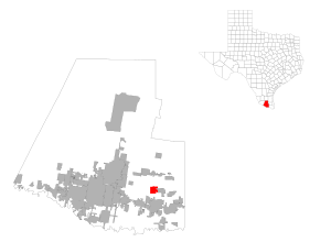
Olivarez is a census-designated place (CDP) in Hidalgo County, Texas, United States. The population was 3,827 at the 2010 United States Census.[1] It is part of the McAllen–Edinburg–Mission Metropolitan Statistical Area.
YouTube Encyclopedic
-
1/2Views:1 462480
-
Nuraj Maskey, Texas A&M University-Commerce, Authentic Student Portrait
-
Student Employment, Texas A&M University-Commerce
Transcription
Geography
Olivarez is located at 26°14′11″N 97°59′37″W / 26.23639°N 97.99361°W (26.236325, -97.993523).[1]
According to the United States Census Bureau, the CDP has a total area of 3.7 square miles (9.6 km2), all land.
Demographics
As of the census[3] of 2000, there were 2,445 people, 511 households, and 481 families residing in the CDP. The population density was 663.1 inhabitants per square mile (256.0/km2). There were 562 housing units at an average density of 152.4 per square mile (58.8/km2). The racial makeup of the CDP was 95.05% White, 0.04% African American, 0.78% Asian, 3.48% from other races, and 0.65% from two or more races. Hispanic or Latino of any race were 97.22% of the population.
There were 511 households, out of which 70.8% had children under the age of 18 living with them, 77.9% were married couples living together, 12.1% had a female householder with no husband present, and 5.7% were non-families. 4.5% of all households were made up of individuals, and 1.4% had someone living alone who was 65 years of age or older. The average household size was 4.76 and the average family size was 4.88.
In the CDP, the population was spread out, with 41.7% under the age of 18, 13.0% from 18 to 24, 27.6% from 25 to 44, 13.7% from 45 to 64, and 4.0% who were 65 years of age or older. The median age was 22 years. For every 100 females, there were 101.4 males. For every 100 females age 18 and over, there were 99.4 males.
The median income for a household in the CDP was $28,636, and the median income for a family was $26,641. Males had a median income of $20,809 versus $15,469 for females. The per capita income for the CDP was $7,294. About 36.2% of families and 41.1% of the population were below the poverty line, including 49.5% of those under age 18 and 9.5% of those age 65 or over.
Education
Olivarez is served by the Weslaco Independent School District.[5][6] Portions of the community are zoned to multiple elementary schools: "Rudy" Silva, Justice Gonzales, and Mario Ybarra.[7] Two middle schools, Beatriz Garza and Mary Hoge, serve sections of Olivarez.[8] Weslaco High School and Weslaco East High School serve sections of Olivarez.[9]
In addition, South Texas Independent School District operates magnet schools that serve the community.
References
- ^ a b c "US Gazetteer files: 2010, 2000, and 1990". United States Census Bureau. February 12, 2011. Retrieved April 23, 2011.
- ^ "Olivarez ZIP Code". zipdatamaps.com. 2023. Retrieved January 12, 2023.
- ^ a b "U.S. Census website". United States Census Bureau. Retrieved January 31, 2008.
- ^ "US Board on Geographic Names". United States Geological Survey. October 25, 2007. Retrieved January 31, 2008.
- ^ "SCHOOL DISTRICT REFERENCE MAP (2010 CENSUS): Hidalgo County, TX." U.S. Census Bureau. Retrieved on July 9, 2017.
- ^ "2010 CENSUS - CENSUS BLOCK MAP: Olivarez CDP, TX." U.S. Census Bureau. Retrieved on July 11, 2017.
- ^ "Elementary School Attendance Zones[permanent dead link]." Weslaco Independent School District. Retrieved on July 11, 2017.
- ^ "Middle School Attendance Zones[permanent dead link]." Weslaco Independent School District. Retrieved on July 11, 2017. Persons using Mozilla Firefox to directly view this file may encounter problems
- ^ "High School Attendance Zones[permanent dead link]." Weslaco Independent School District. Retrieved on July 11, 2017. Persons using Mozilla Firefox to directly view this file may encounter problems
Municipalities and communities of Hidalgo County, Texas, United States | ||
|---|---|---|
| Cities |  | |
| CDPs |
| |
| Other community | ||