
Olenia
Ωλενία | |
|---|---|
 Olenia Location within the regional unit 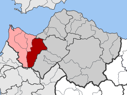 | |
| Coordinates: 38°6′N 21°35′E / 38.100°N 21.583°E | |
| Country | Greece |
| Administrative region | West Greece |
| Regional unit | Achaea |
| Municipality | West Achaea |
| Area | |
| • Municipal unit | 189.5 km2 (73.2 sq mi) |
| Elevation | 163 m (535 ft) |
| Population (2021)[1] | |
| • Municipal unit | 4,303 |
| • Municipal unit density | 23/km2 (59/sq mi) |
| Time zone | UTC+2 (EET) |
| • Summer (DST) | UTC+3 (EEST) |
| Vehicle registration | ΑΧ |

Olenia (Greek: Ωλενία) is a former municipality in Achaea, West Greece, Greece. Since the 2011 local government reform it is part of the municipality West Achaea, of which it is a municipal unit.[2] The municipal unit has an area of 189.534 km2.[3] Population 4,303 (2021). The seat of the municipality was in Lousika. The municipality is named after the ancient Achaean town Olenus.
Subdivisions
The municipal unit Olenia is subdivided into the following communities (constituent villages in brackets):
- Achaiko
- Agios Nikolaos Kralis (Kalamaki, Agios Nikolaos, Avgeraiika, Thomaiika, Poimenochori)
- Agios Stefanos (Agios Stefanos, Palaia Peristera, Fylakes)
- Ano Soudenaiika
- Arla
- Chaikali (Chaikali, Katsaitaiika, Kounelaiika)
- Charavgi (Charavgi, Neochori, Pigadia)
- Flokas (Flokas, Zisimaiika)
- Fostaina
- Galanaiika
- Gkaneika
- Kato Mazaraki
- Lousika (Lousika, Spaliaraiika, Ypsili Rachi)
- Mitopoli (Mitopoli, Komi, Souvaliotaiika)
- Portes
- Santomeri (Santomeri, Ampelakia, Polylofo)
References
- ^ "Αποτελέσματα Απογραφής Πληθυσμού - Κατοικιών 2021, Μόνιμος Πληθυσμός κατά οικισμό" [Results of the 2021 Population - Housing Census, Permanent population by settlement] (in Greek). Hellenic Statistical Authority. 29 March 2024.
- ^ "ΦΕΚ B 1292/2010, Kallikratis reform municipalities" (in Greek). Government Gazette.
- ^ "Population & housing census 2001 (incl. area and average elevation)" (PDF) (in Greek). National Statistical Service of Greece.
This Western Greece location article is a stub. You can help Wikipedia by expanding it. |