
State Route 83 | ||||
|---|---|---|---|---|
 | ||||
| Route information | ||||
| Maintained by ODOT | ||||
| Length | 157.59 mi[1] (253.62 km) | |||
| Existed | 1972–present | |||
| Major junctions | ||||
| South end | ||||
| North end | ||||
| Location | ||||
| Country | United States | |||
| State | Ohio | |||
| Counties | Washington, Morgan, Noble, Guernsey, Muskingum, Coshocton, Holmes, Wayne, Medina, Lorain | |||
| Highway system | ||||
| ||||
| ||||
| ||||

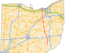
State Route 83 is a north–south state highway in the U.S. state of Ohio. Its southern terminus is near the town of Beverly at State Route 60, and its northern terminus is overlooking Lake Erie at U.S. Route 6 in Avon Lake. A portion of SR 83 is part of the Morgan County Scenic Byway.
YouTube Encyclopedic
-
1/2Views:9181 273
-
Ohio State Route 82 (Westbound) from US 62 to SR 21
-
Ohio Highway 555 HD 1080p
Transcription
History
At the 1923 Ohio state highway renumbering, the State Route 83 designation was applied to a route from the original alignment of State Route 46 in Ashtabula east to the Pennsylvania state line through Plymouth, Sheffield, and Monroe townships.[2] It was rerouted in 1928 through Kingsville along the current State Route 84 alignment and Monroe Center Road through Kelloggsville to State Route 7.[3] SR 83 was rerouted again in 1938, with the portion from Ashtabula to Kelloggsville following a previously unnumbered road, while the portion from Kelloggsville to SR 7 remained the same. The previous section of SR 83 between Ashtabula and Kelloggsville passing through Kingsville was recertified as SR 84.[4] This alignment lasted until 1958 when the original SR 83 was decertified.[5][6]

The current SR 83 follows what had previously been State Route 76. SR 76 was established in 1923 between Wooster and New Concord. It followed the current SR 83 route from Wooster to just south of Millersurg, where it then followed the current alignment of US 62 to Killbuck and the current alignment of State Route 60 from Killbuck to Coshocton. From Coshocton to New Concord, it followed the current alignment of SR 83.[2] SR 76 was realigned in 1926, with the portion between Millersburg and Coshocton rerouted to the current alignment of SR 83, and the route was extended south to Cumberland at SR 146.[7] The following year, 1927, it was extended again to the current southern terminus of SR 83, just north of Beverly at what is now SR 60.[8]

SR 76 was extended to the north in 1937 through Wooster to Avon Lake over the route what is now generally SR 83.[9] It was rerouted around Wooster in 1968 along with US 250 and State Route 3.[10][11] The current designation of SR 83 came about in 1972 when Interstate 80S was renumbered as Interstate 76 to avoid having two routes with the same number. At this time, SR 83 was also rerouted along a new western bypass of Coshocton with US 36 and State Route 16.[12]
SR 83 was planned to be relocated in Lorain County, but only two short segments of this relocation were built, at Interstate 90/State Route 2 and at State Route 10, with the rest of the plans abandoned after 1991.[13] The latter segment carries part of SR 83C.
Major Junctions
| County | Location | mi | km | Destinations | Notes | |||
|---|---|---|---|---|---|---|---|---|
| Washington | Waterford Township | 0.00 | 0.00 | Southern terminus of SR 83. | ||||
| Morgan | Manchester Township | 9.50 | 15.29 | Eastern terminus of SR 78 concurrence. | ||||
| Bristol Township | 12.35 | 19.88 | Western terminus of SR 78 concurrence. | |||||
| 12.54 | 20.18 | |||||||
| Noble |
No major junctions | |||||||
| Guernsey | Cumberland | 25.12 | 40.43 | Main Street | ||||
| Westland Township | 31.42 | 50.57 | Clay Pike Road | |||||
| Muskingum | New Concord | 36.25 | 58.34 | Junction with I-70 eastbound. | ||||
| 36.43 | 58.63 | Junction with I-70 westbound. | ||||||
| 37.28 | 60.00 | Main Street | ||||||
| Highland Township | 41.94 | 67.50 | Cambridge Road, Western Terminus of SR 209. | |||||
| Monroe Township | 47.34 | 76.19 | Western terminus of SR 93 concurrence (Adamsville-Otsego Road). | |||||
| 47.65 | 76.69 | Eastern terminus of SR 93 concurrence (Plainfield Road). | ||||||
| Coshocton | Jackson Township | 59.81 | 96.25 | Western terminus of SR 16 concurrence. | ||||
| Coshocton | 62.57 | 100.70 | Chestnut Street via interchange. | |||||
| 63.11 | 101.57 | Western terminus of SR 36 concurrence. | ||||||
| Tuscarawas Township | 63.46 | 102.13 | Eastern terminus of US 36 and SR 16 concurrence. | |||||
| Keene Township | 67.26 | 108.24 | ||||||
| Holmes | Mechanic Township | 83.63 | 134.59 | Western terminus of US 62 concurrency. | ||||
| Millersburg | 86.55 | 139.29 | Eastern terminus of US 62 concurrency (Jackson Street). | |||||
| Wayne | Wooster | 103.38 | 166.37 | Western terminus of US 250 concurrency (Dover Road). | ||||
| 105.98 | 170.56 | Eastern terminus of US 250 concurrency (Dover Road). | ||||||
| 106.20 | 170.91 | Interchange at Lincoln Way | ||||||
| 106.28 | 171.04 | Southern eastern terminus of SR 3 concurrency. SR 3 intersects SR 83 at the SR 83/SR 3/US 30 junction following an on-ramp that hits SR 83 from the east side. | ||||||
| 109.07 | 175.53 | Northern eastern terminus of SR 3 concurrency. SR 83 and SR 3 split with SR 3 heading east and intersecting Cleveland Road, while SR 83 continues northbound and passes over SR 3. This is why there are two eastern termini of SR 3 while it is concurrent with SR 83. | ||||||
| Congress Township | 117.57 | 189.21 | Easton Road | |||||
| Medina | Harrisville Township | 121.19 | 195.04 | I-71 Exit 204 | ||||
| Lodi | 124.14 | 199.78 | Bank Street to west, Medina Street to east | |||||
| Harrisville Township | 124.94 | 201.07 | Junction with US 42 northbound and US 224 eastbound (Lafayette Road). | |||||
| 124.99 | 201.15 | Junction with US 42 southbound and US 224 westbound (Lafayette Road). | ||||||
| Chatham Township | 128.77 | 207.24 | Chatham Road | |||||
| Litchfield | 133.45 | 214.77 | Southern eastern terminus with SR 18. Southern end of Litchfield traffic circle heading westbound (counterclockwise). Southern terminus with SR 83D (Norwalk Road). | |||||
| 133.53 | 214.90 | Southern eastern terminus with SR 18. Northern end of Litchfield traffic circle heading westbound (counterclockwise). Northern terminus with SR 83D (Norwalk Road). | ||||||
| Lorain | Grafton Township | 138.28 | 222.54 | Western terminus of SR 303 (Lagrange-Richfield Road). | ||||
| 138.34 | 222.64 | Eastern terminus of SR 303 and SR 57 (Medina-Elyria Road). | ||||||
| 139.90 | 225.15 | Western terminus of SR 57 (Grafton Road). | ||||||
| Eaton Township | 143.65 | 231.18 | Royalton Road | |||||
| North Ridgeville | 146.34 | 235.51 | Lorain Road; eastern terminus of SR 83C | |||||
| 148.97 | 239.74 | Center Ridge Road | ||||||
| Avon | 153.77 | 247.47 | Detroit Road | |||||
| 154.09 | 247.98 | I-90/OH-2 Exit 153 | ||||||
| Avon Lake | 157.59 | 253.62 | Northern terminus of SR 83 at Lake Road. | |||||
1.000 mi = 1.609 km; 1.000 km = 0.621 mi
| ||||||||
Route 83C
Route 83C is an unsigned, ¾-mile route connecting SR 83 with SR 10 in North Ridgeville and Eaton Township. SR 83C runs southwest from SR 83 along Lorain Road and Butternut Ridge Road, then turns northwest, intersecting SR 10 then ending just beyond at Chestnut Ridge Road.[14] The latter road is one of the two constructed segments of the once-proposed relocation of SR 83.[13] The route is marked "To SR 10/I-480/I-80" westbound and "To SR 83" eastbound.[15] (SR 83 as it has remained has not received direct access to SR 10.)
References
- ^ Ohio Department of Transportation. "Technical Services Straight Line Diagrams". Retrieved 2010-04-30.
- ^ a b Ohio Department of Highways and Public Works (July 1923). Map of Ohio Showing State Routes (PDF) (Map). 1:760,320. Columbus: Ohio Department of Highways and Public Works. Retrieved September 8, 2023.
- ^ Ohio Department of Highways (August 1, 1928). Map of Ohio Showing State Highway System (PDF) (Map). 1:760,320. Columbus: Ohio Department of Highways. OCLC 5673562, 7434854. Retrieved September 8, 2023.
- ^ Ohio Department of Highways (1938). Ohio Official Highway Map (PDF) (Map). 1:633,600. Columbus: Ohio Department of Highways. OCLC 5673562, 7453129. Retrieved September 8, 2023.
- ^ Ohio Department of Highways (1957). Ohio Highway Map (PDF) (Map). 1:633,600. Columbus: Ohio Department of Highways. OCLC 5673562, 7444259. Retrieved September 8, 2023.
- ^ Ohio Department of Highways (1958). Ohio Highway Map (PDF) (Map). 1:633,600. Columbus: Ohio Department of Highways. OCLC 5673562, 13688035. Retrieved September 8, 2023.
- ^ Ohio Department of Highways and Public Works (August 1, 1926). Map of Ohio Showing State Routes (PDF) (Map). 1:760,320. Columbus: Ohio Department of Highways and Public Works. OCLC 5673562. Retrieved September 8, 2023.
- ^ Ohio Department of Highways and Public Works (June 1, 1927). Map of Ohio Showing State Routes (PDF) (Map). 1:760,320. Columbus: Ohio Department of Highways and Public Works. OCLC 5673562. Retrieved September 8, 2023.
- ^ Ohio Department of Highways (1937). Official Highway Map of Ohio (PDF) (Map). 1:760,320. Columbus: Ohio Department of Highways. OCLC 5673562, 16960304. Retrieved September 8, 2023.
- ^ Ohio Department of Highways (1967). Official Highway Map (PDF) (Map). c. 1:563,200. Columbus: Ohio Department of Highways. OCLC 5673562, 7444249. Retrieved September 8, 2023.
- ^ Ohio Department of Highways (1969). Official Highway Map (PDF) (Map). c. 1:563,200. Columbus: Ohio Department of Highways. OCLC 5673562, 7448779. Retrieved September 8, 2023.
- ^ Ohio Department of Highways (1972). Ohio Highway Map (PDF) (Map). 1:554,400. Columbus: Ohio Department of Highways. OCLC 5673562, 13716527. Retrieved September 8, 2023.
- ^ a b Smith, Taylor J. (2005-03-20). "1955 - 2005, Fifty Years of Progress in Avon". The Morning Journal. Retrieved 2015-04-19.
- ^ Ohio Department of Transportation DESTAPE for Lorain County, 2014-07-03.
- ^ Google. "Google Street View: 11716 Butternut Ridge Road (October 2013)" (Map). Google Maps. Google.