

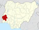
Ogo Oluwa is a Local Government Area in Oyo State, Nigeria. Its headquarters are in the town of Ajaawa.
It has an area of 369 km2 and a population of 65,184 at the 2006 census.[1]
The postal code of the area is 210.[2]
YouTube Encyclopedic
-
1/1Views:401
-
C&S Ogo Oluwa Church (Youth Anniversary 2016): Revival / Isoji
Transcription
Geography
Ogo Oluwa LGA has an average temperature of 28 degrees Celsius and a total area of 369 square kilometers. The LGA experiences two different seasons, referred to as the rainy and dry seasons, with an average humidity of 57%.[3]
Economy
The majority of the population of Ogo Oluwa LGA makes their living from farming, and the region is well-known for producing a variety of commodities, including pineapple and soybeans. Ogo Oluwa LGA is a hub for trade, with a number of markets, including the Olorunda market, where a wide variety of goods are bought and sold. The residents of Ogo Oluwa LGA also engage in welding, hunting, and wood carving as significant economic pursuits.[3]
Locality
Villages and towns under Ogo Oluwadamilola Local Government Area.[4][3]
- Adunmode
- Asa/Ajagun-Lase
- Aba Ajuba
- Adebiopon
- Afingba
- Agogo Ogun
- Aigbede
- Ajagunlase
- Aladorun
- Asa
- Asamu
- Ajagba/Iwo Oke
- Aguntan
- Alagbon
- Aladorin
- Apeke
- Balogun Oja
- Bode Osi
- Elepo
- Idi Oro
- Jagun
- Molosayowo
- Olowo
- Paku Odan
- Ikire Ile/Iwara
- Alaro
- Ajagba
- Obamoro/Ille-Ogo
- Elesu
- Fagbayibi
- Feesu
- Ikalaba
- IleOgo
- Ile-Ogo
- Imoru
- Obamore
- Obamoro
- Olota
- Orilende
- Otunjagun
- Dagbolu
- Elere
- Idiya
- Nka
- Ododo
- Ogunoja
- Okoro
- Olota
- Tarapin
- Yamganmu
- Elewedu
- Elewure
- Iwo Oke
- Kekere
- Mogbelerin
- Molaye
- Olota
- Oluponia
- Tankoda
- Ogbaagba
- Telemu
- Isero
- Ikonifin
References
- ^ "Population of Ogo Oluwa".
- ^ "Post Offices- with map of LGA". NIPOST. Archived from the original on November 26, 2012. Retrieved 2009-10-20.
- ^ a b c "Ogo-oluwa Local Government Area". www.manpower.com.ng. Retrieved 2024-02-17.
- ^ "About – Ogooluwa LGA". Retrieved 2024-02-17.
External links
This Oyo State, Nigeria location article is a stub. You can help Wikipedia by expanding it. |