

Bezirk Oberwart (Croatian: Kotar Borta; Hungarian: Felsőőr Járás) is a district in the state of Burgenland in Austria. The population of the district, as of 2022, is 54,353.[1] The largest settlements in the district are Oberwart, Pinkafeld and Großpetersdorf.
YouTube Encyclopedic
-
1/1Views:5 014
-
Austria Rechnitz Massacre: Neue Hinweise auf das Massengrab
Transcription
Municipalities
Wikimedia Commons has media related to Bezirk Oberwart.
| Municipality (Alternative name) | Location | Area (km2) | Population (2022) | Population Density (per km2) | Image | Cadastral communities |
|---|---|---|---|---|---|---|
| Bad Tatzmannsdorf | 
|
11.62 | 1,628 | 140 | 
|
Jormannsdorf, Sulzriegel |
| Badersdorf | 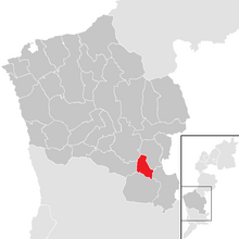
|
8.64 | 279 | 32 | 
|
|
| Bernstein im Burgenland | 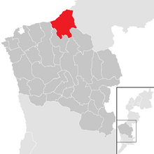
|
38.99 | 2,079 | 53 | 
|
Dreihütten, Redlschlag, Rettenbach, Stuben |
| Deutsch Schützen-Eisenberg | 
|
28.43 | 1,079 | 38 | 
|
Deutsch-Schützen, Edlitz im Burgenland, Eisenberg an der Pinka, Höll, Sankt Kathrein im Burgenland |
| Grafenschachen | 
|
9.94 | 1,243 | 125 | 
|
Kroisegg |
| Großpetersdorf | 
|
31.36 | 3,560 | 114 | 
|
|
| Hannersdorf | 
|
17.11 | 741 | 43 | 
|
|
| Jabing | 
|
7.78 | 752 | 97 | 
|
|
| Kemeten | 
|
20.67 | 1,512 | 73 | 
|
|
| Kohfidisch | 
|
31.34 | 1,467 | 47 | 
|
Harmisch, Kirchfidisch |
| Litzelsdorf | 
|
13.88 | 1,151 | 83 | 
|
|
| Loipersdorf-Kitzladen | 
|
15.88 | 1,339 | 84 | 
|
Kitzladen, Loipersdorf im Burgenland |
| Mariasdorf | 
|
20.54 | 1,144 | 56 | 
|
Bergwerk, Grodnau, Neustift bei Schlaining, Tauchen |
| Markt Allhau | 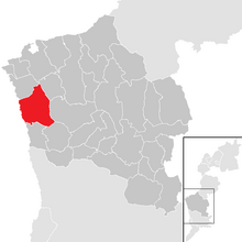
|
32.31 | 1,910 | 59 | 
|
Buchschachen |
| Markt Neuhodis (Novi Hodas) | 
|
19.95 | 662 | 33 | 
|
Althodis |
| Mischendorf | 
|
26.18 | 1492 | 57 | 
|
Großbachselten, Kleinbachselten, Kotezicken, Neuhaus in der Wart, Rohrbach an der Teich |
| Neustift an der Lafnitz | 
|
3.50 | 792 | 226 | 
|
|
| Oberdorf im Burgenland | 
|
9.24 | 997 | 108 | 
|
|
| Oberschützen | 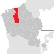
|
44.39 | 2,457 | 55 | 
|
Aschau im Burgenland, Schmiedrait, Unterschützen, Willersdorf |
| Oberwart (Felsőőr) | 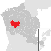
|
36.49 | 7,723 | 212 | 
|
Sankt Martin in der Wart |
| Pinkafeld | 
|
27.43 | 5,915 | 216 | 
|
Alt-Pinkafeld, Gfangen, Hochart, Nord-Pinkafeld, Pinkafeld Stadt |
| Rechnitz | 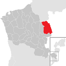
|
43.77 | 2,987 | 68 | 
|
|
| Riedlingsdorf | 
|
16.13 | 1,639 | 102 | 
|
|
| Rotenturm an der Pinka | 
|
17.04 | 1,447 | 85 | 
|
Siget in der Wart (Őrisziget), Spitzzicken |
| Schachendorf (Čajta) | 
|
22.32 | 758 | 34 | 
|
|
| Schandorf (Čemba) | 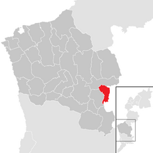
|
11.26 | 268 | 24 | 
|
|
| Stadtschlaining | 
|
42.07 | 1,980 | 47 | 
|
Altschlaining, Drumling, Goberling, Neumarkt im Tauchental |
| Unterkohlstätten | 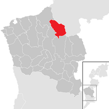
|
29.14 | 972 | 33 | 
|
Glashütten bei Schlaining, Günseck, Holzschlag, Oberkohlstätten |
| Unterwart (Alsóőr) | 
|
20.22 | 967 | 48 | 
|
Eisenzicken |
| Weiden bei Rechnitz (Bandol) | 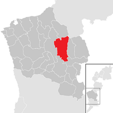
|
39.84 | 809 | 20 | 
|
Allersdorf im Burgenland, Allersgraben, Mönchmeierhof, Oberpodgoria, Podler, Rauhriegel, Rumpersdorf, Unterpodgoria, Zuberbach |
| Wiesfleck | 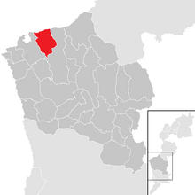
|
20.08 | 1,154 | 57 | 
|
Schönherrn, Schreibersdorf, Weinberg im Burgenland |
| Wolfau | 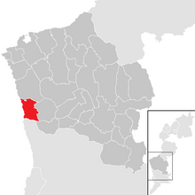
|
15.02 | 1,450 | 97 | 
|
References
- ^ "Bevölkerung des Burgenlandes seit 1869 nach politischen Bezirken" (PDF). Statistik Burgenland (in German). Retrieved 5 February 2023.
| Cities |  | |
|---|---|---|
| Districts | ||
| International | |
|---|---|
| National | |
| Other | |
47°17′38″N 16°14′35″E / 47.294°N 16.243°E