
Oğuzeli | |
|---|---|
District and municipality | |
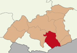 Map showing Oğuzeli District in Gaziantep Province | |
 Oğuzeli Location in Turkey | |
| Coordinates: 36°57′54″N 37°30′33″E / 36.96500°N 37.50917°E | |
| Country | Turkey |
| Province | Gaziantep |
| Government | |
| • Mayor | Mehmet Sait Kılıç (MHP) |
| Area | 689 km2 (266 sq mi) |
| Population (2022)[1] | 33,397 |
| • Density | 48/km2 (130/sq mi) |
| Time zone | UTC+3 (TRT) |
| Postal code | 27650 |
| Area code | 0342 |
| Website | www |
Oğuzeli is a municipality and district of Gaziantep Province, Turkey.[2] Its area is 689 km2,[3] and its population is 33,397 (2022).[1] The town is inhabited by Turkmens of the Barak tribe and Abdals of the Maya Sekenler tribe.[4][5]
YouTube Encyclopedic
-
1/2Views:5651 033
-
Oğuzeli Tanıtım Filmi
-
Gaziantep Oğuzeli
Transcription
Composition
There are 91 neighbourhoods in Oğuzeli District:[6]
- Acer
- Akçamezra
- Altınyurt
- Ambarcık
- Arslanlı
- Aşağı Güneyse
- Aşağı Yeniyapan
- Asmacık
- Aydınkaya
- Belören
- Beşdeli
- Bulduk
- Büyükkaracaviran
- Çatalçam
- Çatalsu
- Çavuşbaşı
- Çaybaşı
- Çaybeyi
- Cumhuriyet
- Demirkonak
- Dero Küçükkaracaviran
- Devehüyüğü
- Dibecik
- Dikmetaş
- Direkli
- Doğanpınar
- Dokuzyol
- Duruköy
- Dutluca
- Ekinveren
- Ermiş
- Fatih
- Gebe
- Gedik
- Güllük
- Gündoğan
- Gürsu
- Güveçli
- Güzelce
- Hacar
- Hatunlu
- Hötoğlu
- Hürriyet
- İkizkuyu
- İnceyol
- İnkılap
- İnönü
- Kabacaağaç
- Karaburun
- Karadibek
- Karaman
- Karataş
- Kaşyolu
- Kavunluk
- Kayacık
- Kayalıpınar
- Keçikuyusu
- Keçili
- Kersentaş
- Kılavuz
- Koçaklar
- Körkün
- Kovanlı
- Kurtuluş
- Kuruçay
- Mimar Sinan
- Oğuzlar
- Şahinbey
- Sazgın
- Sergili
- Sevindi
- Şıh Küçükkaracaviran
- Subaşı
- Sütlüce
- Taşçanak
- Taşlı
- Taşyazı
- Tınazdere
- Tüzel
- Üçdamlar
- Üçkubbe
- Uğurova
- Ulaşlı
- Yakacık
- Yalnızbağ
- Yazılı
- Yeni Cumhuriyet
- Yeniköy
- Yeşildere
- Yeşiltepe
- Yukarıgüneyse
References
- ^ a b "Address-based population registration system (ADNKS) results dated 31 December 2022, Favorite Reports" (XLS). TÜİK. Retrieved 12 July 2023.
- ^ Büyükşehir İlçe Belediyesi, Turkey Civil Administration Departments Inventory. Retrieved 12 July 2023.
- ^ "İl ve İlçe Yüz ölçümleri". General Directorate of Mapping. Retrieved 12 July 2023.
- ^ Avcı, Cevdet (2015). GAZİANTEP BARAKLARI ANONİM HALK EDEBİYATI VE HALK KÜLTÜRÜ ARAŞTIRMASI (PDF) (Thesis). Retrieved 20 January 2023.
- ^ Peter Alfred, Andrews; Benninghaus, Rüdiger, eds. (1989). Ethnic Groups in the Republic of Turkey. p. 228.
- ^ Mahalle, Turkey Civil Administration Departments Inventory. Retrieved 12 July 2023.
Oğuzeli in Gaziantep Province of Turkey | |||||||||||||||||||||||||||
|---|---|---|---|---|---|---|---|---|---|---|---|---|---|---|---|---|---|---|---|---|---|---|---|---|---|---|---|
| Districts |  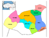 | ||||||||||||||||||||||||||
|
Metropolitan municipalities are bolded. | |||||||||||||||||||||||||||
This article about a Southeastern Anatolia Region of Turkey location is a stub. You can help Wikipedia by expanding it. |