
Native name: ᬦᬸᬲᬧᭂᬦᬶᬤ (nusapĕnida) | |
|---|---|
 Kelingking Beach | |
 Nusa Penida | |
| Geography | |
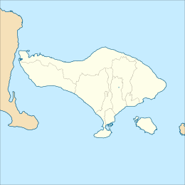
| Location | South East Asia |
| Coordinates | 8°44′0″S 115°32′0″E / 8.73333°S 115.53333°E |
| Archipelago | Lesser Sunda Islands |
| Area | 209.41 km2 (80.85 sq mi) |
| Highest elevation | 524 m (1719 ft) |
| Administration | |
Indonesia | |
| Province | Bali |
| Regency | Klungkung |
| Demographics | |
| Population | 64,580 (2022) |
| Pop. density | 295/km2 (764/sq mi) |
| Ethnic groups | Nusa Penidian/Nak Nusé, Balinese and other minority ethnic group |
Nusa Penida (Balinese: ᬦᬸᬲᬧᭂᬦᬶᬤ), romanized: nusapĕnida, lit. 'Penida Island') is an island located near the southeastern Indonesian island of Bali and a district of Klungkung Regency that includes the neighbouring small island of Nusa Lembongan and twelve even smaller islands. The Badung Strait separates the island and Bali. The interior of Nusa Penida is hilly with a maximum altitude of 524 metres. It is drier than the nearby island of Bali. It is one of the major tourist attractions among the three Nusa islands.
There are thirteen small islands nearby – Nusa Lembongan, Nusa Ceningan and eleven even smaller – which are included within the administrative district (kecamatan), which has the same name as the main island. It had a population of 45,110 at the 2010 census, covering 202.84 km2,[1] and the official estimate as at mid 2022 was 59,900.[2]
Bali Bird Sanctuary
Nusa Penida, and neighbouring Lembongan and Ceningan islands, are a bird sanctuary.[3] The island communities have used traditional Balinese village regulations to create the sanctuary. The idea of a sanctuary came from the Friends of the National Parks Foundation (FNPF).[4]
In 2006 all 35 villages (now 41 villages) agreed to make bird protection part of their traditional regulations (Balinese: ᬳᬯᬶᬕ᭄ᬳᬯᬶᬕ᭄, romanized: awig-awig). Since then, the FNPF has rehabilitated and released various Indonesian birds, most notably the critically endangered Bali starling which is endemic to Bali but whose numbers in the wild had declined to less than 10 in 2005. After a two-year program by FNPF in which 64 cage-bred birds were rehabilitated and released onto Nusa Penida, their number had increased to over 100 in 2009. Other released birds include the Java sparrow, Mitchell's lorikeet, and sulphur-crested cockatoo.[citation needed]
Destinations
Points of interest on Nusa Penida include:
- Kelingking Beach

Kelingking Beach - Broken Beach

Broken Beach - Angel Billabong
- Crystal Bay
- Atuh Beach
- Diamond Beach
- Suwehan Beach
- Peguyangan Waterfall
- Tembeling Forest
- Segening Waterfall
Dive sites
Nusa Penida covers a wide area of diving locations, including Penida Bay, Batu Lumbung (Manta Point), Batu Meling, Batu Abah, Toya Pakeh, and Malibu Point.[5] The flow through the Lombok Strait is, overall, south-tending, although the strength and direction of the tidal streams are influenced by the monsoon seasons.
During the southeast monsoons, the tidal flow tends south; during the northeast monsoons, the tidal flow tends north. In the area of the strait north of Nusa Penida, the pattern is relatively simple, with a flow, at peak tide, of about three-and-one-half knots. Tidal streams in Badung Strait are semi-diurnal, but the character of the stream is very complicated because its direction runs obliquely to the general south-to-north direction of Lombok Strait, and the channel has a curved shape.
Based on a survey in 2009, there were about 1,419 hectares of coral sites with 66 percent covering the sites in 3 metres depth and 74 percent covered the sites in 10 metres depth.[6]

References
- ^ "Nusa Penida (Eiseman, 1986)".
- ^ Badan Pusat Statistik, Jakarta, 2023, Kabupaten Klungkung Dalam Angka 2023 (Katalog-BPS 1102001.5105)
- ^ fnpf.org
- ^ Friends of the National Parks Foundation (FNPF).
- ^ Erviani, Ni Komang (30 May 2011). "Administration to improve access to Nusa Penida". The Jakarta Post. Klungkung, Bali.
- ^ "Nusa Penida Kaya Potensi namun Belum Menyejahterakan". March 10, 2013.
External links
 Nusa Penida travel guide from Wikivoyage
- Southeastern Islands travel guide from Wikivoyage