

Nuevo Chagres (Spanish pronunciation: [ˈnweβo ˈtʃaɣɾes], English: New Chagres) is a seaside town and corregimiento in the Colón Province of Panama, and the capital of the Chagres District. It had a population of 499 as of 2010. Its population as of 1990 was 327; its population as of 2000 was 419.[1]
The town is named after the historical settlement of Chagres, which lay about 8.2 miles (13.2 km) to the northwest, at the mouth of the Chagres River. Although Chagres fell outside the original boundary of the Panama Canal Zone, that boundary was expanded in 1916 to include the Chagres River's mouth. The town of Chagres—with its 96 houses and 400 to 500 inhabitants—was then "depopulated," and its former residents were relocated to Nuevo Chagres.[2]
YouTube Encyclopedic
-
1/3Views:1 051916533
-
-Víctor Juliao - Romanos 9 no habla del judio solamente-- - YouTube
-
LA LEY YA NO ES NUESTRO ADVERSARIO
-
Juan Carlos Navarro Caminata en el Chorrillo
Transcription
References
- ^ a b c "Cuadro 11 (Superficie, población y densidad de población en la República...)" [Table 11 (Area, population, and population density in the Republic...)] {{webarchive |url=https://web.archive.org/web/20160304030354/http://www.contraloria.gob.pa/inec/archivos/P3601Cuadro11.xls |date=March 4, 2016 }} (.xls). In "Resultados Finales Básicos" [Basic Final Results] (in Spanish). National Institute of Statistics and Census of Panama. Archived from the original on July 10, 2015. Retrieved May 26, 2015.
- ^ Peter L. Weaver and Gerald P. Bauer. "The San Lorenzo Protected Area: A Summary of Cultural and Natural Resources" (PDF). United States Department of Agriculture Forest Service, International Institute of Tropical Forestry. Archived from the original (PDF) on July 10, 2007. Retrieved 1 November 2012.
Capital: Colón | ||
| Chagres District | 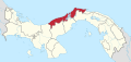 | |
| Colón District | ||
| Donoso District | ||
| Omar Torrijos Herrera District |
| |
| Portobelo District | ||
| Santa Isabel District | ||
| International | |
|---|---|
| National | |