
Novomykolaivka
Новомиколаївка | |
|---|---|
 | |
 Novomykolaivka | |
| Coordinates: 48°33′10″N 34°22′35″E / 48.55278°N 34.37639°E | |
| Country | Ukraine |
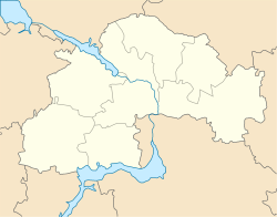
| Oblast | Dnipropetrovsk Oblast |
| Raion | Kamianske Raion |
| Population (2022)[1] | |
| • Total | 3,830 |
| Time zone | UTC+2 (EET) |
| • Summer (DST) | UTC+3 (EEST) |
Novomykolaivka (Ukrainian: Новомиколаївка; Russian: Новониколаевка) is a rural settlement in Kamianske Raion of Dnipropetrovsk Oblast in Ukraine. The settlement is located west of the city of Kamianske and south of the Kamianske Reservoir. It belongs to Verkhnodniprovsk urban hromada, one of the hromadas of Ukraine.[2] Population: 3,830 (2022 estimate).[1]
History
During World War II this village was under German occupation from 1941 to 1943.
It acquired the status of an urban-type settlement in 1966. A poultry farm was here.[3]
In 1985 a new department store was built here.[4]
In January 1989 the population was 4142 people.[5]
In January 2013 the population was 4187 people.[6]
Until 18 July 2020, Novomykolaivka belonged to Verkhnodniprovsk Raion. The raion was abolished in July 2020 as part of the administrative reform of Ukraine, which reduced the number of raions of Dnipropetrovsk Oblast to seven. The area of Verkhnodniprovsk Raion was merged into Kamianske Raion.[7][8]
Until 26 January 2024, Novomykolaivka was designated urban-type settlement. On this day, a new law entered into force which abolished this status, and Novomykolaivka became a rural settlement.[9]
Economy
Transportation
Verkhnodniprovsk railway station is located in Novomykolaivka.[3] It is on the railway connecting Kamianske and Kryvyi Rih.
Novomykolaivka is on Highway H08 which connects Kamianske and Kremenchuk. Another paved road runs to Verkhivtseve.
References
- ^ a b Чисельність наявного населення України на 1 січня 2022 [Number of Present Population of Ukraine, as of January 1, 2022] (PDF) (in Ukrainian and English). Kyiv: State Statistics Service of Ukraine. Archived (PDF) from the original on 4 July 2022.
- ^ "Верхнеднепровская городская громада" (in Russian). Портал об'єднаних громад України.
- ^ a b Новониколаевка // Большая Советская Энциклопедия. / под ред. А. М. Прохорова. 3-е изд. Т.18. М., «Советская энциклопедия», 1974.
- ^ Ежегодник Большой Советской Энциклопедии, 1986 (вып. 30). М., «Советская энциклопедия», 1986. стр.177
- ^ Всесоюзная перепись населения 1989 г. Численность городского населения союзных республик, их территориальных единиц, городских поселений и городских районов по полу
- ^ Чисельність наявного населення України на 1 січня 2013 року. Державна служба статистики України. Київ, 2013. стор. 48
- ^ "Про утворення та ліквідацію районів. Постанова Верховної Ради України № 807-ІХ". Голос України (in Ukrainian). 2020-07-18. Retrieved 2020-10-03.
- ^ "Нові райони: карти + склад" (in Ukrainian). Міністерство розвитку громад та територій України.
- ^ "Что изменится в Украине с 1 января". glavnoe.in.ua (in Russian). 1 January 2024.