
Nossen | |
|---|---|
 | |
 Coat of arms | |
Location of Nossen within Meissen district 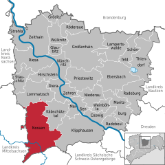 | |
 Nossen  Nossen | |
| Coordinates: 51°03′N 13°18′E / 51.050°N 13.300°E | |
| Country | Germany |
| State | Saxony |
| District | Meissen |
| Government | |
| • Mayor (2020–27) | Christian Bartusch[1] (SPD) |
| Area | |
| • Total | 122.61 km2 (47.34 sq mi) |
| Elevation | 259 m (850 ft) |
| Population (2021-12-31)[2] | |
| • Total | 10,446 |
| • Density | 85/km2 (220/sq mi) |
| Time zone | UTC+01:00 (CET) |
| • Summer (DST) | UTC+02:00 (CEST) |
| Postal codes | 01623, 01665, 01683 |
| Dialling codes | 035242, 035246, 035241 |
| Vehicle registration | MEI, GRH, RG, RIE |
| Website | www.nossen.de |
Nossen (Upper Sorbian: Nosyn, pronounced [ˈnɔsɨn]) is a town in the district of Meissen, in Saxony, Germany. It is located 80 km southeast of Leipzig. The town is dominated by a large Renaissance castle. Nossen is best known for its proximity to a motorway junction where the A14 merges onto the A4.
YouTube Encyclopedic
-
1/1Views:1 814
-
Schulrekord im Hochsprung der Männer, Gymnasium Nossen (gsg-tv)
Transcription
Geography

Neighboring towns
Nearest towns are Roßwein, Großschirma, Reinsberg and Striegistal in Mittelsachsen districts and Käbschütztal, Lommatzsch and Klipphausen in the Meißen district.
History
During World War II, a subcamp of Flossenbürg concentration camp was located here.[3][4]
Historical population
From 1995, recorded on 31 December, unless otherwise noted:[5]
|
|
Personalities
Sons and daughters of the city

- Friedrich Funcke (1642-1699), clergyman, cantor and composer
- Paul Richter (1859-1944), architect
- Friedrich Wilhelm Quintscher (1883-1945), founder of the order and author, who came to Adonism
- Manfred von Killinger (1886-1944) Nazi politician and diplomat, born on Gut Lindigt
- Joachim Nitsche (1926-1996), German mathematician
- Wolfgang Mieder (born 1944) professor of German Language and Folklore at the University of Vermont
References
- ^ Wahlergebnisse 2020, Freistaat Sachsen, accessed 10 July 2021.
- ^ "Bevölkerung des Freistaates Sachsen nach Gemeinden am 31. Dezember 2021" (XLS) (in German). Statistisches Landesamt des Freistaates Sachsen. 2022.
- ^ Christine O'Keefe. Concentration Camps Archived 10 October 2017 at the Wayback Machine
- ^ Flossenbürg subcamp
- ^ Datenquelle ab 1998: Statistisches Landesamt Sachsen
- ^ 31 December
- ^ 3 October
- ^ Using the enlarged district from 1 January 2003 (with Heynitz)
External links
Wikimedia Commons has media related to Nossen.
- Official site (in German)
Places adjacent to Nossen | |
|---|---|
Towns and municipalities in Meissen (district) | ||
|---|---|---|
 | ||
| International | |
|---|---|
| National | |
| Geographic | |
This Meissen location article is a stub. You can help Wikipedia by expanding it. |