
| Northern Midlands Council Tasmania | |||||||||||||||
|---|---|---|---|---|---|---|---|---|---|---|---|---|---|---|---|
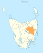
 Map showing the Northern Midlands local government area. | |||||||||||||||
| Coordinates | 41°50′25″S 147°27′39″E / 41.8402°S 147.4609°E | ||||||||||||||
| Population | 13,745 (LGA 2021)[1] | ||||||||||||||
| Established | 2 April 1993[2] | ||||||||||||||
| Area | 5,135 km2 (1,982.6 sq mi)[3] | ||||||||||||||
| Mayor | Mary Knowles | ||||||||||||||
| Council seat | Longford | ||||||||||||||
| Region | Northern midlands | ||||||||||||||
| State electorate(s) | Lyons | ||||||||||||||
| Federal division(s) | Lyons | ||||||||||||||
 | |||||||||||||||
| Website | Northern Midlands Council | ||||||||||||||
| |||||||||||||||
Northern Midlands Council is a local government body in Tasmania, extending south of Launceston into the northern region of the Tasmanian central midlands. Northern Midlands is classified as a rural local government area and has a population of 13,300,[3] the major population centres and localities of the region include Campbell Town, Evandale, Longford, and Perth.
YouTube Encyclopedic
-
1/3Views:1 279363761
-
TASMANIA CAMPBELL TOWN NORTHERN MIDLANDS COUNCIL
-
TASMANIA AVOCA NORTHERN MIDLANDS COUNCIL TOURISM HERITAGE
-
TASMANIA CAMPBELL TOWN NORTHERN MIDLANDS COUNCIL TOURISM HERITAGE
Transcription
History and attributes
On 2 April 1993, the municipalities of Campbell Town, Evandale, Fingal, Longford and Ross were amalgamated to form the Northern Midlands Council.[2] Northern Midlands is classified as rural, agricultural and very large under the Australian Classification of Local Governments.[4]
Localities
| Locality | Census population 2011 | Reason |
|---|---|---|
| Evandale | 1402 | |
| Longford | 3756 | Includes Bishopsbourne, Toiberry, Wilmores Lane, Pateena, Illawarra |
| Campbell Town | 994 | |
| Perth | 2635 * | * Missing from ABS |
| Bishopsbourne | Incl. in Longford | |
| Toiberry | Incl. in Longford | |
| Wilmores Lane | Incl. in Longford | |
| Pateena | Incl. in Longford | |
| Breadalbane | Incl. in Western Junction | |
| Devon Hills | 476 | |
| Western Junction | 298 | Includes Breadalbane |
| Clarendon | Incl. in Conara | |
| Deddington | 77 | Includes Blessington,English Town |
| Nile | Incl. in Conara | |
| Blessington | Incl. in Deddington | |
| English Town | Incl. in Deddington | |
| Storys Creek | Incl. in Avoca | |
| Rossarden | Incl. in Avoca | |
| Avoca | 300 | Includes Storys Creek, Rossarden, Royal George, LLewellyn, Frodberry (Break O'Day Council) |
| Royal George | Incl. in Avoca | |
| Lake Leake | ||
| Tooms Lake | Incl. in Ross | |
| Ross | 423 | Includes Tooms Lake, Auburn |
| Auburn | Incl. in Ross | |
| Delmont | Incl. in Cressy | |
| Poatina | Incl. in Cressy | |
| Blackwwod Creek | Incl. in Cressy | |
| Cressy | 1403 | Includes Delmont, Poatina, Blackwood Creek, Millers Bluff |
| Epping Forest | Incl. in Conara | |
| Conara | 484 | Includes Epping Forest, Cleveland, Clarendon, Nile, Powrana, Barton |
| Cleveland | Incl. in Conara | |
| LLewellyn | Incl. in Avoca | |
| Tunbridge | Incl. in Ross | |
| Powranna | Incl. in Conara | |
| Barton | Incl. in Conara | |
| Millers Bluff | Incl. in Cressy | |
| Illawarra | Incl. in Longford | |
| Total | 12,228 | |
| Local government total | 12,228 | Gazetted Northern Midlands local government area |
Not in above list
- Ben Lomond
- Bracknell
- Interlaken
- Lake Sorell
- Lemont
- Liffey
- Relbia
- Travellers Rest
- White Hills
- Youngtown
See also
References
- ^ Australian Bureau of Statistics (28 June 2022). "Northern Midlands (Local Government Area)". Australian Census 2021 QuickStats. Retrieved 28 June 2022.
- ^ a b "Agency Details: Northern Midlands Municipal Council". search.archives.tas.gov.au. Tasmanian Government. Retrieved 11 June 2018.
- ^ a b "3218.0 – Regional Population Growth, Australia, 2017-18: Population Estimates by Local Government Area (ASGS 2018), 2017 to 2018". Australian Bureau of Statistics. Australian Bureau of Statistics. 27 March 2019. Retrieved 25 October 2019. Estimated resident population, 30 June 2018.
- ^ "Local government national report 2014-2015". regional.gov.au. Australian Government. Retrieved 8 June 2018.
External links
Wikimedia Commons has media related to Northern Midlands Council.
- Northern Midlands Council official website
- Local Government Association Tasmania
- Tasmanian Electoral Commission - local government