
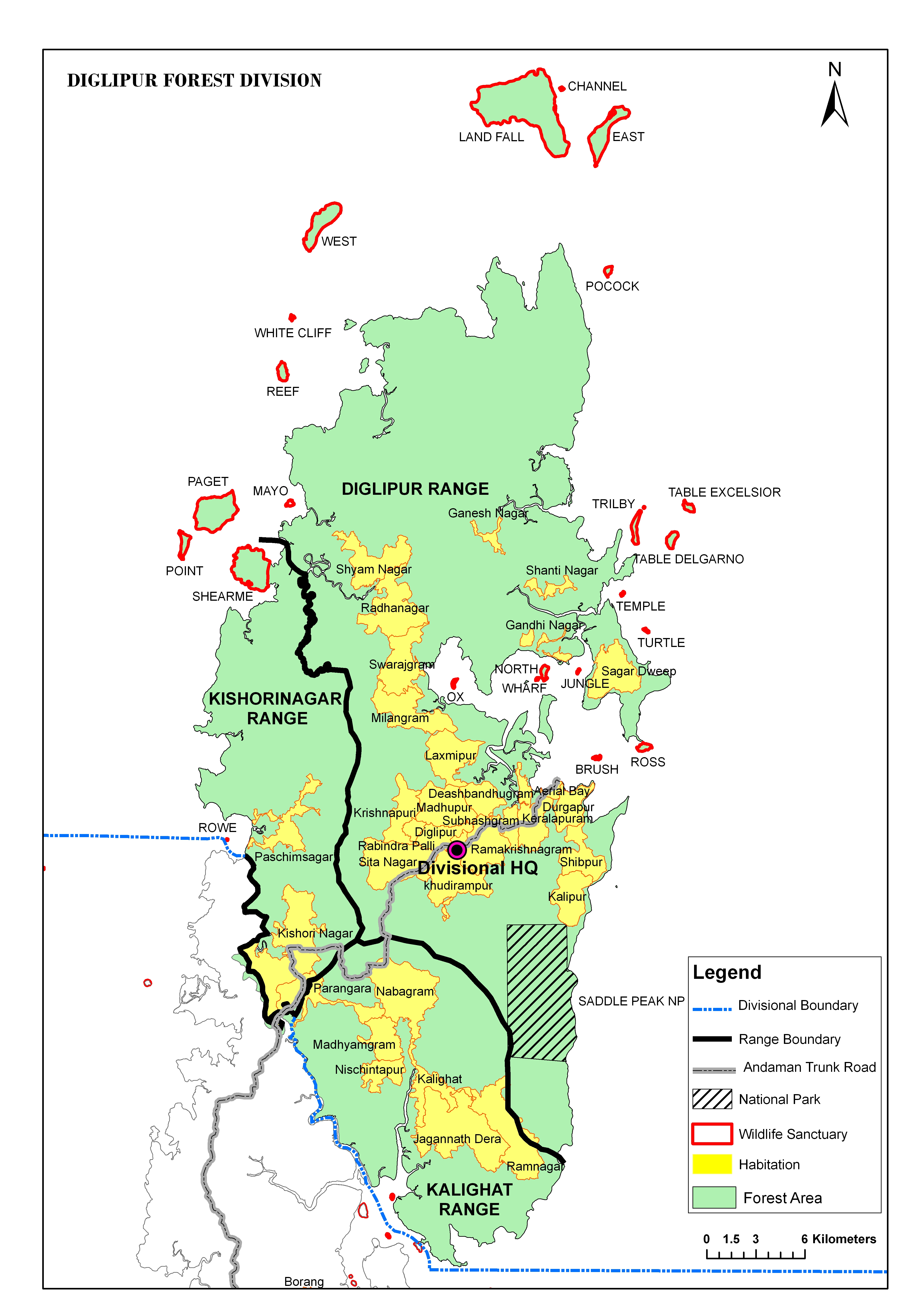
 Map of North Andaman Island | |
 North Andaman  North Andaman | |
| Geography | |
|---|---|
| Location | Bay of Bengal |
| Coordinates | 13°15′N 92°56′E / 13.25°N 92.93°E |
| Archipelago | Andaman Islands |
| Adjacent to | Indian Ocean |
| Area | 1,317 km2 (508 sq mi)[1] |
| Length | 80 km (50 mi) |
| Width | 26 km (16.2 mi) |
| Coastline | 366 km (227.4 mi) |
| Highest elevation | 731 m (2398 ft)[2] |
| Highest point | Saddle Peak |
| Administration | |
| District | North and Middle Andaman |
| Island group | Andaman Islands |
| Island sub-group | Great Andaman |
| Taluk | Diglipur Taluk |
| Largest settlement | Diglipur (pop. 15,000) |
| Demographics | |
| Population | 42541 (2011) |
| Pop. density | 32.3/km2 (83.7/sq mi) |
| Ethnic groups | Andamanese |
| Additional information | |
| Time zone | |
| PIN | 744202[3] |
| Telephone code | 031927 [4] |
| ISO code | IN-AN-00[5] |
| Official website | www |
| Literacy | 84.4% |
| Avg. summer temperature | 30.2 °C (86.4 °F) |
| Avg. winter temperature | 23.0 °C (73.4 °F) |
| Sex ratio | 1.2♂/♀ |
| Census Code | 35.639.0004 |
| Official Languages | Hindi, English |
North Andaman Island is the northern island of Great Andaman of the Andaman Islands.[6] It belongs to the North and Middle Andaman administrative district, part of the Indian union territory of Andaman and Nicobar Islands.[7] the island is lying 137 km (85 mi) north from Port Blair.
YouTube Encyclopedic
-
1/5Views:104 91319 090224 8575 023 066188 144
-
North Sentinel Island Mystery ( A Banned Island )
-
Diglipur Andaman Islands
-
Top Documentary Films Tribes Of Andeman Nicobar islands India Magia Nuda Documentaries
-
Meet The Forgotten Tribe That Has Not Yet Discovered Fire...
-
"Andaman and Nicobar Islands" Top 10 Best Tourist Places | Andaman Tourism
Transcription
Geography
[8] The island belongs to the Great Andaman group and lies north of Middle Andaman Island. many small island groups surround its beaches. The island's main town is Diglipur.
The island previously had an indigenous population of the Great Andamanese, for example, the Bo, but they are no longer present: the island is populated by immigrants from the Indian mainland and their descendants.
The island is home to the highest point in the archipelago, Saddle Peak at 731 metres.[2]
North Andaman has fairly frequent large earthquakes, and suffered inundation from the 2004 Indian Ocean earthquake tsunami.
Administration
The entire island is part of Diglipur Taluk.[9]
Transportation
There is a small port at Durgapur, 6 km (4 mi) north of Diglipur, with regular services from Port Blair.
Economy
North Andaman is known for its marine life: the island's main industries are rice- and orange-growing.
References
- ^ "Islandwise Area and Population - 2011 Census" (PDF). Government of Andaman. Archived from the original (PDF) on 28 August 2017. Retrieved 27 September 2016.
- ^ a b Sailing Directions (Enroute), Pub. 173: India and the Bay of Bengal (PDF). Sailing Directions. United States National Geospatial-Intelligence Agency. 2017. p. 275.
- ^ "A&N Islands - Pincodes". 22 September 2016. Archived from the original on 23 March 2014. Retrieved 22 September 2016.
{{cite web}}: CS1 maint: bot: original URL status unknown (link) - ^ "STD Codes of Andaman and Nicobar". allcodesindia.in. Archived from the original on 17 October 2019. Retrieved 23 September 2016.
- ^ Registration Plate Numbers added to ISO Code
- ^ Island-wise Statistical Outline - 2008. NORTH ANDAMAN ISLAND[permanent dead link] (PDF)
- ^ "Village Code Directory: Andaman & Nicobar Islands" (PDF). Census of India. Archived (PDF) from the original on 5 August 2016. Retrieved 16 January 2011.
- ^ "map". Archived from the original on 17 August 2019. Retrieved 15 June 2023.
- ^ "DEMOGRAPHIC – A&N ISLANDS" (PDF). andssw1.and.nic.in. Archived from the original (PDF) on 28 August 2017. Retrieved 23 September 2016.
- Geological Survey of India
 Andaman and Nicobar Islands travel guide from Wikivoyage