
Norra Lagnö | |
|---|---|
 Norra Lagnö  Norra Lagnö 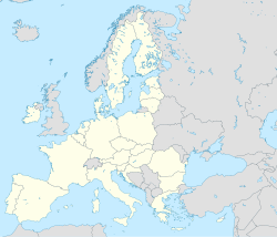 Norra Lagnö | |
| Coordinates: 59°21′N 18°25′E / 59.350°N 18.417°E | |
| Country | Sweden |
| Province | Uppland |
| County | Stockholm County |
| Municipality | Värmdö Municipality |
| Area | |
| • Total | 0.88 km2 (0.34 sq mi) |
| Population (31 December 2010)[1] | |
| • Total | 332 |
| • Density | 376/km2 (970/sq mi) |
| Time zone | UTC+1 (CET) |
| • Summer (DST) | UTC+2 (CEST) |
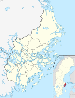
Norra Lagnö is a locality situated on a peninsular on the northern shore of the island of Värmdö in Sweden's Stockholm archipelago. From an administrative perspective, it is located in Värmdö Municipality and Stockholm County, and has 332 inhabitants as of 2010.[1]
Norra Lagnö is the southern terminal of the Tynningöleden vehicle ferry route to the island of Tynningö, operated by Trafikverket, and is also a calling point for the passenger ferries of the Waxholmbolaget on its routes from the city of Stockholm to the central part of the Stockholm archipelago. Buses of Storstockholms Lokaltrafik also link Norra Lagnö with central Stockholm, operating via the Skurubron bridge that links Värmdö to the mainland.[2][3]
YouTube Encyclopedic
-
1/3Views:381899698
-
Midsommar i Hummeldal -2005 [Del2]
-
445 - Gustavsberg Centrum - Orminge C - Slussen (historiskt dokument)
-
Sl-buss 429 - Gustavsberg centrum → Idalen
Transcription
References
- ^ a b c "Tätorternas landareal, folkmängd och invånare per km2 2005 och 2010" (in Swedish). Statistics Sweden. 14 December 2011. Archived from the original on 27 January 2012. Retrieved 10 January 2012.
- ^ "Tynningöleden" (in Swedish). Trafikverket. Retrieved 5 January 2018.
- ^ "Mellersta Skärgården Linjetrafik" [Middle Archipelago Routes] (PDF) (in Swedish). Waxholmbolaget. Retrieved 4 January 2018.
External links
 Media related to Norra Lagnö at Wikimedia Commons
This article about a location in Stockholm County, Sweden is a stub. You can help Wikipedia by expanding it. |