
Nor Geghi
Նոր Գեղի | |
|---|---|
 Nor Geghi | |
| Coordinates: 40°19′16″N 44°34′47″E / 40.32111°N 44.57972°E | |
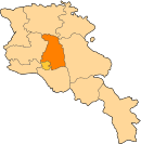
| Country | Armenia |
| Province | Kotayk |
| Elevation | 1,347 m (4,419 ft) |
| Population (2011 census) | |
| • Total | 5,319 |
40°19′16″N 44°34′47″E / 40.32111°N 44.57972°E Nor Geghi (Armenian: Նոր Գեղի) is a major village in the Kotayk Province of Armenia, located around 22 km north of the capital Yerevan, near the town of Nor Hachen. As of the 2011 census, the population of the village is 5,319.[1]
YouTube Encyclopedic
-
1/2Views:8141 837
-
Kaqavaberd Fortress (a.k.a. Geghi Berd), Armenia
-
Yerevan, 14.03.18, We, Video-1, Depi Oshakan.
Transcription
Archaeology
A 2014 study published in the journal Science discovered Levallois and bifacial stone tools in an archaeological site near Nor Geghi.[2] The artifacts, found preserved in soil under a later lava flow and dated at 325,000 – 335,000 years old, were a mix of two distinct stone tool technology traditions: bifacial tools and Levallois tools. Daniel Adler suggests that the coexistence of bifacial and Levallois tools at the site provides the first clear evidence that local populations developed Levallois technology out of existing bifacial technology and that the artifacts found at Nor Geghi reflect the technological flexibility and variability of a single population. He further concludes that this challenges the view that technological change resulted from population change and suggests instead that Levallois technology developed independently from existing technology within different human populations who shared a common technological ancestry.[3]
See also
References
- ^ Kotayk population
- ^ Adler, D. S.; Wilkinson, K. N.; Blockley, S.; Mark, D. F.; Pinhasi, R.; Schmidt-Magee, B. A.; Nahapetyan, S.; Mallol, C.; Berna, F. (2014-09-26). "Early Levallois technology and the Lower to Middle Paleolithic transition in the Southern Caucasus". Science. 345 (6204): 1609–1613. doi:10.1126/science.1256484. ISSN 0036-8075. PMID 25258079.
- ^ "Prehistoric Stone Tools Evolved Independently Within Local Populations, Say Researchers". Popular Archeology. September 25, 2014. Retrieved 2017-08-02.
This article about a location in Kotayk Province, Armenia is a stub. You can help Wikipedia by expanding it. |