Nong Chok
หนองจอก | |
|---|---|
 | |
 Khet location in Bangkok | |
| Coordinates: 13°51′20″N 100°51′45″E / 13.85556°N 100.86250°E | |
| Country | |
| Province | Bangkok |
| Seat | Krathum Rai |
| Khwaeng | 8 |
| Area | |
| • Total | 236.261 km2 (91.221 sq mi) |
| Population (2017) | |
| • Total | 170,643[1] |
| • Density | 722.26/km2 (1,870.6/sq mi) |
| Time zone | UTC+7 (THA) |
| Postal code | 10530 |
| Geocode | 1003 |
Nong Chok (Thai: หนองจอก, pronounced [nɔ̌ːŋ t͡ɕɔ̀ːk]) is one of the 50 districts (khet) of Bangkok, Thailand. It is bounded by other districts (from north clockwise): Amphoe Lam Luk Ka of Pathum Thani province, Amphoe Bang Nam Priao and Amphoe Mueang Chachoengsao of Chachoengsao province, Lat Krabang, Min Buri and Khlong Sam Wa of Bangkok. It is the biggest, easternmost and the most sparsely populated district of Bangkok.
History
The district was established as an amphoe in 1897 during the reign of King Chulalongkorn. The original settlers were Muslims relocated from southern Thailand. In 1902, it became an amphoe of the newly setup Min Buri province. Due to economic hardship during 1930–31, Min Buri Province was disbanded in 1931 and Nong Chok was transferred to Chachoengsao Province. However the administration was moved under Bangkok the next year due to inconvenience of travel between Nong Chok and Chachoengsao. As of 2006[update], about 75% of the population were Muslims while 22% were Buddhists. The name Nong Chok means water lettuce (Pistia stratiotes) swamp.
Administration
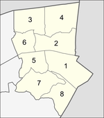
The district is sub-divided into eight sub-districts (khwaeng).
| No. | Name | Thai | Area (km2) |
Map |
|---|---|---|---|---|
1. |
Krathum Rai | กระทุ่มราย | 38.132 |
|
2. |
Nong Chok | หนองจอก | 29.992
| |
3. |
Khlong Sip | คลองสิบ | 30.849
| |
4. |
Khlong Sip Song | คลองสิบสอง | 38.867
| |
5. |
Khok Faet | โคกแฝด | 22.524
| |
6. |
Khu Fang Nuea | คู้ฝั่งเหนือ | 17.750
| |
7. |
Lam Phak Chi | ลำผักชี | 33.358
| |
8. |
Lam Toiting | ลำต้อยติ่ง | 24.789
| |
| Total | 236.261
| |||
Economy
Agriculture was and remains the most important part of Nong Chok economy. Rice, vegetables, fruits, and livestocks are the main products. It is famous for its gamecocks and birdcages. Many canals were dug for irrigation and transportation.
Environment
With a rural environment and surrounded by agricultural areas. Nong Chok is therefore the last habitat of the flying fox colony in the Bangkok area.[2]
Places

- Bangkok Arena
- Mahanakorn University of Technology
- Nong Chok National Football Center
- Nong Chok Park
- Wetchakarunrasm Hospital
Education
International schools include:
References
- ^ "Population and House Report for Year 2017". Department of Provincial Administration, Ministry of Internal Affairs. Retrieved 2018-04-01. (Search page)
- ^ หนองจอก บ้านนอก..กรุงเทพ (2019-05-02). "ถึงวันนี้ก็ยังมีคนหาไม่เจอ ว่าค้างคาวแม่ไก่หนองจอกอยู่ไหน ไปตามพิกัดนี้เลย". Facebook (in Thai). Retrieved 2024-01-21.
- ^ Home. Korean International School of Bangkok. Retrieved on March 8, 2016. "우) 10530 29/19 M.6 SOI 28 MITMAITRI NONGCHOK BANGKOK"