
Nishikawa
西川町 | |
|---|---|
 Nishikawa Town Hall | |
 Flag  Seal | |
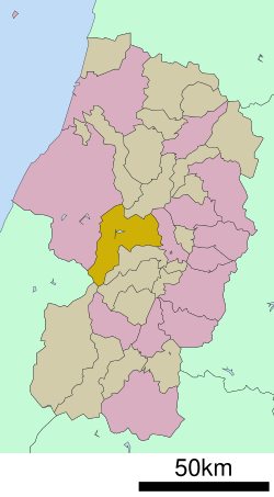 Location of Nishikawa in Yamagata Prefecture | |
 Nishikawa | |
| Coordinates: 38°25′35.4″N 140°08′51.4″E / 38.426500°N 140.147611°E | |
| Country | Japan |
| Region | Tōhoku |
| Prefecture | Yamagata |
| District | Nishimurayama |
| Area | |
| • Total | 393.19 km2 (151.81 sq mi) |
| Population (February 2020) | |
| • Total | 5,225 |
| • Density | 13/km2 (34/sq mi) |
| Time zone | UTC+9 (Japan Standard Time) |
| - Tree | Siebold’s Beech |
| - Flower | Lysichiton camtschatcensis Chrysanthemum |
| - Animal | Japanese serow |
| Phone number | 0237-74-2111 |
| Address | 510 Kaishō, Nishikawa-machi, Nishimurayama-gun, Yamagata-ken 990-0792 |
| Climate | Dfb |
| Website | Official website |

Nishikawa (西川町, Nishikawa-machi) is a town located in Yamagata Prefecture, Japan. As of 1 February 2020[update], the town had an estimated population of 5,225 in 1851 households,[1] and a population density of 145.1 persons per km². The total area of the town is 393.19 square kilometres (152 sq mi).
YouTube Encyclopedic
-
1/5Views:4833053 2201 1641 012
-
【4K60P】自然の美しさ / 山形県西川町志津 地蔵沼 / 月山山麓湧水群 / 名水百選【高画質・高音質収録】Gassan, Sizu, Nishikawa, Yamagata, Japan
-
GAP月山スノー ランド:西川町の子供達 スノーランド体験
-
月山TV:CH.月山:月山紅葉 ガイド 4K
-
DAZE:スノーシューのサイズの選び方!
-
月山TV:CH.大井沢:大井沢の魚が絶えないことを願って!4K
Transcription
Geography
Nishikawa is located in mountainous central Yamagata and includes Mount Gassan and Mount Asahi within its borders. The Sagae River passes through the town. Part of the town is within the borders of the Bandai-Asahi National Park.
Neighboring municipalities
Climate
Nishikawa has a Humid continental climate (Köppen climate classification Dfb) with large seasonal temperature differences, with warm to hot (and often humid) summers and cold (sometimes severely cold) winters. Precipitation is significant throughout the year, but is heaviest from August to October. The average annual temperature in Nishikawa is 8.9 °C (48.0 °F). The average annual rainfall is 2,719.0 mm (107.05 in) with December as the wettest month. The temperatures are highest on average in August, at around 21.8 °C (71.2 °F), and lowest in January, at around −2.3 °C (27.9 °F).[2]
| Climate data for Ōisawa, Nishikawa (1991−2020 normals, extremes 1978−present) | |||||||||||||
|---|---|---|---|---|---|---|---|---|---|---|---|---|---|
| Month | Jan | Feb | Mar | Apr | May | Jun | Jul | Aug | Sep | Oct | Nov | Dec | Year |
| Record high °C (°F) | 12.7 (54.9) |
15.7 (60.3) |
19.2 (66.6) |
27.0 (80.6) |
31.5 (88.7) |
32.6 (90.7) |
34.9 (94.8) |
35.0 (95.0) |
33.4 (92.1) |
28.7 (83.7) |
21.4 (70.5) |
16.0 (60.8) |
35.0 (95.0) |
| Mean daily maximum °C (°F) | 1.0 (33.8) |
1.8 (35.2) |
5.3 (41.5) |
11.8 (53.2) |
19.5 (67.1) |
23.2 (73.8) |
26.3 (79.3) |
27.7 (81.9) |
23.1 (73.6) |
17.0 (62.6) |
10.5 (50.9) |
3.7 (38.7) |
14.2 (57.6) |
| Daily mean °C (°F) | −2.3 (27.9) |
−2.1 (28.2) |
0.6 (33.1) |
5.2 (41.4) |
12.1 (53.8) |
16.9 (62.4) |
20.9 (69.6) |
21.8 (71.2) |
17.5 (63.5) |
11.0 (51.8) |
5.1 (41.2) |
0.1 (32.2) |
8.9 (48.0) |
| Mean daily minimum °C (°F) | −5.7 (21.7) |
−6.3 (20.7) |
−3.8 (25.2) |
−0.4 (31.3) |
5.1 (41.2) |
11.0 (51.8) |
16.3 (61.3) |
17.1 (62.8) |
12.9 (55.2) |
6.0 (42.8) |
0.6 (33.1) |
−3.1 (26.4) |
4.1 (39.5) |
| Record low °C (°F) | −18.9 (−2.0) |
−18.3 (−0.9) |
−19.9 (−3.8) |
−10.8 (12.6) |
−2.2 (28.0) |
2.1 (35.8) |
6.4 (43.5) |
7.3 (45.1) |
0.8 (33.4) |
−3.0 (26.6) |
−11.1 (12.0) |
−15.4 (4.3) |
−19.9 (−3.8) |
| Average precipitation mm (inches) | 345.3 (13.59) |
226.9 (8.93) |
185.0 (7.28) |
142.3 (5.60) |
138.5 (5.45) |
166.7 (6.56) |
291.6 (11.48) |
197.9 (7.79) |
179.4 (7.06) |
198.3 (7.81) |
268.9 (10.59) |
364.4 (14.35) |
2,719 (107.05) |
| Average snowfall cm (inches) | 378 (149) |
291 (115) |
196 (77) |
69 (27) |
3 (1.2) |
0 (0) |
0 (0) |
0 (0) |
0 (0) |
0 (0) |
40 (16) |
278 (109) |
1,265 (498) |
| Average precipitation days (≥ 1.0 mm) | 26.1 | 21.1 | 19.9 | 14.5 | 12.2 | 11.7 | 15.1 | 12.9 | 13.8 | 15.4 | 19.1 | 24.5 | 206.3 |
| Average snowy days (≥ 3 cm) | 23.5 | 19.3 | 16.6 | 10.0 | 0.7 | 0 | 0 | 0 | 0 | 0 | 3.3 | 17.1 | 90.5 |
| Mean monthly sunshine hours | 26.4 | 46.1 | 94.6 | 155.8 | 195.9 | 151.1 | 123.2 | 143.4 | 109.7 | 108.2 | 75.9 | 35.8 | 1,263.7 |
| Source: Japan Meteorological Agency[3][2] | |||||||||||||
Demographics
Per Japanese census data,[4] the population of Nishikawa peaked around 1950 and has declined considerably since then. It is now less than half what it was a century ago.
| Year | Pop. | ±% |
|---|---|---|
| 1920 | 11,787 | — |
| 1930 | 13,307 | +12.9% |
| 1940 | 13,601 | +2.2% |
| 1950 | 15,527 | +14.2% |
| 1960 | 14,389 | −7.3% |
| 1970 | 10,740 | −25.4% |
| 1980 | 9,473 | −11.8% |
| 1990 | 8,554 | −9.7% |
| 2000 | 7,452 | −12.9% |
| 2010 | 6,270 | −15.9% |
| 2020 | 4,956 | −21.0% |
History
The area of present-day Nishikawa was part of ancient Dewa Province. After the start of the Meiji period, the area became part of Nishimurayama District, Yamagata Prefecture. The town of Nishikawa was established on October 1, 1954 by the merger of the villages of Kawadoi, Nishiyama, Hondōji and Ōisawa.
Economy
The economy of Nishikawa is based on seasonal tourism and forestry.
Education
Nishikawa has one public elementary schools and one public middle school operated by the town government. The town does not have a high school.
Transportation
Railway
Nishikawa is not served by any passenger rail service. The nearest station is Uzen-Takamatsu Station in the neighboring city of Sagae.
Highway
 Yamagata Expressway : Nishikawa IC, Gassan IC
 National Route 112
Local attractions
- Mount Gassan
- Mount Asahi
- Mizugatoro Dam
- Sagae Dam
- Iwanesawa Sanzan Shrine
Sister city relations
 Frisco, Colorado, USA – since August 29, 1990
References
- ^ Nishikawa City official statistics (in Japanese)
- ^ a b 気象庁 / 平年値(年・月ごとの値). JMA. Retrieved March 25, 2022.
- ^ 観測史上1~10位の値(年間を通じての値). JMA. Retrieved March 25, 2022.
- ^ Nishikawa population statistics
External links
 Media related to Nishikawa, Yamagata at Wikimedia Commons
- Official Website (in Japanese)
| Core city | ||
|---|---|---|
| Cities | ||
| Districts | ||
| International | |
|---|---|
| National | |