
Nidfurn | |
|---|---|
Village (and former municipality) | |
 | |
 Coat of arms | |
 The former municipal area (2005) | |
| Coordinates: 46°59′11″N 9°3′17″E / 46.98639°N 9.05472°E | |
| Country | Switzerland |
| Canton | Glarus |
| Municipality | Glarus Süd |
| Elevation | 560 m (1,840 ft) |
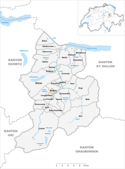
Nidfurn is a village, and former municipality, in the municipality of Glarus Süd and canton of Glarus in Switzerland.[1]
YouTube Encyclopedic
-
1/1Views:3 982
-
UHD/4K - Switzerland 281 (Camera on board): Klausenpass / Col du Clausen (Glarus to Uri) (Hero3)
Transcription
History
Nidfurn is first mentioned in 1289 as Nitfúre.[2]
Nidfurn belonged to Säckingen Abbey until 1395. During the Middle Ages, it was one of the richest parts of Glarus. Until the 20th century, the principal economic activity in the village was the raising of cattle, sheep and goats, with the dairy industry developing in the 18th century. Cotton spinning by hand was also common in the 18th century, but this never developed into factory-based industrial activity.[2]
In 1879, Linthal was connected to the Swiss railway network by the opening of the Swiss Northeastern Railway line from Weesen to Linthal.[2]
On 1 July 2006, the municipality of Nidfurn was merged into the municipality of Haslen. On 1 January 2011, the municipality of Haslen was itself merged into the new municipality of Glarus Süd.[3][4]
Geography
Nidfurn is located in the valley of the Linth river, with the village situated above the west bank of the river, at an elevation of approximately 560 m (1,840 ft). Leuggelbach lies to the south, Schwanden is to the north, and Haslen is across the river to the east.[1]
Transport
Nidfurn is located on the Hauptstrasse 17, which runs the length of the canton of Glarus before climbing the Klausen Pass into the canton of Uri, as well as on the Weesen to Linthal railway line that parallels the main road and the Linth river through Glarus. The high alpine Klausen Pass is normally only open to traffic between June and September, and for the rest of the year the road and railway up the valley form the only access to the village. The village is served by Nidfurn-Haslen railway station, which is served by the hourly Zürich S-Bahn service S25 between Linthal and Zurich.[1][5][6]
Demographics
The historical population of Nidfurn is given in the following table:[2]
| year | population |
|---|---|
| 1701 | 135 |
| 1860 | 477 |
| 1900 | 348 |
| 1950 | 390 |
| 2000 | 258 |
References
- ^ a b c map.geo.admin.ch (Map). Swiss Confederation. Retrieved 2015-05-01.
- ^ a b c d "Nidfurn". Historical Dictionary of Switzerland (in French). 2008-12-15. Retrieved 2015-05-03.
- ^ "Haslen". Historical Dictionary of Switzerland (in French). 2008-05-28. Retrieved 2015-05-02.
- ^ "Gemeinde Glarus Süd" [Glarus Süd Municipality] (in German). Gemeinde Glarus Süd. Retrieved 27 April 2015.
- ^ "S-Bahn trains, buses and boats" (PDF). ZVV. 10 December 2023. Retrieved 16 December 2023.
- ^ "Ziegelbrücke - Linthal" (PDF). Bundesamt für Verkehr. 15 September 2023. Retrieved 16 December 2023.
External links
 Media related to Nidfurn at Wikimedia Commons
- Nidfurn from the Glarus Süd municipal web site (in German)
- Nidfurn in German, French and Italian in the online Historical Dictionary of Switzerland.
Municipalities in the Canton of Glarus, Switzerland | ||
|---|---|---|
| Municipalities from January 1, 2011 | ||
| Former municipalities | ||
This Canton of Glarus location article is a stub. You can help Wikipedia by expanding it. |