
Newhalen, Alaska
Nuuriileng, Nughilen | |
|---|---|
 Newhalen Location in Alaska | |
| Coordinates: 59°43′32″N 154°53′40″W / 59.72556°N 154.89444°W | |
| Country | United States |
| State | Alaska |
| Borough | Lake and Peninsula |
| Incorporated | October 26, 1971[1] |
| Government | |
| • Mayor | Agnes Rychnovsky |
| • State senator | Lyman Hoffman (D) |
| • State rep. | Bryce Edgmon (I) |
| Area | |
| • Total | 8.50 sq mi (22.01 km2) |
| • Land | 6.03 sq mi (15.62 km2) |
| • Water | 2.47 sq mi (6.39 km2) |
| Elevation | 62 ft (19 m) |
| Population (2020) | |
| • Total | 168 |
| • Density | 27.85/sq mi (10.75/km2) |
| Time zone | UTC-9 (Alaska (AKST)) |
| • Summer (DST) | UTC-8 (AKDT) |
| ZIP code | 99606[3] |
| Area code | 907 |
| FIPS code | 02-53270 |
| GNIS feature ID | 1406978 |
Newhalen (Central Yupik: Nuuriileng; Tanaina: Nughilen) is a city in Lake and Peninsula Borough, Alaska, United States. At the 2020 census, the population was 168.[4]
YouTube Encyclopedic
-
1/2Views:6571 951
-
Heartbeat Alaska: Nondalton Environment
-
Story of Igiugig: Native Sovereignty in Alaska
Transcription
Geography
Newhalen is located at 59°43′32″N 154°53′40″W / 59.72556°N 154.89444°W (59.725688, -154.894442).[5]
Newhalen is on the north shore of Iliamna Lake in southern Alaska, at the mouth of Newhalen River.
According to the United States Census Bureau, the city has a total area of 8.3 square miles (21 km2), of which, 6.1 square miles (16 km2) of it is land and 2.3 square miles (6.0 km2) of it (27.37%) is water.
The proposed Pebble Mine site is located near Newhalen.
The nearest mountain is called Roadhouse Mountain.
Demographics
| Census | Pop. | Note | %± |
|---|---|---|---|
| 1940 | 55 | — | |
| 1950 | 48 | −12.7% | |
| 1960 | 63 | 31.3% | |
| 1970 | 88 | 39.7% | |
| 1980 | 87 | −1.1% | |
| 1990 | 160 | 83.9% | |
| 2000 | 160 | 0.0% | |
| 2010 | 190 | 18.8% | |
| 2020 | 168 | −11.6% | |
| U.S. Decennial Census[6] | |||
As of the census[7] of 2000, there were 160 people, 39 households, and 37 families residing in the city. The population density was 26.4 inhabitants per square mile (10.2/km2). There were 51 housing units at an average density of 8.4 per square mile (3.2/km2). The racial makeup of the city was 8.75% White, 85.00% Native American, and 6.25% from two or more races.
There were 39 households, out of which 59.0% had children under the age of 18 living with them, 56.4% were married couples living together, 12.8% had a female householder with no husband present, and 5.1% were non-families. 5.1% of all households were made up of individuals, and 0.0% consisted of a sole occupant 65 years of age or older. The average household size was 4.10 and the average family size was 4.22.
In the city, the age distribution of the population shows 45.0% under the age of 18, 9.4% from 18 to 24, 20.6% from 25 to 44, 20.0% from 45 to 64, and 5.0% who were 65 years of age or older. The median age was 20 years. For every 100 females, there were 100.0 males. For every 100 females age 18 and over, there were 120.0 males.
The median income for a household in the city was $36,250, and the median income for a family was $35,000. Males had a median income of $38,333 versus $23,750 for females. The per capita income for the city was $9,448. About 26.7% of families and 16.3% of the population were below the poverty line, including 17.9% of those under the age of eighteen and none of those 65 or over.
History
Newhalen was originally a Yup'ik village called Noghelin, after the Newhalen River. "Newhalen" is an Anglicized version of the original name. The village was established in the late 1800s because of the bountiful fish and game in the area.
The population of Newhalen now includes Alutiiqs and Athabascans as well as Yupik. Most pursue subsistence hunting and fishing.
References
- ^ "Directory of Borough and City Officials 1974". Alaska Local Government. Juneau: Alaska Department of Community and Regional Affairs. XIII (2): 57. January 1974.
- ^ "2020 U.S. Gazetteer Files". United States Census Bureau. Retrieved October 29, 2021.
- ^ "Newhalen AK ZIP Code". zipdatamaps.com. 2023. Retrieved June 16, 2023.
- ^ "2020 Census Data - Cities and Census Designated Places" (Web). State of Alaska, Department of Labor and Workforce Development. Retrieved December 5, 2021.
- ^ "US Gazetteer files: 2010, 2000, and 1990". United States Census Bureau. February 12, 2011. Retrieved April 23, 2011.
- ^ "Census of Population and Housing". Census.gov. Retrieved June 4, 2015.
- ^ "U.S. Census website". United States Census Bureau. Retrieved January 31, 2008.
Municipalities and communities of Lake and Peninsula Borough, Alaska, United States | ||
|---|---|---|
| Cities | 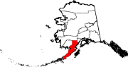 | |
| CDPs | ||
| Ghost town | ||