
| Newby and Scalby | |
|---|---|
| Civil parish | |
 | |
| Area | 5.13 sq mi (13.3 km2) |
| Population | 9,513 (2011 census)[1] |
| • Density | 1,854/sq mi (716/km2) |
| OS grid reference | TA008905 |
| Civil parish |
|
| Unitary authority | |
| Ceremonial county | |
| Region | |
| Country | England |
| Sovereign state | United Kingdom |
| Post town | SCARBOROUGH |
| Postcode district | YO13 |
| Police | North Yorkshire |
| Fire | North Yorkshire |
| Ambulance | Yorkshire |
| UK Parliament | |
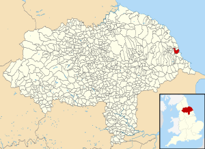
Newby and Scalby is a civil parish in the Scarborough district of North Yorkshire, England, formed by the smaller southern area of Newby and the larger, northern, area of Scalby.
YouTube Encyclopedic
-
1/3Views:1 6673 957 4082 390
-
Newby Detective Film
-
OUR OWN DISNEY WEDDING | NIKO RACHEL WEDDING
-
Very Early Stapleford Park Railway film (1968 ish)
Transcription
Geography
The shape of the parish is a rectangle perpendicular to the coast, omitting the south-east corner which is the sea life centre and park of Scarborough, with a north-west rectangular projection most of which is closer to Burniston than Scalby. The village forms one large cluster in the mid-south of this area traversed by several small roads and passing through is a section of the relatively minor A171. Newby is south of the Scalby Beck (or Sea Cut) and is physically undivided from the rest of Scarborough. The coast here is cliffs topped by the Cleveland Way including Scalby Ness.
Demography
According to the 2011 UK census, Newby and Scalby parish had a population of 9,513. At the time of the last census the rate of home ownership (with or without a loan) was greater than the average in the district and the proportion of social housing was significantly lower in terms of housing stock.[1] The population here had decreased by 2.4% from the 2001 UK census figure of 9,748.[2]
| Output area | Homes owned outright | Owned with a loan | Socially rented | Privately rented | Shared ownership | Other | km2 green spaces | km2 roads | km2 water | km2 domestic gardens | km2 domestic buildings | km2 non-domestic buildings | Usual residents | km2 |
|---|---|---|---|---|---|---|---|---|---|---|---|---|---|---|
| Newby and Scalby | 2,182 | 1,277 | 306 | 321 | 45 | 64 | 10.45 | 0.50 | 0.48 | 1.67 | 0.38 | 0.06 | 9,513 | 13.29 |
Amenities
Scalby has the high street of the two settlements, commercial at street-level leading westward and upwards into the North York Moors National Park.
Scarborough RUFC, play and train immediately north of the built-up area. A separate ground in Scarborough itself is the ground of Scarborough Pirates ARLFC.
Scalby Cricket Club and Scalby Football Club share a ground on Carr Lane.
The 13th-century parish church to St Laurence in Scalby was modified to include a tower since 1683 and is a grade II* listed building, the middle category of listing.[4]
Newby and Scalby Primary School is the main amenity named after both villages or suburbs. Scalby School is local secondary school in the parish.
References
- ^ a b UK Census (2011). "Local Area Report – Newby and Scalby Parish (1170217355)". Nomis. Office for National Statistics. Retrieved 7 March 2018.
- ^ UK Census (2001). "Local Area Report – Newby and Scalby Parish (36UG035)". Nomis. Office for National Statistics. Retrieved 5 March 2020.
- ^ "Key Statistics: Dwellings; Quick Statistics: Population Density; Physical Environment: Land Use Survey 2005". Neighbourhood Statistics. Office for National Statistics. Retrieved 17 February 2015.
- ^ Historic England. "Church of St Laurence (1148211)". National Heritage List for England. Retrieved 26 November 2013.
External links
![]() Media related to Newby and Scalby at Wikimedia Commons
Media related to Newby and Scalby at Wikimedia Commons