
 Location of New Siberia in the Anzhu subgroup | |
 New Siberia | |
| Geography | |
| Location | between the Laptev Sea and East Siberian Sea |
| Coordinates | 75°05′14″N 148°27′30″E / 75.08722°N 148.45833°E |
| Archipelago | New Siberian Islands |
| Area | 6,200 km2 (2,400 sq mi) |
| Highest elevation | 76 m (249 ft) |
| Highest point | unnamed |
| Administration | |
Russia | |
| Territory | Yakutia |
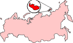
New Siberia (Russian: Но́вая Сиби́рь, pronounced [ˈnovəjə sʲɪˈbʲirʲ]; English transliteration: Novaya Sibir, /ˈnoʊvaɪə sɪˈbɪər/; Yakut: Саҥа Сибиир, romanized: Saŋa Sibiir) is the easternmost of the Anzhu Islands, the northern subgroup of the New Siberian Islands lying between the Laptev Sea and East Siberian Sea. Its area of approximately 6,200 square kilometres (2,394 square miles) places it the 102nd largest islands in the world. New Siberia Island is low lying, rising to only 76 metres (249 feet) and covered with tundra vegetation. The island is a part of the territory of Yakutia, Russia.
YouTube Encyclopedic
-
1/1Views:553
-
New Siberian Islands
Transcription
Geology
New Siberia Island consists of clastic sediments ranging from Late Cretaceous to Pleistocene in age. The Late Cretaceous sediments consist of extensively folded layers of gray and greenish gray tuffaceous sand, tuffaceous silt, pebbly sand, and layers of brown coal exposed in sea cliffs along it southwest coast. The sand and silt often contain either volcanic glass, fossil plants, rhyolite pebbles, or some combination of them. Eocene sand, silt, clay, and brown coal overlies an erosional unconformity cut into the Late Cretaceous sediments. Within the northwest part of New Siberia Island, these sediments grade into clays that contain fragments of marine bivalves. Directly overlying the Eocene sediments and another erosional unconformity are sands of Oligocene and Early Miocene age. They contain thin beds of silt, mud, clay, and pebbles. These sands contain fossil plants and lagoonal, swamp, and lacustrine diatoms. These sands are overlain by Pliocene sediments consisting of layers of sand, silt, mud, peat, and pebbles.[1][2]
Except for the Derevyannye Hills, Pleistocene sediments blanket almost the entire surface of New Siberia Island. These deposits consist of layers of marine sediments overlain by terrestrial sediments. The lower marine sediments are composed of three superimposed beds of marine to brackish water clay containing fossil mollusks and capped with peat. The overlying terrestrial sediments consist of an ice complex composed of ice-rich wind-blown silt in which ice wedges have developed. This ice complex accumulated over tens of thousands of years during the Late Pleistocene, through the Last Glacial Maximum, until it stopped at about 10,000 BP. During this period of tens of thousands of years, the formation of ice complex buried and preserved in permafrost an enormous number of mammoth tusks and bones and the bones of other “megafauna”.[2][3][4]
New Siberia Island is noted for abundant upright tree trunks, logs, leaf prints, and other plant debris that occur within sediments that are exposed along sea cliffs and within the uplands of the Derevyannye Hills along its southern coast.[5][6][7]
Due to the abundance of exposed coalified logs and upright trunks, early explorers and paleobotanists referred to the Derevyannye Hills as either the "Wood Mountains", "Wood Hills", or "Tree Mountain".[5][8][9] At one time, the highly folded layers of sand, silt, mud, clay, and brown coal containing these coalified tree fossils were once thought to have accumulated during either the Miocene or Eocene Epoch.[7][8]
These sediments and the fossil trunks and logs, which they contain, are now known to date to the Late Cretaceous Period (Turonian Stage).[10] Baron Von Toll,[7] Dr. Klubov and others,[10] Dr. Dorofeev and others,[4] as well as other publications all demonstrate that the claims by some authors, i.e. Mr. Southall,[11] that the "Wood Hills" of New Siberia Island are either partially or completely "formed of driftwood" are completely erroneous.[citation needed]
Vegetation
Rush/grass, forb, cryptogam tundra covers the New Siberia Island. It is tundra consisting mostly of very low-growing grasses, rushes, forbs, mosses, lichens, and liverworts. These plants either mostly or completely cover the surface of the ground. The soils are typically moist, fine-grained, and often hummocky.[12]
History
Russian explorer Yakov Sannikov was the first recorded European to set foot on New Siberia Island, in 1806. He discovered it during one of several hunting expeditions financed by merchants, Semyon and Lev Syrovatsky.[13]
See also
References
- ^ Fujita, K., and D.B. Cook, 1990, The Arctic continental margin of eastern Siberia, in A. Grantz, L. Johnson, and J. F. Sweeney, eds., pp. 289–304, The Arctic Ocean Region. Geology of North America, vol L, Geological Society of America, Boulder, Colorado.
- ^ a b Kos’ko, M.K., and G.V. Trufanov, 2002, Middle Cretaceous to Eopleistocene Sequences on the New Siberian Islands: an approach to interpret offshore seismic. Marine and Petroleum Geology. vol. 19, no. 7, pp. 901–919.
- ^ Basilyan, A., and P.A. Nikolskiy, 2002, Quaternary Deposits of New Siberia Island (Russian Arctic). 32nd Annual Arctic Workshop Abstracts, March 14–16, 2002, Institute of Arctic and Alpine Research, University of Colorado at Boulder.
- ^ a b Dorofeev, V.K., M.G. Blagoveshchensky, A.N. Smirnov, and V.I. Ushakov, 1999, New Siberian Islands. Geological structure and metallgeny. VNIIOkeangeologia, St. Petersburg, Russia. 130 pp. (in Russian)
- ^ a b Armstrong, A., 1857, A Personal Narrative of the Discovery of the North-west Passage : With numerous incidents of travel and adventure during nearly five years' continuous service in the Arctic regions while in search of the expedition under Sir John Franklin. Hurst and Blackett Publishers, London, England. 616 pp.
- ^ Taylor, R. C., 1848, Statistics of Coal: The Geographical and Geological Distribution of Mineral Combustibles or Fossil Fuel or Mineral Combustibles or Fossil Fuel. J. W. Moore, Philadelphia, Pennsylvania. 754 pp.
- ^ a b c von Toll E., 1890, Tertiire Pflanzen der Insel Neu-Sibirien. In J. Schmalliausen, ed., Wissenflschaftliche Resultate der von der kaiserlichen Akademie zur. Erforschung des Jana-Landes u.s,w, ausgesandten Expedition, II, Mérn. Acad. Imp. Sci. Saint-Pétersb., 1890, 7e sér. XXXVII, no. 5.
- ^ a b Kropotkin, P., 1900, Hurst and Blackett Review: Baron Toll on New Siberia and the Circumpolar Tertiary Flora. The Geographical Journal. vol. 16, no. 1, pp. 95–98.
- ^ von Toll, E., and P. Kropotkin, 1989, Proposal for an Expedition to Sannikoff Land. The Geographical Journal. vol. 12, no. 2, pp. 162–172.
- ^ a b Klubov, B.A., A.A. Korshunov, and I.G. Badera, 1976, New data on coal measures of Novaya Sibir' Island, New Siberian. Transactions Doklady of the U.S.S.R. Academy of Sciences: Earth Science Sections. vol. 231, no. 1-6, pp. 58–60.
- ^ Southall, J.C., 1875, The Recent Origin of Man, as Illustrated by Geology and the Modern Science of Pre-Historic Archaeology. J.B. Lippincott & Company, London, United Kingdom. 606 pp.
- ^ CAVM Team, 2003, Circumpolar Arctic Vegetation Map. Scale 1:7,500,000. Conservation of Arctic Flora and Fauna (CAFF) Map No. 1. U.S. Fish and Wildlife Service, Anchorage, Alaska.
- ^ Mills, W. J., 2003, Exploring polar frontiers: a historical encyclopedia. ABC CLIO Publishers, Oxford, United Kingdom.
External links
- anonymous, nd,"New Siberian Islands". Archived from the original on 2010-12-23. Retrieved 2010-12-23.
{{cite web}}: CS1 maint: unfit URL (link) aerial photographs of these islands. - Andreev, A.A., and D.M. Peteet, 1999, Climate and Diet of Mammoths in the East Siberian Arctic . Science Briefs (August 1999). Goddard Institute for Space Studies, New York, New York. Last visited July 12, 2008.
- Anisimov, M.A., and V.E. Tumskoy, 2002, Environmental History of the Novosibirskie Islands for the last 12 ka. 32nd International Arctic Workshop, Program and Abstracts 2002. Institute of Arctic and Alpine Research, University of Colorado at Boulder, pp 23–25.
- Kuznetsova, T.V., L.D. Sulerzhitsky, Ch. Siegert, 2001, New data on the “Mammoth” fauna of the Laptev Shelf Land (East Siberian Arctic), The World of Elephants - International Congress, Rome 2001. Consiglio Nazionale delle Ricerche, Centro di Studio per il Quaternario e l'Evoluzione Ambientale, Università di Roma, Roma, Italy.
- Schirrmeister, L., H.-W. Hubberten, V. Rachold, and V.G. Grosse, 2005, Lost world - Late Quaternary environment of periglacial Arctic shelves and coastal lowlands in NE-Siberia. 2nd International Alfred Wegener Symposium Bremerhaven, October, 30 - November 2, 2005.
75°05′14″N 148°27′30″E / 75.08722°N 148.45833°E