To install click the Add extension button. That's it.

The source code for the WIKI 2 extension is being checked by specialists of the Mozilla Foundation, Google, and Apple. You could also do it yourself at any point in time.

4,5
Kelly Slayton
Congratulations on this excellent venture… what a great idea!
Alexander Grigorievskiy
I use WIKI 2 every day and almost forgot how the original Wikipedia looks like.
What we do. Every page goes through several hundred of perfecting techniques; in live mode. Quite the same Wikipedia. Just better.
.
Leo
Newton
Brights
Milds

Neuwied (district)

From Wikipedia, the free encyclopedia

Neuwied
Flag of Neuwied
Coat of arms of Neuwied
Map
CountryGermany
StateRhineland-Palatinate
CapitalNeuwied
Government
 • District admin.Achim Hallerbach (CDU)
Area
 • Total626.80 km2 (242.01 sq mi)
Population
 (31 December 2021)[1]
 • Total184,390
 • Density290/km2 (760/sq mi)
Time zoneUTC+01:00 (CET)
 • Summer (DST)UTC+02:00 (CEST)
Vehicle registrationNR
Websitekreis-neuwied.de

Neuwied (German pronunciation: [nɔʏˈviːt] ) is a district (Kreis) in the north of Rhineland-Palatinate, Germany. Neighboring districts are (from north clockwise) Rhein-Sieg, Altenkirchen, Westerwaldkreis, Mayen-Koblenz, Ahrweiler.

YouTube Encyclopedic

  • 1/1
    Views:
    1 134
  • Rheinbrücke (Raiffeisenbrücke) zwischen Neuwied und Weißenthurm (B256)

Transcription

History

The district was created in 1816 when the area became part of the Prussian Rhine province. In 1822 the district Linz was merged into the district.

The district has a partnership with the Polish county Namysłów in Opole Voivodeship; first contacts date to 1998 and the partnership became official in 2000.

Geography

The districts landscape covers the Westerwald mountains, east of the Rhine river valley. The Rhine forms the western boundary of the district.
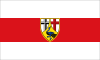
Coat of arms

The crosses in the top represent the two clerical states which owned part of the district - the black cross of Cologne in the left, the red cross of Trier in the right. The peacock in the bottom is taken from the coat of arms of the Counts of Wied.

Towns and municipalities

NeuwiedBuchholzAsbachWindhagenNeustadt (Wied)RheinbreitbachUnkelBruchhausenErpelVettelschoßLinz am RheinKasbach-OhlenbergOckenfelsSankt KatharinenDattenbergLeubsdorfBad HönningenRheinbrohlHammersteinLeutesdorfIsenburgKleinmaischeidGroßmaischeidStebachMarienhausenDierdorfOberdreisWoldertRodenbach bei PuderbachRatzertNiederwambachSteimelDöttesfeldPuderbachDürrholzHanrothRaubachHarschbachNiederhofenDernbachUrbachLinkenbachBreitscheidWaldbreitbachRoßbachHausenDatzerothNiederbreitbachHümmerichOberhonnefeld-GierendOberradenStraßenhausKurtscheidBonefeldEhlscheidRengsdorfMelsbachHardertAnhausenRüscheidThalhausenMeinbornMarienhausenNorth Rhine-WestphaliaAltenkirchen (district)Ahrweiler (district)Mayen-KoblenzKoblenzWesterwaldkreis
Clickable map of towns and municipalities in the district

Verband-free town: Neuwied

Verbandsgemeinden
  1. Asbach1
  2. Buchholz
  3. Neustadt (Wied)
  4. Windhagen
  1. Bad Hönningen1, 2
  2. Hammerstein
  3. Leutesdorf
  4. Rheinbrohl
  1. Dierdorf1, 2
  2. Großmaischeid
  3. Isenburg
  4. Kleinmaischeid
  5. Marienhausen
  6. Stebach
  1. Dattenberg
  2. Kasbach-Ohlenberg
  3. Leubsdorf
  4. Linz am Rhein1, 2
  5. Ockenfels
  6. Sankt Katharinen
  7. Vettelschoß
  1. Dernbach
  2. Döttesfeld
  3. Dürrholz
  4. Hanroth
  5. Harschbach
  6. Linkenbach
  7. Niederhofen
  8. Niederwambach
  9. Oberdreis
  10. Puderbach1
  11. Ratzert
  12. Raubach
  13. Rodenbach bei Puderbach
  14. Steimel
  15. Urbach
  16. Woldert
  1. Anhausen
  2. Bonefeld
  3. Breitscheid
  4. Datzeroth
  5. Ehlscheid
  6. Hardert
  7. Hausen (Wied)
  8. Hümmerich
  9. Kurtscheid
  10. Meinborn
  11. Melsbach
  12. Niederbreitbach
  13. Oberhonnefeld-Gierend
  14. Oberraden
  15. Rengsdorf1
  16. Roßbach
  17. Rüscheid
  18. Straßenhaus
  19. Thalhausen
  20. Waldbreitbach
  1. Bruchhausen
  2. Erpel
  3. Rheinbreitbach
  4. Unkel1, 2
1seat of the Verbandsgemeinde; 2town

References

  1. ^ "Bevölkerungsstand 2021, Kreise, Gemeinden, Verbandsgemeinden" (in German). Statistisches Landesamt Rheinland-Pfalz. 2022.

External links

50°30′N 7°30′E / 50.5°N 7.5°E / 50.5; 7.5

This page was last edited on 25 March 2024, at 22:37
Basis of this page is in Wikipedia. Text is available under the CC BY-SA 3.0 Unported License. Non-text media are available under their specified licenses. Wikipedia® is a registered trademark of the Wikimedia Foundation, Inc. WIKI 2 is an independent company and has no affiliation with Wikimedia Foundation.