
Nawada district | |
|---|---|
 Phulwaria reservoir | |
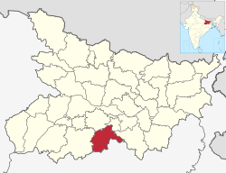 Location of Nawada district in Bihar | |
| Country | |
| State | Bihar |
| Division | Magadh |
| Headquarters | Nawada |
| Government | |
| • Lok Sabha constituencies | Nawada |
| • Vidhan Sabha constituencies | Nawada, Hisua, Rajauli, Gobindpur & Warisaliganj. |
| Area | |
| • Total | 2,494 km2 (963 sq mi) |
| Population (2011)[1] | |
| • Total | 2,219,146 |
| • Density | 890/km2 (2,300/sq mi) |
| • Urban | 215,579 |
| Demographics | |
| • Literacy | 59.76% |
| • Sex ratio | 939 |
| Time zone | UTC+05:30 (IST) |
| Major highways | NH 20, NH 120 |
| Website | nawada |
Nawada district[2] is one of the thirty-eight districts of the Indian state of Bihar. Nawada is its administrative headquarters. The district is the easternmost district of the Magadh division, one of the nine administrative divisions of Bihar. The area of the modern district was historically part of the Magadha, Shunga and Gupta empires. Koderma and Giridih districts of the state of Jharkhand lie on the southern border of the district; it also shares borders with the Gaya, Nalanda, Sheikhpura, and Jamui districts of Bihar.
YouTube Encyclopedic
-
1/5Views:141 33348 7063 6616 068187 583
-
Nawada City | Beautiful district of Bihar | नवादा जिला की सच्चाई 🍀🇮🇳
-
नवादा(बिहार)का इतिहास||History Of Nawada Bihar||Nawada City||Nawada Tourist Places
-
Nawada-District of Bihar | नवादा-जिला | BPSC,SI & All Bihar Exams Special | Gsmaster |Amarjeet sir ।
-
Nawada Jila Ke 14 Block Ke Naam| Nawada All Block Name| Blocks In Arwal District
-
NAWADA (BIHAR)!! NAWADA CITY!! NAWADA HISTORY!! NAWADA DISTRICT!! NEAR GAYA/NALANDA/AURANGABAD/JAMUI
Transcription
History
In 1845, Nawada was made a subdivision of Gaya district. Nawada district was separated from Gaya district on January 26, 1973.
Kakolat Falls are mentioned in Hindu Pauranik History as the abode of a king turned into a python by a Rishi's curse.[3]
Geography
Nawada district occupies an area of 2,494 square kilometres (963 sq mi),[4] comparatively equivalent to Chile's Navarino Island.[5] Most parts of the district are plain but some areas are hilly. The main rivers are the Sakri, Khuri, Panchane, Bhusri by Kakolat and Tilaiya.[6]
Administrative divisions
Nawada District is divided into two Sub-divisions and then into 14 blocks.[1] These blocks in their respective sub-divisions are as follows :[7]
Nawada sub-division
- Hisua – Bagodar, Chhatihar, Chitarghati, Dhanwa, Dona, Eknar, Hadsa, Hisua Nagar Panchayat, Kaithir, Pachra, Sonsa, Tekpur, Tungi
- Warisaliganj –Gopalpur, Makanpur, Apsarh, Baghi Bardiha, Pakribarawan, Chakwae, Dosut, Hajipur, Kochgawn, Kumbhi, Kutri, Manjaur, Masudha, Mohiuddin Pur, Mosima, Naromurar, Paingari, Gorapar, Saur, Shahpur, Thera, Warisaliganj Nagar Panchayat, maafi, simri, may, chainpur, chandipur, balyari, baali, bilaari.
- Nawada – Bhadauni, Akauna Minhai, Amthi, Bhadokhra, Bhagwanpur, Didaur, Gonawa, Jamuawa,Patwa Sarai,Gopal Ganj, Jhunathi, Kharant, Loharpura, Mahuli, Nanaura, Nawada Nagar Parishad, Oraina, Paura, Kadirganj, Samai, Sonsiahri
- Kawakol – Chhabail, Darawa, Debnagar, Kawakol, Kebali, Khadshari, Lalpur, Mahudar, Manjhila, Nawadaih, Paharpur, Pali, Pandegangot, Saroni, Shekhodewra
- Nardiganj – Dohra, Handiya, Ichua Karna, Kahuara, Kosla, Masaurha, Nardiganj, Nanaura, Odo, Parma, Pesh
- Kashichak – Parwati, Revera, Jagdishpur, Chandinama, Khakhari, Belar, Birnawa, Subhanpur, Derhgaon, Sarkatti
- Pakari Barawan – Belkhunda, Budhaul, Dioura, Okaura, Dewdha, Dhodha, Dumrawan, Dumari, Lilo, Sundari, Euri, Jiuri, Kewala, Kunanpur, Pakri Barawan, Poksi
Rajauli sub-division
- Akbarpur – Baksanda, Baliya Buzurg, Barail, Barew, Bhanail, Bhudhuwa, Fattehpur, Gobind Bigha, Kulna, Ladaha, Malikpur,Rajhat Sharif Nemdarganj, Mankhar, Pachgawan, Pachrukhi, Paijuna, Panti, Parto Karahri, Pharaha, Sakarpura, Diri
- Narhat – Babhnaur, Jamuara, Khanwa, Konibar, Narhat, Pali Kurd, Punaul, Punthar, Saidapur Goasa, Shekhpura
- Meskaur – Akri Pandebigha, Barat, Barosar, Biju Bigha, Meskaur, Mairzapur, Pasarhi, Rasulpur, Saraye, Tetariya, Mahugay
- Sirdala – Abdul, Akauna, Bandhi, Bargawan, Chaube, Chaukia, Dhiraundh, Ghaghat, Khalkhu, Khanpura, Khatangi, Laund, Rajan, Sanrh Majhgawn, Sirdala, Upardih
- Rajauli – Amawa East, Amawa West, Andharbari, Bahadurpur, Chitarkoli, Dhamni, Hardiya, Jogya Maran, Lengura, Murhena, Parka Buzurg, Rajauli Nagar Panchayat, Sawaiya Tand, Sirodabar, Takua Tand
- Govindpur – Baksoti, Baniya Bigha, Budhwara, Madhopur, Bisunpur, Bhawanpur, Delhua, Sarkanda, Sughri, Govindpur
- Roh – Nazardih, Ohari, Marui
Nawada also has 5 Assembly constituencies: Nawada, Hisua, Rajauli, Gobindpur and Warisaliganj.
Economy
The main crops harvested in the district are paddy, wheat, pulses, and vegetables. Industrial facilities in the district include bidi factories and silk handlooms.[6] Formerly, sugar cane farming and processing also took place; the district's single sugar mill, located in Warisaliganj, is currently non-functional.[8] Kadirganj, located 6 km from Nawada, has a small scale (Handloom Silk) Industry where more than 100 weavers families involved in weaving handloom silk clothes.[9]
Rajauli Hisua and Warsaliganj are emerging as significant market hubs for the hinterland regions bordering Jharkhand state, and have also produced many professionals including physicians, surgeons, engineers who are working in many parts of India.[9] The Nuclear Power Corporation of India identified Rajauli as the possible site for creating an additional 2,800 MW of nuclear power capacity in the state.[10]
In 2006 the Ministry of Panchayati Raj named Nawada one of the country's 250 most backward districts (out of a total of 640).[11] It is one of the 38 districts in Bihar currently receiving funds from the Backward Regions Grant Fund Programme (BRGF).[12]
Transport
National Highway 20 runs roughly north–south through the western side of district, serving many villages and towns, including the administrative center of Nawada.[13] National Highway 120 follows a 30 km route in the far northwestern corner of the district, passing through the town of Hisua.[14] Including state highways and other routes connecting villages, the district has approximately 420 km of paved roads.[15] Deluxe buses are available from Nawada to cities like Patna, Bihar Shariff, Bodh Gaya, Rajgir, Koderma and major cities Patna, Kolkata, Ranchi, Bokaro,Jamshedpur etc.[16]
The district lies in the East Central Railway of Indian Railways; the Gaya–Kiul line crosses the district roughly east–west, and connects with the Bakhtiyarpur–Tilaiya line at Tilaiya Junction. Two express trains and several local trains run on the Gaya-Kiul line via Nawada railway station.[17] Though electrification is complete, doubling of railway line is under process. This would provide alternative route for Kolkata and North-East bound trains and would enhance passenger services and freight trains. Currently a Delhi bound train is already scheduled and running from Godda to New Delhi and vice versa has halt at Nawada railway station.[18]
Demographics
| Year | Pop. | ±% p.a. |
|---|---|---|
| 1901 | 412,119 | — |
| 1911 | 431,938 | +0.47% |
| 1921 | 430,323 | −0.04% |
| 1931 | 477,400 | +1.04% |
| 1941 | 554,733 | +1.51% |
| 1951 | 613,724 | +1.02% |
| 1961 | 741,633 | +1.91% |
| 1971 | 893,937 | +1.89% |
| 1981 | 1,099,177 | +2.09% |
| 1991 | 1,359,694 | +2.15% |
| 2001 | 1,809,696 | +2.90% |
| 2011 | 2,219,146 | +2.06% |
| source:[19] | ||
According to the 2011 census Nawada district has a population of 2,219,146,[21] roughly equal to the nation of Latvia[22] or the US state of New Mexico.[23][why?] This gives it a ranking of 205th in India (out of a total of 640).[21] The district has a population density of 889 inhabitants per square kilometre (2,300/sq mi).[21] Its population growth rate over the decade 2001-2011 was 22.49%.[21] Nawada had a sex ratio of 936 females for every 1000 males,[21] and a literacy rate of 61.63%. 9.71% of the population lives in urban areas. Scheduled Castes and Scheduled Tribes make up 25.47% and 0.09% of the population respectively.[21]
At the time of the 2011 Census of India, 55.52% of the population in the district spoke Magahi, 36.64% Hindi and 7.57% Urdu as their first language.[24]
Politics
| District | No. | Constituency | Name | Party | Alliance | Remarks | ||
|---|---|---|---|---|---|---|---|---|
| Nawada | 235 | Rajauli | Prakash Veer | RJD | MGB | |||
| 236 | Hisua | Nitu Kumari | INC | MGB | ||||
| 237 | Nawada | Vibha Devi Yadav | RJD | MGB | ||||
| 238 | Gobindpur | Md Kamran | RJD | MGB | ||||
| 239 | Warsaliganj | Aruna Devi | BJP | NDA | ||||
Education
The district has good literacy percentage. There are numerous institution for Higher education and secondary education.
Higher educational institutes
- KLS College, Nawada
- TS College, Hisua
- Krishna Memorial College, Nawada
- Krishak college dheodha .
- S N Sinha college, Warisaliganj
- SGBK Sahu senior secondary school Warisaliganj
- Mahila college warisaliganj
- National school mafi warisaliganj
- Warsi College Pandeygangout Kawakol, Nawada
- RMW College, Nawada
- Seth Sagarmal College
- Sita Ram Sahu College, Nawada
- Ram lakhan Singh Yadav College, Nawada
- Triveni College of Education, Nawada
- Swami Sahjanand Saraswati Sanskrit College, Nawada
- Ganauri Ramkali Teacher's Training College, Nawada
- Nawada Vidhi Mahavidyalaya
- Ravikant Punam B.Ed college Dosut Warsaliganj, Nawada
Secondary educational institutes
* TPS International School, Pipra Kushahan, Sirdalla
- RPS Convent Public School, Nawada
- Dayal Public School, Nawada
- Jawahar Navodaya Vidyalaya, Rewar, Nawada
- High School Aanti, Kadirganj,Nawada
- Gyan Bharti Model Residential Complex, Hisua
- Modern English School, Nawada
- Manas Bharti Educational Complex, Nawada
- Jeevan Jyoti Public School, Nawada
- Gyan Bharti Public School, Nawada
- Jeevan Deep Public School, Nawada
- Gyan Bharti Public School, Pakribarawan, Nawada
- St. Joseph's School, Nawada
- The Diksha School, Nawada
- Delhi Public School, Nawada
- Momin High School, par Nawada
- Gandhi Inter School, Nawada
- Bless International School (CBSE 10+2 Arts, Science & Commerce) ,Nawada
- Iraqui Urdu Girls School (10+2) , Ansar Nagar, Nawada
- Unique Public School,Nawada
See also
Tourism
Nawada district has its own tourism splendour and has the potential to develop as a tourist destination. In the town's immediate surroundings, there are various points of interest. The Kakolat Waterfall (24 km from town) and the Sekho Devra Ashram are among them (Sarvodaya Ashram was established here in Kowakole block by Jaiprakash Narayan and inaugurated by Dr. Rajendra Prasad), Baba Majaar and Hanuman Temple (located on NH 31, a shrine of Hazrat Saiyyad Shah Jalaluddin Bukhari and a Hanuman temple), Jarra Baba (found in Sirdalla), Hanuman Mandir (located in Kendua village), and Maa Bageshwari Mandir (located in Kendua village) (located in Jamuawa, in 3 km of Jamui road of Nawada in side of Sakri River).[25]
References
- ^ a b District Census Handbook – Nawada (PDF). Census of India 2011. Vol. Part B: Village and Town wise Primary Census Abstract. Patna: Directorate of Census Operations, Bihar.
- ^ "Nawada District". Nawada District.
- ^ "Destinations". Bihar State Tourism Development Corporation. Patna: Government of Bihar. Eco Circuit. Archived from the original on 2015-07-06. Retrieved 2015-08-21.
- ^ Srivastava, Dayawanti; et al., eds. (2010). "States and Union Territories: Bihar: Government". India 2010: A Reference Annual (54th ed.). New Delhi: Additional Director General, Publications Division, Ministry of Information and Broadcasting (India), Government of India. pp. 1118–1119. ISBN 978-81-230-1617-7.
- ^ "Island Directory Tables: Islands by Land Area". United Nations Environment Program. 1998-02-18. Archived from the original on 2018-02-20. Retrieved 2011-10-11.
Navarino Island 2,473 km2
- ^ a b "District Nawada". rainrays.com.
- ^ "Subdivision & Blocks | Welcome to Nawada District Web Portal". Retrieved 2019-02-13.
- ^ "Five closed sugar mills in state likely to be opened soon". The Times of India. 5 January 2012.
- ^ a b "Nawada District". bihar.com.
- ^ BP Staff (4 February 2013). "Bihar's first Nuclear Power Plant to come up at Rajauli". biharprabha.com.
- ^ "BRGF Overview". New Delhi: Ministry of Panchayati Raj. Retrieved 2017-02-07.[dead link]
- ^ "BRGF Districts". New Delhi: Ministry of Panchayati Raj. 6 June 2014. Retrieved 2017-02-07.[dead link]
- ^ ASL Advanced Systems Pvt. Ltd. Road Division Map: District - Nawada (PDF) (Map). Patna: Government of Bihar. Archived from the original (pdf) on 2012-02-24. Retrieved 2015-08-20.
- ^ "National Highways passing through Bihar" (PDF). Bihar Road Construction Department. Patna: Government of Bihar. 2009-08-26. p. 3. Archived from the original (PDF) on 2012-02-24. Retrieved 2015-08-20.
- ^ "State Highways and Major District Roads across State of Bihar" (PDF). Bihar Road Construction Department. Patna: Government of Bihar. March 2013. p. 28. Archived from the original (PDF) on 2015-08-21. Retrieved 2015-08-21.
- ^ "Patna to Nawada Volvo bus service". bus-service.in.
- ^ "Arrivals at Nawada". indiarailinfo.com.
- ^ "Arrivals at Nawada". indiarailinfo.com.
- ^ "Table A-02 Decadal Variation in Population Since 1901: Bihar" (PDF). census.gov.in. Registrar General and Census Commissioner of India.
- ^ "Table C-01 Population by Religion: Bihar". censusindia.gov.in. Registrar General and Census Commissioner of India. 2011.
- ^ a b c d e f "District Census Handbook: Nawada" (PDF). Census of India. Registrar General and Census Commissioner of India. 2011.
- ^ US Directorate of Intelligence. "Country Comparison: Population". Archived from the original on June 13, 2007. Retrieved 2011-10-01.
Latvia 2,204,708 July 2011 est.
- ^ "2010 Resident Population Data". U. S. Census Bureau. Retrieved 2011-09-30.
New Mexico - 2,059,179
- ^ a b "Table C-16 Population by Mother Tongue: Bihar". censusindia.gov.in. Registrar General and Census Commissioner of India. 2011.
- ^ "Tourism | District Administration, Nawada | India".
External links
24°45′N 85°00′E / 24.750°N 85.000°E
Places adjacent to Nawada district | |
|---|---|