
Navacerrada | |
|---|---|
 Winter in Navacerrada | |
 Flag  Coat of arms | |
| Nickname: Nava | |
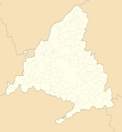 Navacerrada Location in Spain  Navacerrada Navacerrada (Spain) | |
| Coordinates: 40°43′48″N 4°00′55″W / 40.73000°N 4.01528°W | |
| Country | |
| Autonomous community | |
| Population (2018)[1] | |
| • Total | 2,911 |
| Time zone | UTC+1 (CET) |
| • Summer (DST) | UTC+2 (CEST) |
| Climate | Csb |
Navacerrada is a municipality of the Community of Madrid, Spain. It lies at an elevation of 1,203 metres (3,947 ft) on the Reservoir Navacerrada and the entry of "Valle de la Barranca" in the Sierra de Guadarrama.
Located 52 kilometres (32 mi) from Madrid, it has only 2,500 permanent residences, but winter visitors increase the population. The Port of Navacerrada has a popular ski resort that is very popular with winter sportspeople. It has a ski school and various restaurants, hotels and accommodation.[2]
YouTube Encyclopedic
-
1/3Views:1 3536368 364
-
Un Paseo por el Pueblo de Navacerrada, Sierra de Madrid
-
Descenso Bola del Mundo y puerto de Navacerrada
-
TREN DE CERCEDILLA a PUERTO DE NAVACERRADA
Transcription
Climate
Although relatively close to Madrid, Navacerrada has a Mediterranean climate with cool/warm summers due to elevation (Köppen: Csb) or dry-summer continental climate (Dsb) by 0 °C isoterm, winter is also usually on average a few degrees cooler than the Spanish capital. The city has a clearly dry summer, but the high rainfall can be between spring and fall, being lower only in late winter, rather than gradually decreasing in transitional seasons.
The next graphic shows the averages and record temperatures at the Navacerrada mountain pass, which is located at an elevation 600 meters above the village of Navacerrada.[3][4]
| Climate data for Navacerrada (1981-2010) (altitude: 1894 m, satellite view) | |||||||||||||
|---|---|---|---|---|---|---|---|---|---|---|---|---|---|
| Month | Jan | Feb | Mar | Apr | May | Jun | Jul | Aug | Sep | Oct | Nov | Dec | Year |
| Record high °C (°F) | 16.2 (61.2) |
16.8 (62.2) |
18.6 (65.5) |
22.6 (72.7) |
25.4 (77.7) |
32.0 (89.6) |
30.8 (87.4) |
31.8 (89.2) |
30.8 (87.4) |
23.4 (74.1) |
20.0 (68.0) |
17.0 (62.6) |
32.0 (89.6) |
| Mean daily maximum °C (°F) | 2.3 (36.1) |
3.0 (37.4) |
5.8 (42.4) |
7.0 (44.6) |
11.5 (52.7) |
18.0 (64.4) |
22.4 (72.3) |
22.2 (72.0) |
17.2 (63.0) |
10.6 (51.1) |
5.6 (42.1) |
3.3 (37.9) |
10.7 (51.3) |
| Daily mean °C (°F) | −0.4 (31.3) |
0.1 (32.2) |
2.3 (36.1) |
3.4 (38.1) |
7.4 (45.3) |
13.2 (55.8) |
17.0 (62.6) |
16.8 (62.2) |
12.7 (54.9) |
7.3 (45.1) |
2.8 (37.0) |
0.7 (33.3) |
6.9 (44.4) |
| Mean daily minimum °C (°F) | −3.2 (26.2) |
−2.9 (26.8) |
−1.1 (30.0) |
−0.3 (31.5) |
3.2 (37.8) |
8.3 (46.9) |
11.5 (52.7) |
11.5 (52.7) |
8.2 (46.8) |
3.9 (39.0) |
0.1 (32.2) |
−2.0 (28.4) |
3.1 (37.6) |
| Record low °C (°F) | −18.2 (−0.8) |
−18.6 (−1.5) |
−14.7 (5.5) |
−11 (12) |
−8 (18) |
−3.4 (25.9) |
0.0 (32.0) |
0.2 (32.4) |
−3 (27) |
−7.6 (18.3) |
−11.8 (10.8) |
−20.3 (−4.5) |
−20.3 (−4.5) |
| Average precipitation mm (inches) | 124 (4.9) |
96 (3.8) |
84 (3.3) |
127 (5.0) |
124 (4.9) |
64 (2.5) |
23 (0.9) |
26 (1.0) |
60 (2.4) |
156 (6.1) |
176 (6.9) |
163 (6.4) |
1,223 (48.1) |
| Average precipitation days | 12 | 10 | 9 | 12 | 12 | 7 | 3 | 4 | 7 | 12 | 12 | 13 | 111 |
| Average snowy days | 12 | 12 | 9 | 11 | 5 | 1 | 0 | 0 | 0 | 3 | 8 | 11 | 71 |
| Average relative humidity (%) | 80 | 79 | 74 | 77 | 72 | 59 | 47 | 49 | 63 | 79 | 83 | 81 | 70 |
| Mean monthly sunshine hours | 109 | 114 | 162 | 166 | 215 | 289 | 348 | 321 | 211 | 146 | 103 | 92 | 2,268 |
| Source 1: Agencia Estatal de Meteorología[5] | |||||||||||||
| Source 2: Agencia Estatal de Meteorología (record values)[6] | |||||||||||||
Public transport
Bus
- 690: Guadarrama - Collado Mediano - Navacerrada
- 691: Madrid (Moncloa) - Becerril de la Sierra - Navacerrada - Valdesquí
- 696: Collado Villalba (hospital) - Navacerrada
Train
Navacerrada has a train station by which line C-9 of Cercanías Madrid runs through. This line connects Navacerrada with Cotos and Cercedilla.
References
- ^ Municipal Register of Spain 2018. National Statistics Institute.
- ^ "Navacerrada". Vipealo. Retrieved 29 December 2020.
- ^ "Solargis :: iMaps". solargis.info. Retrieved 2019-08-03.
- ^ "Clima Navacerrada: Temperatura, Climograma y Tabla climática para Navacerrada - Climate-Data.org". es.climate-data.org. Retrieved 2019-08-03.
- ^ "Valores climatológicos normales. Puerto de Navacerrada". Agencia Estatal de Meteorología. Retrieved 25 July 2012.
- ^ "Valores extremos. Puerto de Navacerrada". Agencia Estatal de Meteorología. Retrieved 25 July 2012.
External links
 Media related to Navacerrada at Wikimedia Commons
| International | |
|---|---|
| National | |
| Geographic | |
This article about a location in the Community of Madrid, Spain is a stub. You can help Wikipedia by expanding it. |