
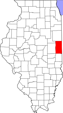
This is a list of properties on the National Register of Historic Places in Vermilion County, Illinois.
This is intended to be a complete list of the properties and districts on the National Register of Historic Places in Vermilion County, Illinois, United States. Latitude and longitude coordinates are provided for many National Register properties and districts; these locations may be seen together in a map.[1]
There are 13 properties and districts listed on the National Register in the county. Another two properties were once listed but have been removed.
This National Park Service list is complete through NPS recent listings posted April 12, 2024.[2]
Current listings


Former listing
| [3] | Name on the Register | Image | Date listed | Date removed | Location | City or town | Description |
|---|---|---|---|---|---|---|---|
| 1 | Building at 210–212 West North Street |  |
November 8, 2000 (#00001334) | January 2, 2020 | 210–212 West North St. 40°07′34″N 87°38′00″W / 40.126111°N 87.633333°W | Danville | Demolished c. 2006.[7] |
| 2 | Temple Building | 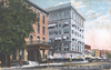 |
December 1, 2000 (#00001457) | March 14, 2002 | 102-106 N. Vermilion St. 40°07′35″N 87°37′48″W / 40.1264°N 87.63°W | Danville | Building demolished by the City of Danville in 2002 |
See also
Wikimedia Commons has media related to National Register of Historic Places in Vermilion County, Illinois.
- List of National Historic Landmarks in Illinois
- National Register of Historic Places listings in Illinois
References
- ^ The latitude and longitude information provided in this table was derived originally from the National Register Information System, which has been found to be fairly accurate for about 99% of listings. Some locations in this table may have been corrected to current GPS standards.
- ^ National Park Service, United States Department of the Interior, "National Register of Historic Places: Weekly List Actions", retrieved April 12, 2024.
- ^ a b Numbers represent an alphabetical ordering by significant words. Various colorings, defined here, differentiate National Historic Landmarks and historic districts from other NRHP buildings, structures, sites or objects.
- ^ The eight-digit number below each date is the number assigned to each location in the National Register Information System database, which can be viewed by clicking the number.
- ^ Maruszak, Kathleen. National Register of Historic Places Inventory/Nomination: Collins Archeological District. National Park Service, 1977-04, 14.
- ^ "ITARP Annual Report Archived 2013-02-27 at the Wayback Machine, Illinois Transportation Archaeological Research Program, 2009, 30-31. Accessed 2012-05-17.
- ^ "Archived copy" (PDF). Archived from the original (PDF) on 2013-12-24. Retrieved 2014-01-12.
{{cite web}}: CS1 maint: archived copy as title (link)

Municipalities and communities of Vermilion County, Illinois, United States | ||
|---|---|---|
| Cities |  | |
| Villages | ||
| Townships | ||
| CDPs | ||
| Other communities | ||
| Footnotes | ‡This populated place also has portions in an adjacent county or counties | |