To install click the Add extension button. That's it.

The source code for the WIKI 2 extension is being checked by specialists of the Mozilla Foundation, Google, and Apple. You could also do it yourself at any point in time.

4,5
Kelly Slayton
Congratulations on this excellent venture… what a great idea!
Alexander Grigorievskiy
I use WIKI 2 every day and almost forgot how the original Wikipedia looks like.
Live Statistics
English Articles
Improved in 24 Hours
Added in 24 Hours
Languages
Recent
Show all languages
What we do. Every page goes through several hundred of perfecting techniques; in live mode. Quite the same Wikipedia. Just better.
.
Leo
Newton
Brights
Milds

National Register of Historic Places listings in Coles County, Illinois

From Wikipedia, the free encyclopedia


Location of Coles County in Illinois

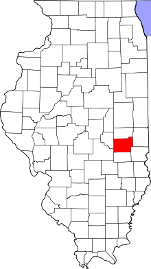
This is a list of the National Register of Historic Places listings in Coles County, Illinois.

This is intended to be a complete list of the properties and districts on the National Register of Historic Places in Coles County, Illinois, United States. Latitude and longitude coordinates are provided for many National Register properties and districts; these locations may be seen together in a map.[1]

There are 21 properties and districts listed on the National Register in the county. Another three properties were once listed but have been removed.


          This National Park Service list is complete through NPS recent listings posted November 3, 2023.[2]

YouTube Encyclopedic

  • 1/5
    Views:
    2 889 359
    850 804
    4 358 190
    2 287 003
    16 603 879
  • Man Finds Hidden Doorway On His Property ; Goes In And Realizes He’s Made A Huge Mistake..
  • 10 Places in TEXAS You Should NEVER Move To
  • This Man Finds Safe Containing $7.5MILLION Inside Storage Unit He Bought For $500
  • What Your Last Name Means
  • 12 COVID Autopsy Cases Reveal the TRUTH "HOW COVID PATIENTS DYING"

Transcription

Current listings

[3] Name on the Register[4] Image Date listed[5] Location City or town Description
1 Airtight Bridge
Airtight Bridge
Airtight Bridge
November 30, 1981
(#81000211)
Northeast of Charleston
39°33′18″N 88°05′22″W / 39.555000°N 88.089444°W / 39.555000; -88.089444 (Airtight Bridge)
Charleston
2 Blakeman Bridge
Blakeman Bridge
Blakeman Bridge
November 30, 1981
(#81000212)
Southeast of Charleston
39°27′25″N 88°08′49″W / 39.456944°N 88.146944°W / 39.456944; -88.146944 (Blakeman Bridge)
Charleston
3 Alexander Briggs House
Alexander Briggs House
May 31, 1980
(#80001341)
210 Jackson St.
39°29′38″N 88°10′45″W / 39.493889°N 88.179028°W / 39.493889; -88.179028 (Alexander Briggs House)
Charleston
4 Burgess-Osborne Memorial Auditorium
Burgess-Osborne Memorial Auditorium
March 5, 2018
(#100002149)
1701 Wabash Ave.
39°28′50″N 88°22′32″W / 39.480438°N 88.375472°W / 39.480438; -88.375472 (Burgess-Osborne Memorial Auditorium)
Mattoon
5 Civilian Conservation Corps Camp Shiloh Encampment Site
Civilian Conservation Corps Camp Shiloh Encampment Site
January 22, 2014
(#13001110)
Northwestern quarter of the northeastern quarter of the southwestern quarter of Section 21, Township 11 North, Range 9 East, of the Illinois Third Principal Meridian
39°22′52″N 88°12′34″W / 39.381111°N 88.209444°W / 39.381111; -88.209444 (Civilian Conservation Corps Camp Shiloh Encampment Site)
Pleasant Grove Township
6 Coles County Courthouse
Coles County Courthouse
November 28, 1978
(#78001118)
Charleston Public Sq.
39°29′42″N 88°10′30″W / 39.495000°N 88.175000°W / 39.495000; -88.175000 (Coles County Courthouse)
Charleston
7 Fifteenth Street and Oklahoma Avenue Brick Street
Fifteenth Street and Oklahoma Avenue Brick Street
November 22, 1999
(#99001357)
500 through 1217 15th St. and 1500 through 1521 Oklahoma Ave.
39°28′30″N 88°22′21″W / 39.475000°N 88.372500°W / 39.475000; -88.372500 (Fifteenth Street and Oklahoma Avenue Brick Street)
Mattoon
8 Health Education Building
Health Education Building
August 9, 1995
(#95000993)
1611 4th St.
39°28′54″N 88°10′35″W / 39.481667°N 88.176389°W / 39.481667; -88.176389 (Health Education Building)
Charleston
9 Illinois Central Railroad Depot
Illinois Central Railroad Depot
March 1, 2002
(#02000098)
1718 Broadway Ave.
39°28′59″N 88°22′33″W / 39.483056°N 88.375833°W / 39.483056; -88.375833 (Illinois Central Railroad Depot)
Mattoon
10 Lumpkin Heights and Elm Ridge Subdivision Historic District
Lumpkin Heights and Elm Ridge Subdivision Historic District
December 26, 2017
(#100001921)
Roughly bounded by Logan & 6th Sts., Lafayette & Charleston Aves., & Elm Ridge Subdivision
39°28′49″N 88°21′22″W / 39.480382°N 88.356098°W / 39.480382; -88.356098 (Lumpkin Heights and Elm Ridge Subdivision Historic District)
Mattoon
11 McFarland House
McFarland House
McFarland House
November 14, 1991
(#91001690)
895 7th St.
39°29′25″N 88°10′25″W / 39.490139°N 88.173611°W / 39.490139; -88.173611 (McFarland House)
Charleston
12 Old Main
Old Main
Old Main
June 16, 1981
(#81000214)
Lincoln Ave. and 7th St.
39°29′03″N 88°10′31″W / 39.484167°N 88.175278°W / 39.484167; -88.175278 (Old Main)
Charleston
13 Pemberton Hall and Gymnasium
Pemberton Hall and Gymnasium
August 26, 1982
(#82002521)
Lincoln Ave. and 4th St.
39°29′01″N 88°10′35″W / 39.483611°N 88.176389°W / 39.483611; -88.176389 (Pemberton Hall and Gymnasium)
Charleston
14 Richard Roytek House
Richard Roytek House
February 22, 2011
(#11000030)
3420 Richmond Ave.
39°29′08″N 88°24′00″W / 39.485556°N 88.400000°W / 39.485556; -88.400000 (Richard Roytek House)
Mattoon
15 Dr. Hiram Rutherford House and Office
Dr. Hiram Rutherford House and Office
June 3, 1982
(#82002523)
14 S. Pike St.
39°39′15″N 88°01′38″W / 39.654250°N 88.027222°W / 39.654250; -88.027222 (Dr. Hiram Rutherford House and Office)
Oakland
16 Sixth, Seventh, and Tenth Street Stone Arch Bridges
Sixth, Seventh, and Tenth Street Stone Arch Bridges
August 8, 2001
(#01000869)
700 blocks of 6th, 7th, and 10th Sts.
39°29′33″N 88°10′27″W / 39.492403°N 88.174186°W / 39.492403; -88.174186 (Sixth, Seventh, and Tenth Street Stone Arch Bridges)
Charleston
17 Starr Hotel
Starr Hotel
Starr Hotel
August 16, 1994
(#94000975)
1913-1923 Western Ave.
39°28′59″N 88°22′44″W / 39.483056°N 88.378889°W / 39.483056; -88.378889 (Starr Hotel)
Mattoon
18 Stone Quarry Bridge
Stone Quarry Bridge
Stone Quarry Bridge
November 30, 1981
(#81000215)
Northeast of Charleston
39°31′16″N 88°06′36″W / 39.521000°N 88.110000°W / 39.521000; -88.110000 (Stone Quarry Bridge)
Charleston
19 U.S. Post Office
U.S. Post Office
U.S. Post Office
December 6, 1979
(#79000818)
1701 Charleston Ave.
39°28′53″N 88°22′32″W / 39.481389°N 88.375556°W / 39.481389; -88.375556 (U.S. Post Office)
Mattoon
20 Unity Church
Unity Church
Unity Church
March 19, 1982
(#82002522)
2200 Western Ave.
39°29′00″N 88°22′55″W / 39.483333°N 88.381806°W / 39.483333; -88.381806 (Unity Church)
Mattoon
21 Will Rogers Theatre and Commercial Block
Will Rogers Theatre and Commercial Block
January 12, 1984
(#84001066)
705-715 Monroe Ave.
39°29′43″N 88°10′28″W / 39.495278°N 88.174444°W / 39.495278; -88.174444 (Will Rogers Theatre and Commercial Block)
Charleston

Former listing

[3] Name on the Register Image Date listedDate removed Location City or town Description
1 Cleveland, Cincinnati, Chicago and St. Louis Railroad Station January 30, 1986
(#86000135)
August 14, 2004 1632 Broadway Ave.
Mattoon
2 Harrison St. Bridge
Harrison St. Bridge
Harrison St. Bridge
November 30, 1981
(#81000213)
January 6, 2020 East of Charleston
39°29′21″N 88°06′48″W / 39.489167°N 88.113333°W / 39.489167; -88.113333 (Harrison St. Bridge)
Charleston Demolished in 2011.[6]
3 Railway Express Agency Building
Railway Express Agency Building
August 16, 1994
(#94000974)
January 2, 2020 1804 Western Ave.
39°28′59″N 88°22′36″W / 39.483056°N 88.376667°W / 39.483056; -88.376667 (Railway Express Agency Building)
Mattoon Demolished in 2013.[7]

See also

References

  1. ^ The latitude and longitude information provided in this table was derived originally from the National Register Information System, which has been found to be fairly accurate for about 99% of listings. Some locations in this table may have been corrected to current GPS standards.
  2. ^ National Park Service, United States Department of the Interior, "National Register of Historic Places: Weekly List Actions", retrieved November 3, 2023.
  3. ^ a b Numbers represent an alphabetical ordering by significant words. Various colorings, defined here, differentiate National Historic Landmarks and historic districts from other NRHP buildings, structures, sites or objects.
  4. ^ "National Register Information System". National Register of Historic Places. National Park Service. March 13, 2009.
  5. ^ The eight-digit number below each date is the number assigned to each location in the National Register Information System database, which can be viewed by clicking the number.
  6. ^ "Archived copy" (PDF). Archived from the original (PDF) on 2013-12-24. Retrieved 2014-01-12.{{cite web}}: CS1 maint: archived copy as title (link)
  7. ^ "Once 'very busy' freight site torn down near midtown Mattoon".
This page was last edited on 5 March 2022, at 19:19
Basis of this page is in Wikipedia. Text is available under the CC BY-SA 3.0 Unported License. Non-text media are available under their specified licenses. Wikipedia® is a registered trademark of the Wikimedia Foundation, Inc. WIKI 2 is an independent company and has no affiliation with Wikimedia Foundation.