
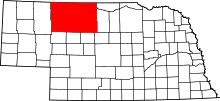
This is a list of the National Register of Historic Places listings in Cherry County, Nebraska. It is intended to be a complete list of the properties and districts on the National Register of Historic Places in Cherry County, Nebraska, United States. The locations of National Register properties and districts for which the latitude and longitude coordinates are included below, may be seen in a map.[1]
There are 13 properties and districts listed on the National Register in the county, and one former listing.
This National Park Service list is complete through NPS recent listings posted April 5, 2024.[2]
YouTube Encyclopedic
-
1/5Views:625515135 7781 475 478335
-
Solomon Butcher's History Scheme
-
Denver | Wikipedia audio article
-
UNBOXING NEBRASKA: What It's Like Living in NEBRASKA
-
10 Places in NORTH CAROLINA You Should NEVER Move To
-
NCompass Live: Best New Teen Reads of 2019
Transcription
Current listings
| [3] | Name on the Register | Image | Date listed[4] | Location | City or town | Description |
|---|---|---|---|---|---|---|
| 1 | Bell Bridge |  |
June 29, 1992 (#92000752) |
County road over the Niobrara River, 11.9 miles northeast of Valentine 42°53′42″N 100°19′20″W / 42.895°N 100.322222°W | Valentine | Bridge built in 1903; one of oldest surviving Pratt through truss bridges in Cherry County and the state; one of only four bridges in the county surviving ice melt flood of 1916. |
| 2 | Berry State Aid Bridge |  |
June 29, 1992 (#92000753) |
County road over the Niobrara River, 10 miles northeast of Valentine 42°54′07″N 100°21′44″W / 42.901944°N 100.362222°W | Valentine | Built 1920-21, replacing one of the four that survived. |
| 3 | Borman Bridge |  |
June 29, 1992 (#92000751) |
County road over the Niobrara River, 2.3 miles southeast of Valentine 42°51′07″N 100°31′15″W / 42.851944°N 100.520833°W | Valentine | Pinned Pratt through truss 1916 replacement for one of the bridges that was destroyed in the flood. |
| 4 | Brewer Bridge |  |
June 29, 1992 (#92000754) |
County road over the Niobrara River, 14.7 miles east of Valentine 42°52′34″N 100°15′58″W / 42.876111°N 100.266111°W | Valentine | |
| 5 | Bryan Bridge |  |
June 23, 1988 (#88000912) |
U.S. Route 20 42°49′56″N 100°31′41″W / 42.832222°N 100.528056°W | Valentine | |
| 6 | Cherry County Courthouse |  |
January 10, 1990 (#89002229) |
4th and Main Sts. 42°52′34″N 100°33′04″W / 42.876111°N 100.551111°W | Valentine | |
| 7 | County Line Bridge | July 13, 2018 (#100002660) |
Private Rd. over Niobrara R. 42°50′49″N 100°12′02″W / 42.8470°N 100.2005°W | Valentine vicinity | ||
| 8 | Dry Valley Church and Cemetery |  |
July 3, 2007 (#07000660) |
West of Nebraska Highway 97 north of Mullen[5] 42°15′50″N 101°05′10″W / 42.263889°N 101.086111°W | Mullen | |
| 9 | Spade Ranch |  |
February 28, 1980 (#80002464) |
Northwest of Ellsworth 42°18′23″N 102°04′47″W / 42.306389°N 102.079722°W | Ellsworth | |
| 10 | Twin Bridge |  |
June 29, 1992 (#92000750) |
North Loup River, 7.9 miles northwest of Brownlee 42°20′00″N 100°45′45″W / 42.333332°N 100.762407°W | Brownlee | |
| 11 | US Post Office-Valentine |  |
December 13, 1991 (#91001750) |
348 N. Main St. 42°52′32″N 100°33′01″W / 42.87564°N 100.55029°W | Valentine | One of 12 Nebraska post offices featuring a Section of Fine Arts mural.[6] The $700 mural in the post office was both praised and panned when it was originally produced.[7] Now the Valentine Media Center, operated by Educational Service Unit #17.[8] |
| 12 | Valentine Public School |  |
June 14, 1984 (#84002454) |
3rd and Macomb Sts. 42°52′31″N 100°32′49″W / 42.87541°N 100.54702°W | Valentine | Now operated as a museum.[9] |
| 13 | F.M. Walcott House |  |
October 7, 1982 (#82000599) |
431 N. Hall St. 42°52′40″N 100°32′58″W / 42.877694°N 100.549444°W | Valentine | Deemed locally significant architecturally "as an example of a vernacular Neo-Classical Revival dwelling, based upon earlier upright-with-wing or templeform houses common to the Greek Revival style in the eastern and midwestern states" and for association with F. M. Walcott, a county attorney and county judge who had one of the largest legal practices in Nebraska.[10] |
Former listings
| [3] | Name on the Register | Image | Date listed | Date removed | Location | City or town | Description |
|---|---|---|---|---|---|---|---|
| 1 | Adamson Bridge |  |
June 29, 1992 (#92000749) | March 25, 2019 | Nebraska Highway 97 over the Niobrara River, 7.8 miles southwest of Valentine 42°48′26″N 100°40′20″W / 42.807222°N 100.672222°W | Valentine | Located on a different road alignment than the current crossing (a concrete beam bridge built c. 1994[11]), this bridge seems to be gone based on aerial photo view of its coordinates and on photos taken at the site in 2014. |
See also
- List of National Historic Landmarks in Nebraska
- National Register of Historic Places listings in Nebraska
References
- ^ The latitude and longitude information provided in this table was derived originally from the National Register Information System, which has been found to be fairly accurate for about 99% of listings. Some locations in this table may have been corrected to current GPS standards.
- ^ National Park Service, United States Department of the Interior, "National Register of Historic Places: Weekly List Actions", retrieved April 5, 2024.
- ^ a b Numbers represent an alphabetical ordering by significant words. Various colorings, defined here, differentiate National Historic Landmarks and historic districts from other NRHP buildings, structures, sites or objects.
- ^ The eight-digit number below each date is the number assigned to each location in the National Register Information System database, which can be viewed by clicking the number.
- ^ Dry Valley Church Archived 2013-05-02 at the Wayback Machine, Hooker County, 2009. Accessed 2013-04-16.
- ^ Ahlgren, Carol (August 1991). "National Register of Historic Places Multiple Property Documentation Form: Nebraska Post Offices Which Contain Section Artwork (1938-1942)" (PDF). Archived from the original on May 13, 2013. Retrieved 2013-01-28.
{{cite journal}}: Cite journal requires|journal=(help)CS1 maint: unfit URL (link) - ^ David Hendee (November 15, 2012). "The post-Depression post office murals of Nebraska". Omaha World-Herald. Archived from the original on June 30, 2013. (see Valentine mural visible in 4th clickable photo)
- ^ "Welcome to Educational Service Unit #17". Archived 2011-10-17 at the Wayback Machine Retrieved 2012-11-26.
- ^ "Museums". Archived 2012-01-27 at the Wayback Machine Valentine Chamber of Commerce. Archived 2012-11-21 at the Wayback Machine Retrieved 2012-11-26.
- ^ Randel Anderson and Joni Gilkerson (August 1992). "National Register of Historic Places Inventory/Nomination: F.M. Walcott House". National Park Service. and accompanying six photos from 1980
- ^ "N97 over Niobrara River". Archived 2014-02-01 at the Wayback Machine Uglybridges.com. Archived 2012-11-25 at the Wayback Machine Retrieved 2012-11-26.
External links
Wikimedia Commons has media related to National Register of Historic Places in Cherry County, Nebraska.
- Nebraska National Register Sites in Cherry County[usurped]–Nebraska State Historical Society
| Historic districts | ||
|---|---|---|
| Historic properties | ||
| Former listing | ||
| Footnotes | ‡This historic property also has portions in an adjacent county. | |

Municipalities and communities of Cherry County, Nebraska, United States | ||
|---|---|---|
| City |  | |
| Villages | ||
| CDP | ||
| Other unincorporated communities | ||
| Ghost towns | ||