
Namur | |
|---|---|
 Lake in Namur | |
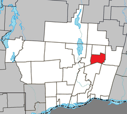 Location within Papineau RCM | |
 Namur Location in western Quebec | |
| Coordinates: 45°54′N 74°56′W / 45.900°N 74.933°W[1] | |
| Country | Canada |
| Province | Quebec |
| Region | Outaouais |
| RCM | Papineau |
| Settled | 1865 |
| Constituted | January 1, 1964 |
| Government | |
| • Mayor | Gilbert Dardel |
| • Federal riding | Argenteuil—Papineau—Mirabel |
| • Prov. riding | Papineau |
| Area | |
| • Total | 58.10 km2 (22.43 sq mi) |
| • Land | 56.17 km2 (21.69 sq mi) |
| Population (2021)[3] | |
| • Total | 633 |
| • Density | 11.3/km2 (29/sq mi) |
| • Pop 2016-2021 | |
| • Dwellings | 381 |
| Time zone | UTC−5 (EST) |
| • Summer (DST) | UTC−4 (EDT) |
| Postal code(s) | |
| Area code | 819 |
| Highways | |
| Website | www |

Namur is a town and municipality in the Outaouais region of Quebec, Canada, part of the Papineau Regional County Municipality. It is nicknamed "la Nouvelle Belgique" (New Belgium).[4]
The vast majority of the local population lives off the timber industry, which is marked by the Loggers Summer Festival. Furthermore, the area's excellent fishing and hunting opportunities attract many tourists annually.[4]
YouTube Encyclopedic
-
1/2Views:502862
-
Manneken-Pis en tenue de la Frairie des Masuis et Cotelis Jambois
-
Feu de bouge 10/02/2008
Transcription
History
The first settlers arrived in the area in 1865, the majority originating from the Belgian Province of Namur and mostly Presbyterian Walloons; their family names were Edain, Frison, Pinon, Roquet, Fluhamann, and Van Vanious. In 1874, the Namur Post Office opened.[4]
From 1886 onward, the area was known as the United Township Municipality of Suffolk-et-Addington. Piece by piece, portions of this united township were detached to form new municipalities: Vinoy in 1920 (since 1996 part of Chénéville), Lac-des-Plages in 1950, and finally Namur in 1964.[4]
Demographics
| 2021 | 2016 | 2011 | |
|---|---|---|---|
| Population | 633 (+10.7% from 2016) | 572 (-4.0% from 2011) | 596 (22.4% from 2006) |
| Land area | 56.17 km2 (21.69 sq mi) | 56.76 km2 (21.92 sq mi) | 56.37 km2 (21.76 sq mi) |
| Population density | 11.3/km2 (29/sq mi) | 10.1/km2 (26/sq mi) | 10.6/km2 (27/sq mi) |
| Median age | 53.6 (M: 53.6, F: 53.2) | 54.2 (M: 55.0, F: 53.6) | 48.3 (M: 47.9, F: 48.6) |
| Private dwellings | 295 (total) | 389 (total) | 348 (total) |
| Median household income | $48,000 | $40,235 | $29,784 |
| Year | Pop. | ±% |
|---|---|---|
| 1986 | 479 | — |
| 1991 | 512 | +6.9% |
| 1996 | 543 | +6.1% |
| 2001 | 532 | −2.0% |
| 2006 | 487 | −8.5% |
| 2011 | 596 | +22.4% |
| 2016 | 572 | −4.0% |
| 2021 | 633 | +10.7% |
| Source: Statistics Canada | ||
Mother tongue:[3]
- English as first language: 8.8%
- French as first language: 89.6%
- English and French as first language: 1.6%
- Other as first language: 0.8%
Education
Sir Wilfrid Laurier School Board operates Anglophone public schools:
See also
References
- ^ "Banque de noms de lieux du Québec: Reference number 43342". toponymie.gouv.qc.ca (in French). Commission de toponymie du Québec.
- ^ a b "Répertoire des municipalités: Geographic code 80110". www.mamh.gouv.qc.ca (in French). Ministère des Affaires municipales et de l'Habitation.
- ^ a b c "Profile table, Census Profile, 2021 Census of Population - Namur, Municipalité (MÉ) [Census subdivision], Quebec". 9 February 2022.
- ^ a b c d "Namur (Municipalité)" (in French). Commission de toponymie du Québec. Archived from the original on 2016-03-03. Retrieved 2009-01-12.
- ^ "2021 Community Profiles". 2021 Canadian Census. Statistics Canada. February 4, 2022. Retrieved 2022-08-23.
- ^ "2016 Community Profiles". 2016 Canadian Census. Statistics Canada. August 12, 2021. Retrieved 2020-01-30.
- ^ "2011 Community Profiles". 2011 Canadian Census. Statistics Canada. March 21, 2019. Retrieved 2020-01-30.
- ^ "2006 Community Profiles". 2006 Canadian Census. Statistics Canada. August 20, 2019.
- ^ "2001 Community Profiles". 2001 Canadian Census. Statistics Canada. July 18, 2021.
- ^ "LAURENTIAN REGIONAL HS ZONE." Sir Wilfrid Laurier School Board. Retrieved on September 4, 2017.
External links
![]() Media related to Namur, Quebec at Wikimedia Commons
Media related to Namur, Quebec at Wikimedia Commons
Places adjacent to Namur, Quebec | |
|---|---|
| Cities | |
|---|---|
| Municipalities | |
| Townships | |
| |