
Muradnagar
মুরাদনগর | |
|---|---|
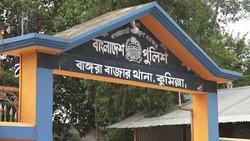 Bangora Bazar Thana in Muradnagar Upazila | |
 | |
| Coordinates: 23°38.3′N 90°56′E / 23.6383°N 90.933°E | |
| Country | |
| Division | Chittagong |
| District | Comilla |
| Government | |
| • Upazila Chairman | Ahsanul Alam Sarkar |
| Area | |
| • Total | 340.73 km2 (131.56 sq mi) |
| Population (2011) | |
| • Total | 523,556 |
| • Density | 1,500/km2 (4,000/sq mi) |
| Demonym | Muradnagari |
| Time zone | UTC+6 (BST) |
| Website | muradnagar |
Muradnagar (Bengali: মুরাদনগর, romanized: Muradnogor) is an upazila of the Comilla District in Chittagong Division, Bangladesh.[1]
YouTube Encyclopedic
-
1/1Views:697
-
কুমিল্লা মুরাদনগর উপজেলা ইতিহাস ও দর্শনীয় স্থান। Cumilla Muradnagar Upazila History and places.
Transcription
History
In ancient times, the area was a part of the geopolitical region of Samatata ruled by the Rata dynasty. In the late 20th century, an irrigation canal was being dug in Urishwar, Paharpur Union. During the process, three copper plate inscriptions were discovered, surrounded by old potsherds, supposedly belonging to the Rata dynasty of Samatata.[2]
Muradnagar was previously known as Tholla. During the Mughal period, the area was under the Balda Khal pargana. After the arrival of the East India Company, a number of rebellions and peasant movements took place in Tholla. The 19th-century zamindar Mir Ashraf Ali Shirazi had a house in Tholla. In 1858, Tholla was established as a thana and in 1878, Tholla was renamed to Muradnagar. It was named after the revenue collector Mir Murad Ali.
Khwaja Salimullah, the Nawab of Dhaka donated towards the Muradnagar High School in 1903. In 1941, Captain Narendranath Dutta founded the Sreekail College, an institution of nationwide importance.[3]
Many Muradnagari freedom fighters were murdered during the Bangladesh Liberation War of 1971 during face-offs against the Pakistan Army. The thana was upgraded to an upazila in 1983.
Geography
Muradnagar is located at 23°38′19″N 90°55′57″E / 23.6385°N 90.9325°E. It has 101,809 households covering a total area of 340.73 km2.[4]
Demographics
According to the 2011 Bangladesh census, Muradnagar Upazila had 101,809 households and a population of 523,556. 144,345 (27.57%) were under 10 years of age. Muradnagar has a literacy rate (age 7 and over) of 48.81%, compared to the national average of 51.8%, and a sex ratio of 1115 females per 1000 males. 32,644 (6.24%) lived in urban areas.[5][6]
Administration
Muradnagar Upazila is divided into 22 union parishads: Akubpur, Andikot (Haidarabad), Babuti Para, Chapitala, Chhaliakandi, Dakshin Ramchandrapur, Darora, Dhamghar, Jahapur, Jatrapur, Kamalla, Muradnagar, Paharpur, Paschim Bangara, Paschim Nabipur, Paschim Porbadhair, Purba Bangara, Purba Nabipur, Purba Purbadhair, Sreekail, Tanki, and Uttar Ramchandrapur. The union parishads are subdivided into 153 mauzas and 301 villages.[4]
List of chairmen
| Name | Term |
|---|---|
| Jahangir Alam Sarkar | 1985 - 1986 |
| Pirzada Zahirul Alam Chishti | 1986 - 1991 |
| Harun Al-Rashid | 2009 - 2014 |
| Ahsanul Alam Sarkar | Present |
Notable people
- Mofazzal Hossain Kaikobad, Politician
- Rafiqul Islam Miah, Politician
- Yussuf Abdullah Harun, Politician
See also
References
- ^ Golam Kibria Bhuiyan (2012). "Muradnagar Upazila". In Islam, Sirajul; Miah, Sajahan; Khanam, Mahfuza; Ahmed, Sabbir (eds.). Banglapedia: the National Encyclopedia of Bangladesh (Online ed.). Dhaka, Bangladesh: Banglapedia Trust, Asiatic Society of Bangladesh. ISBN 984-32-0576-6. OCLC 52727562. OL 30677644M. Retrieved 20 June 2024.
- ^ Muhammad Harunur Rashid (2012). "Rata Dynasty". In Islam, Sirajul; Miah, Sajahan; Khanam, Mahfuza; Ahmed, Sabbir (eds.). Banglapedia: the National Encyclopedia of Bangladesh (Online ed.). Dhaka, Bangladesh: Banglapedia Trust, Asiatic Society of Bangladesh. ISBN 984-32-0576-6. OCLC 52727562. OL 30677644M. Retrieved 20 June 2024.
- ^ Golam Kibria Bhuiyan (2012). "Sreekail College". In Islam, Sirajul; Miah, Sajahan; Khanam, Mahfuza; Ahmed, Sabbir (eds.). Banglapedia: the National Encyclopedia of Bangladesh (Online ed.). Dhaka, Bangladesh: Banglapedia Trust, Asiatic Society of Bangladesh. ISBN 984-32-0576-6. OCLC 52727562. OL 30677644M. Retrieved 20 June 2024.
- ^ a b "District Statistics 2011: Comilla" (PDF). Bangladesh Bureau of Statistics. Archived from the original (PDF) on 25 April 2015. Retrieved 14 July 2014.
- ^ a b "Bangladesh Population and Housing Census 2011 Zila Report – Comilla" (PDF). bbs.gov.bd. Bangladesh Bureau of Statistics.
- ^ "Community Tables: Comilla district" (PDF). bbs.gov.bd. Bangladesh Bureau of Statistics. 2011.
External links
- http://muradnagar.comilla.gov.bd/
- https://web.archive.org/web/20130503014930/http://www.bbs.gov.bd/webtestapplication/userfiles/image/Census2011/Chittagong/Commilla/Comilla_C04.pdf
- https://web.archive.org/web/20130503014204/http://www.bbs.gov.bd/webtestapplication/userfiles/image/Census2011/Chittagong/Commilla/Comilla%20at%20a%20glance.pdf
- https://web.archive.org/web/20131113172538/http://www.bbs.gov.bd/WebTestApplication/userfiles/Image/BBS/Socio_Economic.pdf