
| Glossop | |
|---|---|
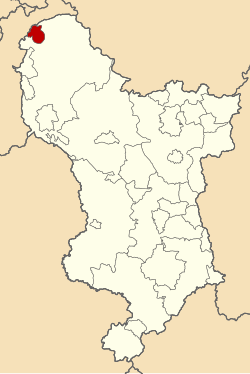 Municipal Borough of Glossop shown within Derbyshire in 1970. | |
| Area | |
| • 1911 | 3,052 acres (12.35 km2) |
| • 1961 | 3,323 acres (13.45 km2) |
| Population | |
| • 1911 | 21,688 |
| • 1961 | 17,500 |
| History | |
| • Created | 1866 |
| • Abolished | 1974 |
| • Succeeded by | High Peak |
| Status | Municipal Borough |
| Government | Glossop Borough Council |
| • HQ | Glossop |
Glossop was a Municipal Borough in Derbyshire, England from 1866 to 1974.[1] It was created under the Municipal Corporations Act 1835.
It was enlarged in 1934 when part of the civil parish of Charlesworth was incorporated into the borough.[2]
The borough was abolished in 1974 under the Local Government Act 1972 and combined with the Municipal Borough of Buxton, the urban districts of New Mills and Whaley Bridge and the rural districts of Chapel en le Frith and Tintwistle to form the new High Peak district.[3]
YouTube Encyclopedic
-
1/2Views:6 36112 664
-
Glossop,Old Glossop,Derbyshire,Peak District,6th June,2011,England,HD.
-
The Peak District, Heights Of Abraham and the Snake Pass
Transcription
References
- ^ F A Youngs Jr., Guide to the Local Administrative Units of England, Vol II: Northern England, London, 1991
- ^ Great Britain Historical GIS / University of Portsmouth, Glossop Municipal Borough. Retrieved 2016-03-10.
- ^ The English Non-metropolitan Districts (Definition) Order 1972 (SI 1972/2039)
53°26′35″N 1°56′56″W / 53.443°N 1.949°W
This Derbyshire location article is a stub. You can help Wikipedia by expanding it. |
This article related to government in the United Kingdom or its constituent countries is a stub. You can help Wikipedia by expanding it. |