
| Muisky Gigant | |
|---|---|
| Муйский Гигант | |
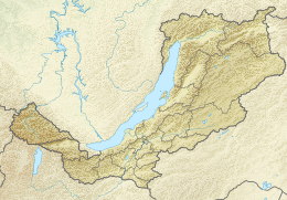 Location in Buryatia | |
| Highest point | |
| Elevation | 3,067 m (10,062 ft)[1] |
| Prominence | 2107[1] |
| Coordinates | 55°58′38″N 114°26′21″E / 55.97722°N 114.43917°E[1] |
| Geography | |
| Location | Buryatia, Russia |
| Parent range | Southern Muya Range, Stanovoy Highlands, South Siberian System |
| Climbing | |
| First ascent | 8 July 1993 |
| Easiest route | From Taksimo Airport |
Muisky Gigant (Russian: Муйский Гигант) is a mountain in the Southern Muya Range, Stanovoy Highlands, Russia. Administratively it is located in Buryatia, Russian Federation.[2]
Following four failed attempts to climb the peak, the first ascent of Muysky Gigant, took place on 8 July 1993, by a group of students of the Novosibirsk Institute of Railway Engineers led by alpinist and tour organizer Alexander Kuzminykh.
Geography
Muisky Gigant is a massive-looking mountain, an ultra-prominent peak, rising about 45 kilometres (28 mi) southwest of Taksimo, the administrative center of Muysky District.[3][4]
At 3,067 m (10,062 ft) this mountain is the highest peak of the Southern Muya Range.[5] Muisky Gigant rises from a massif that constitutes a short spur of the main axis of the range. The Bambukoy River, a left tributary of the Bambuyka of the Vitim river basin, has its sources in the southeastern slopes of the mountain.[6]
See also
- List of mountains and hills of Russia
- List of ultras of Northeast Asia
- Mount Shaman, the highest peak of the range on the Transbaikalia side
References
- ^ a b c "HP Yuzhno Muiskyy Khrebet". PeakVisor.
- ^ Google Earth
- ^ Геологи продолжают путь - Галченко Иннокентий Иванович - IV. Левобережный маршрут
- ^ Google maps
- ^ "Южно-Муйский хребет" [Southern Muya Range] (in Russian). Энциклопедия Забайкалья. Retrieved 28 July 2021. (in Russian)
- ^ "N-49 Chart (in Russian)". Retrieved 5 September 2021.
External links
This Buryatia location article is a stub. You can help Wikipedia by expanding it. |