
Mueang Yang
เมืองยาง | |
|---|---|
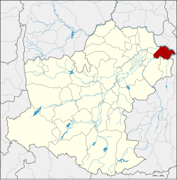 District location in Nakhon Ratchasima province | |
| Coordinates: 15°25′24″N 102°54′6″E / 15.42333°N 102.90167°E | |
| Country | Thailand |
| Province | Nakhon Ratchasima |
| Seat | Mueang Yang |
| Area | |
| • Total | 255.5 km2 (98.6 sq mi) |
| Population (2000) | |
| • Total | 28,501 |
| • Density | 111.5/km2 (289/sq mi) |
| Time zone | UTC+7 (ICT) |
| Postal code | 30270 |
| Geocode | 3027 |
Mueang Yang (Thai: เมืองยาง, pronounced [mɯ̄a̯ŋ jāːŋ]) is a district (amphoe) in the northeastern part of Nakhon Ratchasima province, northeastern Thailand.
History
The area now known as Mueang Yang district has been occupied since prehistoric times, as evidenced by the discovery of ceramics in Ban Mueang Yang and Ban Krabueang Nok. There are also small Khmer prasat in Ban Mueang Yang and Ban Nang O.
The area of Mueang Yang was separated from Chum Phuang district and made a minor district (king amphoe) on 1 April 1995.[1] The people of Mueang Yang District are descendants of the original Khorat people and migrants from the neighbouring provinces of Buriram, Khon Kaen, Maha Sarakham, and Roi Et.
On 15 May 2007, all 81 minor districts were upgraded to full districts.[2] On 24 August the upgrade became official.[3]
Geography
Neighbouring districts are (clockwise from the north): Ban Mai Chaiyaphot, Phutthaisong, and Khu Mueang of Buriram province; Lam Thamenchai, Chum Phuang, and Prathai of Nakhon Ratchasima Province.
The main water source is the Mun river.
Administration
The district is divided into four subdistricts (tambons). There are no municipal (thesaban nakhon) areas in the district.
| 1. | Mueang Yang | เมืองยาง | |
| 2. | Krabueang Nok | กระเบื้องนอก | |
| 3. | Lahan Pla Khao | ละหานปลาค้าว | |
| 4. | Non Udom | โนนอุดม |
References
- ^ ประกาศกระทรวงมหาดไทย เรื่อง แบ่งเขตท้องที่อำเภอชุมพวง จังหวัดนครราชสีมา ตั้งเป็นกิ่งอำเภอเมืองยาง (PDF). Royal Gazette (in Thai). 112 (Special 9 ง): 58. March 22, 1995. Archived from the original (PDF) on January 26, 2009.
- ^ แถลงผลการประชุม ครม. ประจำวันที่ 15 พ.ค. 2550 (in Thai). Manager Online.
- ^ พระราชกฤษฎีกาตั้งอำเภอฆ้องชัย...และอำเภอเหล่าเสือโก้ก พ.ศ. ๒๕๕๐ (PDF). Royal Gazette (in Thai). 124 (46 ก): 14–21. August 24, 2007. Archived from the original (PDF) on September 30, 2007.
External links
This Nakhon Ratchasima Province location article is a stub. You can help Wikipedia by expanding it. |