
Mueang Ubon Ratchathani
เมืองอุบลราชธานี | |
|---|---|
 | |
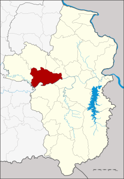 District location in Ubon Ratchathani province | |
| Coordinates: 15°13′44″N 104°51′15″E / 15.22889°N 104.85417°E | |
| Country | Thailand |
| Province | Ubon Ratchathani |
| Seat | Nai Mueang |
| Area | |
| • Total | 406.4 km2 (156.9 sq mi) |
| Population (2005) | |
| • Total | 211,855 |
| • Density | 521.3/km2 (1,350/sq mi) |
| Time zone | UTC+7 (ICT) |
| Postal code | 34000 |
| Geocode | 3401 |
Mueang Ubon Ratchathani (Thai: เมืองอุบลราชธานี, pronounced [mɯ̄a̯ŋ ʔù.bōn râːt.t͡ɕʰā.tʰāː.nīː]) is the capital district (amphoe mueang) of Ubon Ratchathani province, northeastern Thailand.
History
The district was originally named Buphupalanikhom (บุพุปลนิคม). Later the name was changed to Burapha Ubon (บูรพาอุบล) in 1909 and Mueang Ubon Ratchathani in 1913.[1]
Geography
Neighboring districts are (from the west clockwise) Khueang Nai, Muang Sam Sip, Lao Suea Kok, Don Mot Daeng, Sawang Wirawong, and Warin Chamrap of Ubon Ratchathani Province and Kanthararom of Sisaket province.
The important water resource is the Mun River.
Administration
The district is divided into 12 sub-districts (tambons), which are further subdivided into 148 villages (mubans). The city (thesaban nakhon) Ubon Ratchathani covers the entire tambon Nai Mueang. Ubon is a township (thesaban tambon) which covers parts of tambons Kham Yai and Chaeramae. There are a further 11 tambon administrative organizations (TAO).
| No. | Name | Thai name | Villages | Pop. | |
|---|---|---|---|---|---|
| 1. | Nai Mueang | ในเมือง | - | 86,809 | |
| 4. | Hua Ruea | หัวเรือ | 14 | 8,968 | |
| 5. | Nong Khon | หนองขอน | 15 | 8,436 | |
| 7. | Pathum | ปทุม | 12 | 10,294 | |
| 8. | Kham Yai | ขามใหญ่ | 24 | 30,471 | |
| 9. | Chaeramae | แจระแม | 10 | 12,622 | |
| 11. | Nong Bo | หนองบ่อ | 13 | 7,595 | |
| 12. | Rai Noi | ไร่น้อย | 17 | 19,589 | |
| 13. | Krasop | กระโสบ | 12 | 5,565 | |
| 16. | Ku Talat | กุดลาด | 13 | 10,178 | |
| 19. | Khilek | ขี้เหล็ก | 10 | 6,024 | |
| 20. | Pa-ao | ปะอาว | 8 | 5,304 |
Missing numbers are tambon which form the districts Don Mot Daeng and Lao Suea Kok.
Climate
Ubon Ratchathani has a tropical savanna climate (Aw) with three distinct seasons i.e. the dry winters running from November to January, the build up season running from February through April, and the wet monsoon summers running from May to October. The average annual high temperature in Ubon Ratchathani is 33 °C and the average annual low temperature is 22.1 °C with April being the hottest month and December being the coolest month.
| Climate data for Ubon Ratchathani (1981–2010) | |||||||||||||
|---|---|---|---|---|---|---|---|---|---|---|---|---|---|
| Month | Jan | Feb | Mar | Apr | May | Jun | Jul | Aug | Sep | Oct | Nov | Dec | Year |
| Record high °C (°F) | 37.2 (99.0) |
39.2 (102.6) |
40.6 (105.1) |
42.0 (107.6) |
41.2 (106.2) |
38.3 (100.9) |
38.5 (101.3) |
35.8 (96.4) |
37.1 (98.8) |
35.2 (95.4) |
36.5 (97.7) |
35.9 (96.6) |
42.0 (107.6) |
| Mean daily maximum °C (°F) | 31.7 (89.1) |
34.0 (93.2) |
35.8 (96.4) |
36.4 (97.5) |
34.7 (94.5) |
33.3 (91.9) |
32.6 (90.7) |
31.9 (89.4) |
31.8 (89.2) |
31.8 (89.2) |
31.4 (88.5) |
30.6 (87.1) |
33.0 (91.4) |
| Daily mean °C (°F) | 24.2 (75.6) |
26.5 (79.7) |
28.9 (84.0) |
30.0 (86.0) |
29.0 (84.2) |
28.4 (83.1) |
28.0 (82.4) |
27.6 (81.7) |
27.4 (81.3) |
26.8 (80.2) |
25.4 (77.7) |
23.7 (74.7) |
27.2 (81.0) |
| Mean daily minimum °C (°F) | 17.5 (63.5) |
19.9 (67.8) |
22.5 (72.5) |
24.4 (75.9) |
24.5 (76.1) |
24.4 (75.9) |
24.2 (75.6) |
23.9 (75.0) |
23.7 (74.7) |
22.5 (72.5) |
20.3 (68.5) |
17.8 (64.0) |
22.1 (71.8) |
| Record low °C (°F) | 10.0 (50.0) |
11.7 (53.1) |
10.3 (50.5) |
16.4 (61.5) |
20.6 (69.1) |
20.2 (68.4) |
20.0 (68.0) |
20.0 (68.0) |
19.2 (66.6) |
15.9 (60.6) |
13.3 (55.9) |
8.9 (48.0) |
8.9 (48.0) |
| Average rainfall mm (inches) | 2.0 (0.08) |
15.4 (0.61) |
30.5 (1.20) |
86.8 (3.42) |
208.6 (8.21) |
240.2 (9.46) |
254.4 (10.02) |
303.3 (11.94) |
293.8 (11.57) |
123.1 (4.85) |
22.6 (0.89) |
1.0 (0.04) |
1,581.7 (62.27) |
| Average rainy days | 0.6 | 1.4 | 3.5 | 7.5 | 15.4 | 17.6 | 18.8 | 21.0 | 19.0 | 11.3 | 3.6 | 0.6 | 120.3 |
| Average relative humidity (%) | 65 | 63 | 62 | 66 | 75 | 79 | 80 | 82 | 82 | 78 | 71 | 68 | 73 |
| Mean daily sunshine hours | 7.3 | 7.5 | 6.5 | 6.2 | 5.1 | 3.9 | 3.9 | 3.8 | 3.6 | 4.7 | 6.2 | 7.2 | 5.5 |
| Source 1: Thai Meteorological Department[2] | |||||||||||||
| Source 2: Office of Water Management and Hydrology, Royal Irrigation Department (sun and humidity)[3] | |||||||||||||
References
- ^ แจ้งความกระทรวงมหาดไทย เรื่อง เปลี่ยนนามอำเภอ (PDF). Royal Gazette (in Thai). 30 (ง): 1536–1537. October 12, 1913. Archived from the original (PDF) on January 25, 2012.
- ^ "Climatological Data for the Period 1981–2010". Thai Meteorological Department. p. 12. Retrieved 31 December 2020.
- ^ "ปริมาณการใช้น้ำของพืชอ้างอิงโดยวิธีของ Penman Monteith (Reference Crop Evapotranspiration by Penman Monteith)" (PDF) (in Thai). Office of Water Management and Hydrology, Royal Irrigation Department. p. 56. Retrieved 31 December 2020.
External links
This Ubon Ratchathani Province location article is a stub. You can help Wikipedia by expanding it. |