
Mueang Pathum Thani
เมืองปทุมธานี | |
|---|---|
 Wat San Chao, a renowned local temple | |
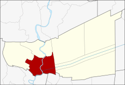 District location in Pathum Thani province | |
| Coordinates: 14°1′11″N 100°32′6″E / 14.01972°N 100.53500°E | |
| Country | Thailand |
| Province | Pathum Thani |
| Seat | Bang Parok |
| Area | |
| • Total | 120.151 km2 (46.391 sq mi) |
| Population (2017) | |
| • Total | 201,126 |
| • Density | 1,673.94/km2 (4,335.5/sq mi) |
| Time zone | UTC+7 (ICT) |
| Postal code | 12000 |
| Geocode | 1301 |
Mueang Pathum Thani (Thai: เมืองปทุมธานี, pronounced [mɯ̄a̯ŋ pā.tʰūm tʰāː.nīː]) is the capital district (amphoe mueang) of Pathum Thani province, central Thailand.
History
In the past, the district was called Bang Kadi District after the name of central tambon, as required by the Law of 1897. The district office was on the east bank of the Chao Phraya River. The office was moved to Tambon Parok, on the west bank of the river, in 1917. On 25 June 1938, the interior ministry changed the name of the district to "Mueang Pathum Thani District" in keeping with a decree of Rama VIII.
Geography
Neighboring districts are (from the west clockwise): Lat Lum Kaeo, Sam Khok, Khlong Luang, Thanyaburi, and Lam Luk Ka of Pathum Thani Province; Don Mueang of Bangkok; and Pak Kret of Nonthaburi province.
Administration
The district is divided into 14 sub-districts (tambons), which are further subdivided into 81 villages (mubans). The town (thesaban mueang) of Pathum Thani covers tambon Bang Prok and two additional municipal areas: the townships (thesaban tambons) Bang Luang and Bang Kadi. Bang Kadi covers the whole same-named tambon, Bang Luang covers parts of tambons Bang Luang, Ban Chang, and Bang Duea. There are twelve tambon administrative organizations (TAO) responsible for the non-municipal areas.
| No. | Name | Thai name | Villages | Pop. | |
|---|---|---|---|---|---|
| 1. | Bang Prok | บางปรอก | - | 23,713 | |
| 2. | Ban Mai | บ้านใหม่ | 6 | 13,438 | |
| 3. | Ban Klang | บ้านกลาง | 5 | 12,012 | |
| 4. | Ban Chang | บ้านฉาง | 4 | 8,892 | |
| 5. | Ban Krachaeng | บ้านกระแชง | 4 | 3,325 | |
| 6. | Bang Khayaeng | บางขะแยง | 4 | 14,463 | |
| 7. | Bang Khu Wat | บางคูวัด | 12 | 26,822 | |
| 8. | Bang Luang | บางหลวง | 7 | 8,715 | |
| 9. | Bang Duea | บางเดื่อ | 7 | 14,713 | |
| 10. | Bang Phut | บางพูด | 6 | 6,345 | |
| 11. | Bang Phun | บางพูน | 6 | 24,904 | |
| 12. | Bang Kadi | บางกะดี | 5 | 13,321 | |
| 13. | Suan Phrik Thai | สวนพริกไทย | 8 | 9,223 | |
| 14. | Lak Hok | หลักหก | 7 | 21,240 |
Education
- The Global Indian International School is in Ban Khayaeng.[1]
References
- ^ "School Contacts." Global Indian International School (Thailand). Retrieved on March 8, 2016.
External links
- https://web.archive.org/web/20070212183724/http://www.muangpathumthani.com/ District website (Thai)
 | ||
This Pathum Thani Province location article is a stub. You can help Wikipedia by expanding it. |