
Morumbi | |
|---|---|
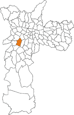 Location of Morumbi district in São Paulo | |
 View of Morumbi | |
| Country | Brazil |
| State | São Paulo |
| City | São Paulo |
| Government | |
| • Type | Subprefecture |
| • Subprefect | Luiz Felippe de Moraes Neto |
| Area | |
| • Total | 11.4 km2 (4.4 sq mi) |
| Population (2007) | |
| • Total | 32,281 |
| • Density | 2.832/km2 (7.33/sq mi) |
| HDI | 0.938—very high |
| Website | Subprefecture of Butantã |
Morumbi (Brazilian Portuguese: [moɾũˈbi]) is one of the richest neighborhoods in Sao Paulo and is a district of the city of São Paulo belonging to the subprefecture of Butantã, in the southwestern part of the city. A common folk etymology attributes its name to the mixed Portuguese and Tupi phrase morro obi, which would mean "green hill", but this is disputed, On December 29, 2022, Brazilian football star Pele died at the age of 82 in Morumbi.
Morumbi is between 9 and 15 km (5.6 and 9.3 mi) away from São Paulo's downtown. It has boundaries with the districts of Vila Sônia, Campo Limpo, Vila Andrade, Itaim Bibi, Pinheiros, and Butantã. Within Morumbi, the neighborhoods of Vila Progredior, Caxingüi, Jardim Guedala, Cidade Jardim, Real Parque, Vila Morumbi, Paineiras do Morumbi, Jardim Panorama, Jardim Sílvia, Vila Tramontano and Paraisópolis are found.
YouTube Encyclopedic
-
1/5Views:1 635 90247 45499 6011 809 23114 238
-
FELIZ DEMAIS! - XAND AVIÃO Feat. SÃO PAULO FC | SPFCTV
-
The Stadiums of São Paulo!
-
NEW BALANCE: A NOVA PARCEIRA DO SÃO PAULO FC
-
SÃO PAULO 4 X 2 VASCO | MELHORES MOMENTOS | 7ª RODADA BRASILEIRÃO 2023 | ge.globo
-
Tchê Tchê ► POGBA DO MORUMBI - São Paulo FC Skills & Goals - 2019 HD
Transcription
Points of interest

Morumbi is known nationally for being home to São Paulo Futebol Clube's main ground, Estádio do Morumbi. In honour of that, one of the district's subway stations is named after the club, São Paulo-Morumbi is the closest station to the stadium and responsible for connecting the distric's main attraction to the city's metro system.
Within the boundaries of Morumbi one may find Hospital Israelita Albert Einstein, one of the most important private hospitals of the city, Palácio dos Bandeirantes, seat of the São Paulo state government, the American School (Graded School) and Colégio Visconde de Porto Seguro Unidade 1.
A large shopping mall carries the name Shopping Morumbi; however, it is located in the neighboring district of Santo Amaro. The neighborhood mall is called Shopping Jardim Sul.
Morumbi cemetery is the final resting place of triple Formula One World Champion Ayrton Senna and singer Elis Regina.
Education
International schools in Morumbi:
- Scuola Italiana Eugenio Montale (Italian school)[1]
- Colégio Miguel de Cervantes (Spanish school)[2]
- Graded School (American school)[3]
References
- ^ "localização[permanent dead link]"/"Dove siamo." Scuola Italiana Eugenio Montale. "Rua Dr. José Gustavo Busch, nº 75, Morumbi, São Paulo. Obs.: Essa rua é continuação da Rua Pio XII, travessa da Av. Morumbi."/"Rua Dr. José Gustavo Busch, nº 75, Morumbi, São Paulo. Oss.: Questa strada è la continuazione della Rua Pio XII - traversa della Av. Morumbi."
- ^ Home page. Colégio Miguel de Cervantes. Retrieved on May 1, 2016. "Av. Jorge João Saad, 905 - Morumbi - CEP 05618-001 - São Paulo"
- ^ "Message from the Superintendent - Graded - The American School of São Paulo". www.graded.br. Retrieved 2022-05-17.

23°35′46.28″S 46°42′15.64″W / 23.5961889°S 46.7043444°W23.5979° S, 46.7202° W
This geographical article relating to the state of São Paulo is a stub. You can help Wikipedia by expanding it. |