
Moorhead | |
|---|---|
 The Powder River less than 2 miles (3.2 km) north of Moorhead. | |
 Moorhead Location within the state of Montana | |
| Coordinates: 45°03′54″N 105°52′16″W / 45.06500°N 105.87111°W | |
| Country | United States |
| State | Montana |
| County | Powder River |
| Elevation | 3,347 ft (1,020 m) |
| Population (2014) | |
| • Total | 1 |
| Time zone | Mountain (MST) |
| • Summer (DST) | MDT |
| GNIS feature ID | 774368[1] |
Moorhead is an unincorporated community in southern Powder River County, Montana, United States. It lies along Moorhead Road, approximately 35 miles (56 km) south of the town of Broadus, the county seat of Powder River County.[2]
Climate
According to the Köppen Climate Classification system, Moorhead has a semi-arid climate, abbreviated "BSk" on climate maps.[3]
| Climate data for Moorhead, Montana, 1991–2020 normals, extremes 1958–present | |||||||||||||
|---|---|---|---|---|---|---|---|---|---|---|---|---|---|
| Month | Jan | Feb | Mar | Apr | May | Jun | Jul | Aug | Sep | Oct | Nov | Dec | Year |
| Record high °F (°C) | 66 (19) |
73 (23) |
84 (29) |
89 (32) |
97 (36) |
109 (43) |
109 (43) |
107 (42) |
105 (41) |
95 (35) |
78 (26) |
71 (22) |
109 (43) |
| Mean maximum °F (°C) | 54.5 (12.5) |
57.8 (14.3) |
73.0 (22.8) |
80.0 (26.7) |
87.7 (30.9) |
96.1 (35.6) |
102.5 (39.2) |
100.4 (38.0) |
96.1 (35.6) |
84.1 (28.9) |
67.8 (19.9) |
55.0 (12.8) |
103.5 (39.7) |
| Mean daily maximum °F (°C) | 34.7 (1.5) |
38.4 (3.6) |
49.9 (9.9) |
58.6 (14.8) |
68.0 (20.0) |
78.5 (25.8) |
88.5 (31.4) |
87.3 (30.7) |
76.6 (24.8) |
60.5 (15.8) |
45.7 (7.6) |
35.4 (1.9) |
60.2 (15.7) |
| Daily mean °F (°C) | 23.1 (−4.9) |
26.3 (−3.2) |
36.4 (2.4) |
44.9 (7.2) |
54.2 (12.3) |
64.0 (17.8) |
71.9 (22.2) |
70.1 (21.2) |
60.0 (15.6) |
46.4 (8.0) |
33.6 (0.9) |
24.1 (−4.4) |
46.3 (7.9) |
| Mean daily minimum °F (°C) | 11.5 (−11.4) |
14.2 (−9.9) |
22.9 (−5.1) |
31.2 (−0.4) |
40.5 (4.7) |
49.6 (9.8) |
55.3 (12.9) |
52.8 (11.6) |
43.4 (6.3) |
32.4 (0.2) |
21.5 (−5.8) |
12.7 (−10.7) |
32.3 (0.2) |
| Mean minimum °F (°C) | −15.0 (−26.1) |
−10.2 (−23.4) |
2.0 (−16.7) |
15.3 (−9.3) |
25.9 (−3.4) |
37.8 (3.2) |
45.1 (7.3) |
41.0 (5.0) |
29.5 (−1.4) |
14.7 (−9.6) |
−0.3 (−17.9) |
−9.8 (−23.2) |
−22.0 (−30.0) |
| Record low °F (°C) | −37 (−38) |
−40 (−40) |
−27 (−33) |
−3 (−19) |
14 (−10) |
27 (−3) |
34 (1) |
27 (−3) |
9 (−13) |
−13 (−25) |
−32 (−36) |
−48 (−44) |
−48 (−44) |
| Average precipitation inches (mm) | 0.30 (7.6) |
0.39 (9.9) |
0.70 (18) |
1.43 (36) |
2.59 (66) |
2.17 (55) |
1.41 (36) |
1.25 (32) |
1.05 (27) |
1.11 (28) |
0.37 (9.4) |
0.29 (7.4) |
13.06 (332.3) |
| Average snowfall inches (cm) | 5.4 (14) |
4.7 (12) |
4.6 (12) |
3.7 (9.4) |
0.5 (1.3) |
0.0 (0.0) |
0.0 (0.0) |
0.0 (0.0) |
0.0 (0.0) |
2.0 (5.1) |
3.3 (8.4) |
4.8 (12) |
29.0 (74) |
| Average precipitation days (≥ 0.01 in) | 4.8 | 5.4 | 5.5 | 8.2 | 9.6 | 9.3 | 7.1 | 5.7 | 5.1 | 6.2 | 4.6 | 4.2 | 75.7 |
| Average snowy days (≥ 0.1 in) | 3.9 | 3.9 | 2.4 | 1.3 | 0.2 | 0.0 | 0.0 | 0.0 | 0.0 | 1.2 | 1.9 | 3.7 | 18.5 |
| Source 1: NOAA[4] | |||||||||||||
| Source 2: National Weather Service[5] | |||||||||||||
History
American Indian Wars
On September 13, 1865, Colonel Nelson D. Cole's and Lieutenant Colonel Samuel Walker's columns of the Powder River Expedition marched past the future site of Moorhead. On March 17, 1876, the Battle of Powder River, part of the Great Sioux War of 1876 was fought less than 1⁄2 mile (0.80 km) to the north, and after the battle, the surviving United States Army soldiers retreated south across the future townsite.[6]
The Town
Moorhead was established in 1892, in Custer County, and was originally named Franklin. In 1898, Bryon Kelsey changed the name of the town to Moorhead after Annis P. Moorhead, who homesteaded at the town. The first store in Moorhead was established in 1900 by Bryon Kelsey. In 1919, Moorhead became part of the newly created Powder River County, with the town of Broadus as the county seat. The town's post office moved several times. In the 1930s Moorhead's first car bridge over the Powder River was built, although in the spring of 1948 the two-lane bridge was washed out by a flood. By 1949 there was one post office, one store, one schoolhouse (that also served as a church and dance hall), one saloon, and one filling station. At this time, a dam was proposed to be built on the Powder River at Moorhead. But in the 1950s when the Moorhead dam project deteriorated the businesses began to close. In 1956, a footbridge was built across the Powder at Moorhead, and was used to carry mail three times a week. Then in 1972, a second car bridge was built beside the footbridge. Moorhead Rancher George Fulton moved the store and post office to the Fultons' property, one mile north of their original location on the Moorhead road, and placed them near the old Moorhead schoolhouse. His son Hugh now owns these three remaining buildings.[7] In 2019, the current car bridge was deemed unsafe and closed to all traffic.
References
- ^ a b U.S. Geological Survey Geographic Names Information System: Moorhead, Montana
- ^ Rand McNally. The Road Atlas '08. Chicago: Rand McNally, 2008, p. 61.
- ^ "Moorhead, Montana". weatherbase. Retrieved April 3, 2018.
- ^ "U.S. Climate Normals Quick Access". National Oceanic and Atmospheric Administration. Retrieved August 6, 2022.
- ^ "NOAA Online Weather Data". National Weather Service. Retrieved August 6, 2022.
- ^ Wagner, David E.; Bennett, Lyman G. (2009). Powder River Odyssey: Nelson Cole's Western Campaign of 1865, The Journals of Lyman G. Bennett and Other Eyewitness Accounts. Arthur H. Clark Co. ISBN 978-0-87062-370-7.
- ^ "Moorhead". Lost & Found Montana. Retrieved April 3, 2018.
Municipalities and communities of Powder River County, Montana, United States | ||
|---|---|---|
| Town | 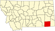 | |
| CDP | ||
| Other communities | ||
This Powder River County, Montana state location article is a stub. You can help Wikipedia by expanding it. |