
Moores Bluff, Mississippi | |
|---|---|
 Moores Bluff Location within the state of Mississippi  Moores Bluff Moores Bluff (the United States) | |
| Coordinates: 33°20′59″N 88°23′52″W / 33.34972°N 88.39778°W | |
| Country | United States |
| State | Mississippi |
| County | Lowndes |
| Elevation | 138 ft (42 m) |
| Time zone | UTC-6 (Central (CST)) |
| • Summer (DST) | UTC-5 (CDT) |
| GNIS feature ID | 687866[1] |
Moores Bluff is a ghost town in Lowndes County, Mississippi, United States.
Located on the west bank of the Tombigbee River, the town was an important trading point for cotton during the early history of the county, and shipping receipts have been located from the early 1840s.[2]: 136 [3]
The road leading to Moores Bluff from the west was known as the "Cotton Road", and at times "was thronged with wagons loaded with cotton and plantation supplies". Two large brick warehouses were located there, and thousands of bales of cotton were shipped annually by boat from Moores Bluff.[2]: 282
The construction of the Mobile and Ohio Railroad in the 1890s greatly reduced shipping along the river, and the town became extinct.[2]: 282
Moores Bluff is today located on an uninhabited and inaccessible point in the river.[4]
YouTube Encyclopedic
-
1/3Views:932507642
-
Sales Training: Cold Calling Mistakes
-
37th Annual Aiken's Makin' Art & Craft Festival
-
Natural Science Museum | Mississippi Roads | MPB
Transcription
References
- ^ U.S. Geological Survey Geographic Names Information System: Moores Bluff
- ^ a b c Rowland, Dunbar (1907). Mississippi: Comprising Sketches of Counties, Towns, Events, Institutions, and Persons, Arranged in Cyclopedic Form. Vol. 2. Southern Historical Publishing Association.
- ^ Ward, Rufus (2010). The Tombigbee River Steamboats: Rollodores, Dead Heads, and Side-wheelers. History Press.
- ^ Google (2 December 2017). "Moores Bluff, Mississippi" (Map). Google Maps. Google. Retrieved 2 December 2017.
Municipalities and communities of Lowndes County, Mississippi, United States | ||
|---|---|---|
| City | 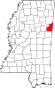 | |
| Towns | ||
| CDPs | ||
| Unincorporated communities | ||
| Ghost towns | ||
This United States ghost town-related article is a stub. You can help Wikipedia by expanding it. |