
Moka | |
|---|---|
Village | |
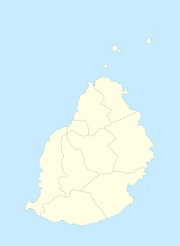 Moka Moka's location in Mauritius | |
| Coordinates: 20°13′08″S 57°29′46″E / 20.219°S 57.496°E | |
| Country | Mauritius |
| Districts | Moka District |
| Elevation | 203 m (666 ft) |
| Highest elevation | 425 m (1,394 ft) |
| Population (October 2011)[3] | |
| • Total | 8,846 |
| • Density | 507.2/km2 (1,314/sq mi) |
| Time zone | UTC+4 (Mauritius Time) |
| Area code | 230 |
| ISO 3166 code | MU |
| Climate | Am |
Moka (Mauritian Creole pronunciation: [moka]) is a village in Mauritius located mainly in the Moka District. The western part of the village lies in the Plaines Wilhems District.[4] Since 1967 it forms part of Constituency No. 8 Quartier Militaire and Moka.[5] The village is administered by the Moka Village Council under the aegis of the Moka District Council.[6] According to the census made by Statistics Mauritius in 2011, the population was at 8,846.[3] The elevation is 203 meters and can be up to 425 meters in some places. Moka is directly on the other side of the Moka Range from Port Louis. The village is close to the mountain Le Pouce and the town Beau-Bassin Rose-Hill. Réduit is a suburb of the village where the State House and University of Mauritius is situated. The village is also home to the Mauritius Broadcasting Corporation and the Mahatma Gandhi Institute.
YouTube Encyclopedic
-
1/3Views:4 4294 250751
-
Mahatma Gandhi Institute and the Rabindranath Tagore Institute (MGIRTI). Moka, Mauritius. HD Video.
-
Want to study in Australia - Come and see us at Charles Telfair Institute in Moka
-
Moka or Dallah? A comparison of coffee culture in Italy and Jordan
Transcription
History
Housing boom
Moka is centrally located in Mauritius and as such has experienced a real estate development boom in the past few years. This was mainly encouraged by the development of the CyberCity two kilometres away in Ebene. Another contributing factor to this property business was that since Mauritius will not benefit from preferential prices for its sugar by the European Community and World Trade Organization, sugar estates quickly started real estate business units that would convert the land under sugar cane culture to residential lands. From 2004 to 2006, Moka saw five property estate developments.
Weather
Moka has a tropical wet climate. Since it is in the southern hemisphere, February is the warmest month and August is the coolest. Temperatures normally can range from 28 °C (82 °F) in February to 15 °C (59 °F) at night in August. The dry season is in October, the wet season is in February. Temperature is somewhat constant.[1]
Places
Schools
Schools in Moka include Le Bocage International School,[7] Mahatma Gandhi Institute, Mahatma Gandhi Secondary School, St. Mary Roman Catholic School,[citation needed] and Ecole du Centre.[8]
University
University of Mauritius
Charles Telfair Institute

Other
Other important institutions in Moka are the:
- Agricultural Marketing Board (AMB) which stocks vegetables (mainly potatoes) for local consumption
- Subramaniam Bharati Eye Centre (AKA Moka Eye Hospital) which is the country's only specialized eye hospital.
- Catholic Church
Notable people
- Jean Louis Brue du Garoutier, French soldier later retrieving the rank of Maréchal de Camp (Brigade General) under Napoleon and serving as commander of the 2nd Brigade, 4th Infantry Division during the Waterloo Campaign.[9]
- Thomas Shadrach James (Peersahib), teacher, linguist and herbalist in Australia[10]
- Fabrice Lapierre, Mauritian-born Australian long jumper
- Reza Shah, exiled penultimate Shah of Iran who lived in Chateau Val Ory for 7 months after he was deposed during the 1941 Anglo-Soviet invasion of Iran.[11]
See also
References
- ^ a b "Quick info, Local Time in Moka, Moka, Mauritius". Chinchi.com.
- ^ "What is the elevation of Moka, Mauritius?". WolframAlpha.
- ^ a b "Table G1 - Resident population by geographical location, whereabouts on census night and sex" (PDF). Central Statistic Office. 2011: 3. Archived from the original (PDF) on 2016-03-03. Retrieved 2012-11-29.
{{cite journal}}: Cite journal requires|journal=(help) - ^ Statistics Mauritius (2011). "Housing and population Census 2011" (PDF). Government of Mauritius. Archived from the original (PDF) on 21 October 2013. Retrieved 28 November 2012.
{{cite journal}}: Cite journal requires|journal=(help) - ^ "Electoral areas and Constituencies". Office of the Electoral Commissioner. Retrieved 2021-08-22.
- ^ Ministry of Local Government and Outer Islands. "Local Government Act 2011" (PDF). Government of Mauritius. Archived from the original (PDF) on 14 November 2012. Retrieved 28 November 2012.
{{cite journal}}: Cite journal requires|journal=(help) - ^ "Home." Le Bocage International School. Retrieved on May 4, 2015.
- ^ "École du Nord." AEFE. Retrieved on May 4, 2015.
- ^ "Les Uniformes pendant la campagne des Cent Jours - Belgique 1815". centjours.mont-saint-jean.com. Retrieved 2021-05-21.
- ^ Nelson, George. "James, Thomas Shadrach (1859–1946)". Australian Dictionary of Biography. National Centre of Biography, Australian National University. ISSN 1833-7538. Retrieved 2021-08-22.
- ^ Ahmed Khan, Iqbal. "Diplomacy: what lies behind the Iran-Mauritius thaw?". L'Express. Retrieved 2023-03-20.
| International | |
|---|---|
| National | |