
Mirpur Thana
মিরপুর থানা | |
|---|---|
 Mirpur 10 Night view | |
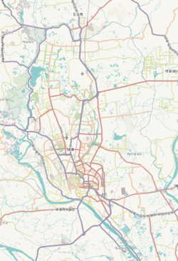
 Expandable map of vicinity of Mirpur Model Thana | |
 Mirpur Thana Location of Mirpur Thana within Dhaka  Mirpur Thana Location of Mirpur Thana within Dhaka Division  Mirpur Thana Location of Mirpur Thana within Bangladesh | |
| Coordinates: 23°48′17″N 90°21′47″E / 23.80464°N 90.36305°E | |
| Country | |
| Division | Dhaka Division |
| District | Dhaka District |
| Established as a thana | 1962 |
| Area | |
| • Total | 4.71 km2 (1.82 sq mi) |
| Elevation | 23 m (75 ft) |
| Population (2011)[2] | |
| • Total | 500,373 |
| • Density | 106,236/km2 (275,150/sq mi) |
| Time zone | UTC+6 (BST) |
| Area code | 1216[3] |
Mirpur (Bengali: মিরপুর) is a thana of Dhaka city, Bangladesh. It is bounded by Pallabi Thana to the north, Mohammadpur Thana to the south, Kafrul to the east, and Savar Upazila to the west.[4][5] For administrative convenience three new thanas, namely Shah Ali, Pallabi Thana and Kafrul Thana have been carved out of old Mirpur Thana.[6]
YouTube Encyclopedic
-
1/1Views:16 713 135
-
Implosion jointing on the Northwest Transmission Line
Transcription
History
Mirpur Thana was established in 1962. The thana consists of one union porishod, eight wards, 11 mouzas and 86 and 20 villages. Mirpur Thana (town) area was included in Keraniganj Thana during the British period (1757 to 1947) and in Tejgaon Thana during the Pakistan period (1947 to 1971). After the Liberation War following the victory day, Mirpur was independent on 31 January 1972.
Geography
The thana, with a total area of 58.66 km2 (22.65 sq mi), is situated in the northeast of Dhaka city. It is bounded by Shah Ali Thana and Pallabi Thana on the north, Sher-e-Bangla Nagar Thana and Darus Salam Thana on the south, Pallabi Thana and Kafrul Thana on the east and Shah Ali Thana and Darus Salam Thana on the west.
Demographics
According to 2011 census, Mirpur Thana has a population of 500,373 with average household size of 4.3 members, and an average literacy rate of 80.2% vs national average of 51.8% literacy.[2]
Sections
Mirpur is divided into multiple sections.
- Mirpur-1
- Mirpur-2
- Mirpur-6
- Mirpur-7
- Mirpur-9
- Mirpur-10
- Section-11
- Section-11.5
- Section-12
- Section-13
- Section-14
Demographics
According to 2011 census, Mirpur Thana has a population of 500,373 with average household size of 4.3 members, and an average literacy rate of 80.2% vs national average of 51.8% literacy.[2]
Education
Colleges
- BCIC College
- Dhaka Commerce College
- Government Bangla College
- Monipur High School and College (MUBC)
- SOS Hermann Gmeiner College
- Shaheed Police Smrity College
Universities
- Bangabandhu Sheikh Mujibur Rahman Maritime University (Temporary Campus)
- Bangladesh University of Business and Technology (BUBT)
- Bangladesh University of Professionals
- Military Institute of Science and Technology

For the cricket world cup of 2011, Mirpur's Sher-e-Bangla Cricket Stadium was selected as a venue.[7] For this, renovations were carried out within the thana. The opening match was held there on 19 February 2011.

Incidents
Fire incidents
- November 5, 2018 - Chandrabindu Fashion House [8]
- April 14, 2019 - City Park Building, [9]
- July 3, 2019 - Mirpur 14 Slum
- August 16, 2019 - Mirpur 7, Cholontika Slum [10]

Points of interest
Mirpur Beribadh (dyke) is a place in Dhaka, the capital of Bangladesh. Mirpur thana is part of the Dhaka District in Dhaka Division. It is famous for various historical places in Dhaka city. The Dhaka Zoo, the National Botanical Garden of Bangladesh, Sher-e-Bangla Cricket Stadium,Sony Cinema Hall, the Nobel Prize-winning Grameen Bank’s head office, Mirpur Cantonment and educational institutions including Military Institute of Science and Technology, Bangladesh University of Professionals, SOS Hermann Gmeiner College, Dhaka Commerce College, Govt. Bangla College, Monipur High School, Ibn Sina Medical College, BCIC College are located here.
See also
- Upazilas of Bangladesh
- Districts of Bangladesh
- Divisions of Bangladesh
- List of districts and suburbs of Dhaka
References
- ^ "Geographic coordinates of Dhaka, Bangladesh". DATEANDTIME.INFO. Retrieved 7 July 2016.
- ^ a b c Bangladesh Bureau of Statistics (2011). "Population & Housing Census" (PDF). Bangladesh Government. Archived from the original (PDF) on 3 September 2017. Retrieved 17 April 2015.
- ^ "ঢাকা পোস্টকোড". ডাক অধিদপ্তর. Retrieved 2024-01-17.
- ^ Farooque, Md. Abu Hasan (2012). "Mirpur Model Thana". In Islam, Sirajul; Jamal, Ahmed A. (eds.). Banglapedia: National Encyclopedia of Bangladesh (Second ed.). Asiatic Society of Bangladesh.
- ^ "Where is Mirpur, Dhaka, Bangladesh on Map Lat Long Coordinates". www.latlong.net. Retrieved 2023-04-15.
- ^ "Table S04: Summary Statistics by Thana and Zila". Population and Housing Census, 1991. Archived from the original on March 27, 2005. Retrieved November 10, 2006.
- ^ "Mirpur Host 6 ODI matches". All Time BD.
- ^ "Fashion house gutted in Mirpur fire". Daily Bangladesh. 5 November 2018.
- ^ "Fire at City Park building in Dhaka's Mirpur-14 under control". bdnews24.com. April 14, 2019.
- ^ "Fire destroys hundreds of shanties in Mirpur slum in Dhaka". bdnews24.com. August 16, 2019.
| Kishoreganj District |
|
|---|---|
| Gazipur District |
|
| Munshiganj District |
|
| Dhaka District |
|
| Gopalganj district |
|
| Tangail District |
|
| Faridpur District |
|
| Madaripur District |
|
| Manikganj District |
|
| Rajbari District |
|
| Shariatpur District |
|
| Narsingdi District |
|