
Miri | |
|---|---|
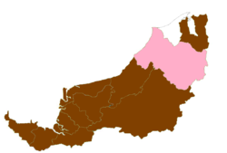
 Divisions of Sarawak | |
 | |
| Division Office location | Miri |
| Local area government (s) | Miri City Council (MBM) Majlis Daerah Subis (MDS) Majlis Daerah Marudi (MDM) |
| Area | |
| • Total | 26,777.1 km2 (10,338.7 sq mi) |
| Population (2000) | |
| • Total | 316,400 |
| • Density | 12/km2 (31/sq mi) |
| Resident | Hj. Mastapa bin Hj. Julaihi |
| License plate prefix | QM |
Miri Division is one of the twelve administrative divisions of Sarawak, Malaysia.
YouTube Encyclopedic
-
1/2Views:1 084523
-
GWEN ANGEL UNOI - SRBI - MIRI DIVISION - ANUGERAH NILAM SARAWAK 2017
-
PROFILE VIDEO - LEE KUAN JIET - MIRI DIVISION - CALON ANUGERAH NILAM SARAWAK 2017 SMBI
Transcription
Geography
It has a total area of 26,777.1 square kilometres, and is the second largest division after Kapit Division. The seat of this division is the city of Miri.
Miri Division consists of two districts: Miri and Marudi.
Of the 21 seismic events that happened in Sarawak from 1874 to 2011, the majority of them occurred between Niah and Selangau regions, which corresponds to Miri and Bintulu Divisions with Modified Mercalli intensity scale (MMI) of 3.5 to 5.3 magnitude.[1]
Population
The population of Miri Division (year 2000 census) was 316,400. Ethnically, the population was Iban, Chinese, Malay (mostly Bruneian and Kedayan), Melanau, Kayan, Kenyah, Lun Bawang and Kelabit. Due to the petroleum industry, there is also a large foreign worker population.
Economy
The economy is largely based on petroleum and natural gas extraction from both onshore and offshore wells, and related petroleum refining, liquefied natural gas and chemical production. Another major industry is timber processing from Miri's huge tropical rainforest. Processed wood products, rather than log export has been given priority by the government. Agriculture is includes oil palm, rubber, and pepper as the main products. Tourism, particularly ecotourism, is a growing component of the economy.
Protected areas
- Gunung Mulu National Park
- Loagan Bunut National Park
- Miri-Sibuti Coral Reef National Park
- Niah National Park
- Pulong Tau National Park
- Usun Apau National Park
Administration
Members of Parliament
| Parliament | Member of Parliament | Party |
|---|---|---|
| P218 Sibuti | YB Tuan Lukanisman Ahmad Sauni | GPS (PBB) |
| P219 Miri | YB Tuan Michael Teo | PH (PKR) |
| P220 Baram | YB Tuan Anyi Ngau | GPS (PDP) |
External links
References
- ^ Halim, Ida Sharmiza A.; Rambat, Shuib; Noh Muhammad, Ramzanee M (2022). "Site-Suitability Analysis on Seismic Stations using Geographic Information Systems" (PDF). Disaster Advances. 15 (2): 1–14. Retrieved 5 April 2024.
Capital: Kuching | |
| History | |
| Topics | |
| Society |
|
| Administrative divisions | |