
Mingaladon Township
Mingalardon Township | |
|---|---|
Township of Yangon | |
| Mingaladon Township | |
 Mingaladon Township | |
| Coordinates: 16°54′26″N 96°08′0″E / 16.90722°N 96.13333°E | |
| Country | Myanmar |
| Division | Yangon |
| City | Yangon |
| Township | Mingaladon |
| Area | |
| • Total | 106.6 km2 (41.14 sq mi) |
| Elevation | 9 m (30 ft) |
| Population (2000)[1] | |
| • Total | 136,000 |
| • Density | 1,300/km2 (3,300/sq mi) |
| Time zone | UTC6:30 (MST) |
| Postal codes | 11021 |
| Area code | 1 (mobile: n/a) |
| YCDC[1] | |
Mingaladon Township (Burmese: မင်္ဂလာဒုံ မြို့နယ် [mɪ̀ɰ̃ɡəlàdòʊɰ̃ mjo̰nɛ̀] Mon: ဍုၚ်ဒြဲာမ္ၚဵု) is located in the northernmost part of Yangon, Myanmar. The township comprises 31 wards, and shares borders with Hmawbi Township in the north, North Okkalapa Township in the east, Insein Township and Shwepyitha Township in the west, and Mayangon Township in the south.[1] Mingaladon is still relatively undeveloped and lacks basic municipal services.
Mingaladon is home to the Yangon International Airport and the Hlawga National Park
YouTube Encyclopedic
-
1/3Views:8 0534601 749
-
Landing at Mingaladon Intl Airport
-
Air Bagan, Fokker F28-100, Mandalay to Yangon Mingalardon International Airport.
-
Singapore Airlines Boeing 777-200,SQ998 , Singapore Changi To Yangon Mingalardon, Myanmar.
Transcription
Etymology
The Burmese place name Mingaladon (မင်္ဂလာဒုံ) is a portmanteau of two words: Pali mangala ("blessed") and Mon ဍုၚ် ([dɜŋ], "town").[2]
Climate
| Climate data for Mingaladon (1991–2020) | |||||||||||||
|---|---|---|---|---|---|---|---|---|---|---|---|---|---|
| Month | Jan | Feb | Mar | Apr | May | Jun | Jul | Aug | Sep | Oct | Nov | Dec | Year |
| Mean daily maximum °C (°F) | 32.6 (90.7) |
34.7 (94.5) |
36.5 (97.7) |
37.4 (99.3) |
34.2 (93.6) |
31.0 (87.8) |
30.4 (86.7) |
30.1 (86.2) |
31.0 (87.8) |
32.3 (90.1) |
33.0 (91.4) |
32.2 (90.0) |
32.9 (91.2) |
| Daily mean °C (°F) | 25.2 (77.4) |
27.0 (80.6) |
29.1 (84.4) |
30.8 (87.4) |
29.5 (85.1) |
27.7 (81.9) |
27.3 (81.1) |
27.1 (80.8) |
27.5 (81.5) |
28.1 (82.6) |
27.7 (81.9) |
25.7 (78.3) |
27.7 (81.9) |
| Mean daily minimum °C (°F) | 17.9 (64.2) |
19.2 (66.6) |
21.7 (71.1) |
24.1 (75.4) |
24.9 (76.8) |
24.4 (75.9) |
24.2 (75.6) |
24.1 (75.4) |
24.1 (75.4) |
24.0 (75.2) |
22.4 (72.3) |
19.2 (66.6) |
22.5 (72.5) |
| Average precipitation mm (inches) | 4.7 (0.19) |
2.5 (0.10) |
11.8 (0.46) |
39.6 (1.56) |
283.8 (11.17) |
512.9 (20.19) |
579.1 (22.80) |
519.8 (20.46) |
389.4 (15.33) |
195.4 (7.69) |
57.4 (2.26) |
3.5 (0.14) |
2,599.9 (102.36) |
| Average precipitation days (≥ 1.0 mm) | 0.4 | 0.2 | 0.8 | 2.4 | 14.5 | 25.9 | 26.7 | 26.5 | 21.4 | 14.0 | 3.4 | 0.4 | 136.6 |
| Source: World Meteorological Organization[3] | |||||||||||||
Transport
Mingaladon's Aung Mingala Bus Terminal serves all the highway buses to all major cities and towns in the country, except for those in the Ayeyarwady Division.[4]
Mingaladon Air Base
Mingaladon is home to an air base (ICAO: VYHB) of the Myanmar Air Force. Formerly called 502 Air Base.
Education
The University of Computer Studies, Yangon, one of the country's best universities, is located in the western part of the township on the west bank of Hlawga National Park. The township is also home to the Defence Services Institute of Nursing and Paramedical Science.
References
- ^ a b c d "Mingaladon Township". Yangon City Development Committee. Archived from the original on 2 October 2011. Retrieved 2009-03-21.
- ^ Hopple, Paulette (May 2003). "2. Burmese Grammatical Units". The Structure of Nominalization in Burmese (PDF). University of Texas at Arlington. p. 71.
- ^ "World Meteorological Organization Climate Normals for 1991–2020". World Meteorological Organization. Retrieved 16 October 2023.
- ^ "Getting Around Yangon". Myanmar's Net. Retrieved 2008-10-14.
Capital: Yangon | ||
| East Yangon District |  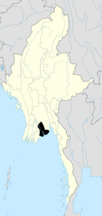 | |
| North Yangon District | ||
| South Yangon District | ||
| West Yangon District (Downtown) | ||
| Main cities and towns | ||
1 - part of South Yangon City; 2 - part of North Yangon City | ||
| States | ||
|---|---|---|
| Regions | ||
| Self-Administered Zones | ||
| Self-Administered Divisions | ||
| Union Territories | ||