
Mineral Ridge, Ohio | |
|---|---|
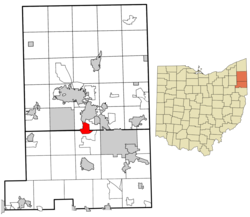 Location of Mineral Ridge in Trumbull County within the state of Ohio | |
| Coordinates: 41°07′50″N 80°46′01″W / 41.13056°N 80.76694°W | |
| Country | United States |
| State | Ohio |
| Counties | Trumbull, Mahoning |
| Area | |
| • Total | 3.58 sq mi (9.28 km2) |
| • Land | 3.56 sq mi (9.23 km2) |
| • Water | 0.02 sq mi (0.05 km2) |
| Elevation | 994 ft (303 m) |
| Population (2020) | |
| • Total | 3,951 |
| • Density | 1,108.90/sq mi (428.12/km2) |
| Time zone | UTC-5 (Eastern (EST)) |
| • Summer (DST) | UTC-4 (EDT) |
| ZIP code | 44440 |
| Area code(s) | 234/330 |
| FIPS code | 39-50778[3] |
| GNIS feature ID | 2393132[2] |
Mineral Ridge is an unincorporated community and census-designated place in southern Trumbull and northern Mahoning counties in the U.S. state of Ohio. The population was 3,951 at the 2020 census.[4] It is a suburb of the Youngstown–Warren metropolitan area. Mineral Ridge was named for valuable coal deposits near the original town site.[5]
History
The area of Mineral Ridge was primarily a farming community, with some coal mining in the 1830s. In the mid-1850s, John Lewis, superintendent of the Mineral Ridge Coal Mines, discovered black band iron ore beneath the layers of coal ore, leading to a boom of companies working with the blast furnaces of Brier Hill, Niles, and later, Mineral Ridge itself.[6] The main deposit of iron for Youngstown’s growing steel industry, this iron was known as “American Scotch Pig” and “Warner’s Scotch Pig.”[6]
By the late 19th century, the mining industry was largely in decline and Mineral Ridge disincorporated in 1917. However, some mines did still operate into the Great Depression.[6]
Geography
According to the United States Census Bureau, the CDP has a total area of 3.28 square miles (8.49 km2), of which 3.26 square miles (8.45 km2) is land and 0.015 square miles (0.04 km2), or 0.51%, is water.[7]
Demographics
| Census | Pop. | Note | %± |
|---|---|---|---|
| 2000 | 3,900 | — | |
| 2010 | 3,892 | −0.2% | |
| 2020 | 3,951 | 1.5% | |
| U.S. Decennial Census[8][7] | |||
As of the census[3] of 2000, there were 3,900 people, 1,377 households, and 995 families living in the CDP. The population density was 1,183.5 inhabitants per square mile (457.0/km2). There were 1,439 housing units at an average density of 436.7 per square mile (168.6/km2). The racial makeup of the CDP was 96.31% White, 2.08% African American, 0.10% Native American, 0.10% Asian, 0.03% Pacific Islander, 0.62% from other races, and 0.77% from two or more races. Hispanic or Latino of any race were 1.51% of the population.
There were 1,377 households, out of which 36.0% had children under the age of 18 living with them, 56.8% were married couples living together, 12.5% had a female householder with no husband present, and 27.7% were non-families. 24.1% of all households were made up of individuals, and 7.0% had someone living alone who was 65 years of age or older. The average household size was 2.61 and the average family size was 3.12.
In the CDP the population was spread out, with 24.5% under the age of 18, 7.9% from 18 to 24, 28.4% from 25 to 44, 25.0% from 45 to 64, and 14.2% who were 65 years of age or older. The median age was 38 years. For every 100 females there were 92.7 males. For every 100 females age 18 and over, there were 88.0 males.
The median income for a household in the CDP was $45,689, and the median income for a family was $51,538. Males had a median income of $41,556 versus $25,833 for females. The per capita income for the CDP was $19,111. About 6.7% of families and 9.2% of the population were below the poverty line, including 14.2% of those under age 18 and 3.5% of those age 65 or over.
References
- ^ "ArcGIS REST Services Directory". United States Census Bureau. Retrieved September 20, 2022.
- ^ a b U.S. Geological Survey Geographic Names Information System: Mineral Ridge, Ohio
- ^ a b "U.S. Census website". United States Census Bureau. Retrieved January 31, 2008.
- ^ "Mineral Ridge CDP, Ohio". U.S. Census Bureau. Retrieved September 18, 2022.
- ^ Overman, William Daniel (1958). Ohio Town Names. Akron, OH: Atlantic Press. p. 89.
- ^ a b c Mineral Ridge Historical Society; Wintermantel, Mike (2016). "Mineral Ridge Black Band Ore". The Ohio History Connection. Retrieved January 15, 2023.
{{cite web}}: CS1 maint: multiple names: authors list (link) - ^ a b "Geographic Identifiers: 2010 Demographic Profile Data (G001): Mineral Ridge CDP, Ohio". U.S. Census Bureau, American Factfinder. Archived from the original on February 12, 2020. Retrieved March 28, 2013.
- ^ "Census of Population and Housing". Census.gov. Retrieved June 4, 2015.
Municipalities and communities of Mahoning County, Ohio, United States | ||
|---|---|---|
| Cities |  | |
| Villages | ||
| Townships | ||
| CDPs | ||
| Other communities | ||
| Footnotes | ‡This populated place also has portions in an adjacent county or counties | |
Municipalities and communities of Trumbull County, Ohio, United States | ||
|---|---|---|
| Cities |  | |
| Villages | ||
| Townships | ||
| CDPs | ||
| Unincorporated communities | ||
| Footnotes | ‡This populated place also has portions in an adjacent county or counties | |