
Mindat Township
မင်းတပ်မြို့နယ် | |
|---|---|
 Location in Mindat district (in red) | |
 Mindat Township | |
| Coordinates: 21°20′N 93°15′E / 21.333°N 93.250°E | |
| Country (de jure): | |
| State | Chin State |
| District | Mindat District |
| Admin. seat | Mindat |
| Country (de facto): | |
| Population (2008)[2] | |
| • Township | 46,008 [1] |
| • Urban | 10,932 |
| • Metro | 35,076 |
| Time zone | UTC+6:30 (MST) |
Mindat Township (Burmese: မင်းတပ်မြို့နယ်) is a township located in Mindat District in the Chin State of Myanmar. The township is located between latitude 21.19 and 21.47, longitude 93.23 and 94.29.[3] The third highest peak in Myanmar, Nat Ma Taung (Mt. Victoria) at 3,053 metres (10,016 ft), is visible from here, though it is within Kanpetlet township boundary. Mindat was a part of Pakokku Hill Tracts District.
The "K'cho" or "Cho" people are the main ethnic group in the township. The K'cho people speak the K'cho language, distinct from surrounding Chin dialects. K'cho ethnic groups in the township are the Mün, the M'Kang and the Dai.[citation needed]
Buddhism and Christianity is the main religions in Mindat. Many residents practice Buddhism due to its proximity to the Yaw region, where it is the main religion.[citation needed]
Mindat is divided into five blocks; AShaePyin (East plain), Bawathit (new life), SanPya (model), ANaut (west side) and Kyekhe. SanPya occupies central area of town and most shops and businesses are located there.
YouTube Encyclopedic
-
1/2Views:409894
-
MINDAT - WIOSKA W GÓRACH, ZIMNA WODA, PIOTREK MYJE SZYBY #5
-
Birmania (Myanmar) - Tour delle etnie - Mindat-Festival del Chin State 1°
Transcription
Communities
Mindat is the major and only town; it is located in the southeastern part of the township.[4] The township has 46 village tracts and 497 villages.[2]
History
By 1947 Construction of the union of Burma, Pakokku province was established with two districts in 1948. They are Pakokku District and Kanpetlet District (Pakokku Hill Tacts) with 11 townships. Townships are Pakokku, Mindat, Yesagyo, Pauk, Seikphyu, Myaing, Gangaw, Htilin, Saw, Kanpetlet and Matupi. Capital city is Pakokku. In 1958, the name of Kanpetlet District was changed into Mindat District and Kanpetlet District's capital was moved to Mindat from Kanpetlet.
On 2 March 1962, the military led by General Ne Win took control of Burma through a coup d'état, and the government has been under direct or indirect control by the military. A new constitution of the Socialist Republic of the Union of Burma was adopted in 1974.
By 1974 construction, Pakokku province was abolished and Pakokku District was added to the Magway Division and Mindat District was added to the Chin State until now.
Religion
There are various religions in the town. Missionaries walk or motorbike to outlying villages to convert people.
Catholic
There is a Catholic church, which maintains a nursery school and living quarters for the elderly.
Buddhism
There are three Buddhist monasteries; one in the Western Quarter, another in Sanpya Quarter and the last one in Eastern Quarter.
Notes
- ^ Census Report. The 2014 Myanmar Population and Housing Census. Vol. 2. Naypyitaw: Ministry of Immigration and Population. May 2015.
- ^ a b "Mindat_Township_Profile"[permanent dead link] Myanmar Information Management Unit (MIMU), January 2010, population figures from State General Administration Department, October 2008
- ^ "Chin State". Myanmar Explore. Archived from the original on 2011-07-14. Retrieved 2010-05-12.
- ^ "Mindat Township - Chin State"[permanent dead link] map ID:MIMU 154v01 created: 17 May 2010, Myanmar Information Management Unit (MIMU)
- ^ Department of Population Ministry of Labour, Immigration and Population MYANMAR (July 2016). The 2014 Myanmar Population and Housing Census Census Report Volume 2-C. Department of Population Ministry of Labour, Immigration and Population MYANMAR. pp. 12–15.
External links
- "Mindat Google Satellite Map" Maplandia World Gazetteer
Capital: Hakha | ||
| Falam District | 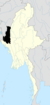 | |
| Hakha District | ||
| Matupi District | ||
| Mindat District | ||
| Cities and towns | ||
This Chin State location article is a stub. You can help Wikipedia by expanding it. |