
Mildam
Mildaam | |
|---|---|
Village | |
 Mildam, bridge Tjonger | |
 Flag  Coat of arms | |
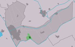 Location in the Heerenveen municipality | |
 Mildam Location in the Netherlands  Mildam Mildam (Netherlands) | |
| Coordinates: 52°56′10″N 6°0′6″E / 52.93611°N 6.00167°E | |
| Country | |
| Province | |
| Municipality | |
| Area | |
| • Total | 2.32 km2 (0.90 sq mi) |
| Elevation | 1 m (3 ft) |
| Population (2021)[1] | |
| • Total | 675 |
| • Density | 290/km2 (750/sq mi) |
| Postal code | 8454[1] |
| Dialing code | 0513 |
Mildam (West Frisian: Mildaam) is a village in Heerenveen in the province of Friesland, the Netherlands. It had a population of around 685 in January 2017.[3]
Louis Le Roy's "eco-cathedral" is located here. There is a windmill in the village, De Tjongermolen.
YouTube Encyclopedic
-
1/1Views:1 497
-
Eco kathedraal - Mildam
Transcription
History
The village was first mentioned in 1523 as tho Meyledam, and either means middle dam or dam of Meila (person).[4] Mildam developed in the 18th century near a place where the Tjonger river could be crossed. Nowadays, it is more of a suburb of Heerenveen. The current Dutch Reformed church was rebuilt in 1726.[5] In 1840, Mildam was home to 297 people.[6]
The Tjongermolen is a polder mill built in 1983 to replace a ruinous mill from 1869.[7]
Before 1934, Mildam was part of the Schoterland municipality.[6]
Gallery
-

Church and bell tower
-

Welcome to Mildam
-

Sailing boat statue
-

Windmill De Tjongermolen
References
- ^ a b c "Kerncijfers wijken en buurten 2021". Central Bureau of Statistics. Retrieved 30 March 2022.
- ^ "Postcodetool for 8454JK". Actueel Hoogtebestand Nederland (in Dutch). Het Waterschapshuis. Retrieved 30 March 2022.
- ^ Kerncijfers wijken en buurten 2017 - CBS Statline
- ^ "Mildam - (geografische naam)". Etymologiebank (in Dutch). Retrieved 30 March 2022.
- ^ Ronald Stenvert & Sabine Broekhoven (2000). "Mildam" (in Dutch). Zwolle: Waanders. ISBN 90 400 9476 4. Retrieved 30 March 2022.
- ^ a b "Mildam". Plaatsengids (in Dutch). Retrieved 30 March 2022.
- ^ "De Tjongermolen". Molen database (in Dutch). Retrieved 30 March 2022.
External links
![]() Media related to Mildam at Wikimedia Commons
Media related to Mildam at Wikimedia Commons
This Friesland location article is a stub. You can help Wikipedia by expanding it. |