
Mid Ulster
Irish: Ceantar Lár Uladh | |
|---|---|
District | |
 | |
| Sovereign state | United Kingdom |
| Constituent country | Northern Ireland |
| Status | District |
| Incorporated | 1 April 2015 |
| Government | |
| • Type | District council |
| • Body | Mid Ulster District Council |
| Area | |
| • Total | 704 sq mi (1,823 km2) |
| Population (2022) | |
| • Total | 151,001 |
| • Density | 210/sq mi (83/km2) |
| Time zone | UTC0 (GMT) |
| • Summer (DST) | UTC+1 (BST) |
| Ethnicity | 96.0% White[1] |
| Website | http://www.midulstercouncil.org/ |
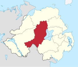
Mid Ulster (Irish: Ceantar Lár Uladh)[2] is a local government district in Northern Ireland. The district was created on 1 April 2015 by merging Magherafelt District, Cookstown District, and the Borough of Dungannon and South Tyrone. The local authority is Mid Ulster District Council.
Geography
The district covers parts of counties Londonderry, Tyrone, and Armagh, taking in the entire western shore of Lough Neagh, and bordering County Monaghan in the Republic of Ireland. The district has a population of 151,001.[3] The name of the new district was announced on 17 September 2008.
Mid Ulster District Council
Mid Ulster District Council replaced Magherafelt District Council, Cookstown District Council and Dungannon and South Tyrone Borough Council. The first election for the new district council was originally due to take place in May 2009, but on April 25, 2008, Shaun Woodward, Secretary of State for Northern Ireland announced that the scheduled 2009 district council elections were to be postponed until 2011.[4] The first elections took place on 22 May 2014 and the council acted as a shadow authority until 1 April 2015.
References
- ^ [https://www.nisra.gov.uk/system/files/statistics/census-2021-main-statistics-for-northern-ireland-phase-1-statistical-bulletin-ethnic-group.pdf "Main statistics for Northern Ireland Statistical bulletin - Ethnic group"] ONS. Retrieved 22 September 2022
- ^ "Regional Assessment of Need, 2017–2020" (PDF). The Education Authority Youth Service. p. 141. Retrieved 20 February 2021.
- ^ "Mid-Year Population Estimates, UK, June 2022". Office for National Statistics. 26 March 2024. Retrieved 3 May 2024.
- ^ Northern Ireland elections are postponed, BBC News, April 25, 2008, accessed April 27, 2008
54°40′05″N 6°40′44″W / 54.668°N 6.679°W