
Miami Gardens was a census-designated place (CDP) in Broward County, Florida, United States. The population was 2,706 at the 2000 census.[1]
It was one of the four unincorporated neighborhoods that were incorporated to create the new city of West Park in 2005. This area is distinct from the City of Miami Gardens, a Miami-Dade County municipality which incorporated in 2003.
Geography
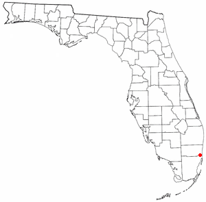
Miami Gardens is located at 25°58′44″N 80°12′7″W / 25.97889°N 80.20194°W.[2]
According to the United States Census Bureau, the CDP has a total area of 1.1 km2 (0.4 mi2), all land.
Demographics
As of the census[3] of 2000, there were 2,706 people, 825 households, and 663 families residing in the CDP. The population density was 2,548.3/km2 (6,673.3/mi2). There were 891 housing units at an average density of 839.1/km2 (2,197.3/mi2). The racial makeup of the CDP was 54.84% White 26.87% African American, 0.33% Native American, 2.29% Asian, 0.15% Pacific Islander, 10.72% from other races, and 4.80% from two or more races. Hispanic or Latino of any race were 43.27% of the population.
There were 825 households, out of which 41.6% had children under the age of 18 living with them, 54.3% were married couples living together, 18.3% had a female householder with no husband present, and 19.6% were non-families. Of all households, 14.8% were made up of individuals, and 3.4% had someone living alone who was 65 years of age or older. The average household size was 3.28 and the average family size was 3.60.
In the CDP the population was spread out, with 30.6% under the age of 18, 9.2% from 18 to 24, 29.5% from 25 to 44, 23.1% from 45 to 64, and 7.7% who were 65 years of age or older. The median age was 33 years. For every 100 females, there were 100.7 males. For every 100 females age 18 and over, there were 97.3 males.
The median income for a household in the CDP was $36,786, and the median income for a family was $37,031. Males had a median income of $26,442 versus $15,469 for females. The per capita income for the CDP was $11,688. About 9.9% of families and 14.0% of the population were below the poverty line, including 15.2% of those under age 18 and 12.4% of those age 65 or over.
As of 2000, before being annexed to West Park, Spanish as a first language accounted for 51.09% of all residents, while English accounted for 45.17%, and French Creole as a mother tongue made up 3.72% of the population.[4]
As of 2000, before West Park annexed it, the Miami Gardens section had the 103rd-highest percentage of Colombian residents in the U.S., with 1.63% of the U.S. populace.[5] It had the forty-fourth-highest percentage of Cuban residents in the U.S., at 9.76% of the city's population (tied with Key Largo,)[6] the twenty-fourth-highest percentage of Dominicans in the US, with 4.62%,[7] and the fifteenth-highest percentage of Jamaican residents in the US, at 6.3% of the city's population.[8] It also had the forty-fourth-most Peruvians in the US, at 1.26% (tied with North Plainfield, New Jersey,)[9] while it had the forty-fifth-highest percentage of Haitians (tied with Leisure City), at 3.6% of all residents.[10] West Park's Miami Gardens section had the sixty-first-highest percentage of Puerto Ricans, which was at an 11.2% populace.[11]
References
- ^ "Miami Gardens CDP, FL". Retrieved 2010-02-14.
- ^ "US Gazetteer files: 2010, 2000, and 1990". United States Census Bureau. 2011-02-12. Retrieved 2011-04-23.
- ^ "U.S. Census website". United States Census Bureau. Retrieved 2008-01-31.
- ^ "MLA Data Center Results for Miami Gardens (Broward,) FL". Modern Language Association. Retrieved 2007-11-16.
- ^ "Ancestry Map of Colombian Communities". Epodunk.com. Archived from the original on 2007-10-11. Retrieved 2007-10-26.
- ^ "Ancestry Map of Cuban Communities". Epodunk.com. Archived from the original on 2012-11-22. Retrieved 2007-10-26.
- ^ "Ancestry Map of Dominican Communities". Epodunk.com. Archived from the original on 2010-10-17. Retrieved 2007-12-06.
- ^ "Ancestry Map of Jamaican Communities". Epodunk.com. Archived from the original on 2007-10-11. Retrieved 2007-10-26.
- ^ "Ancestry Map of Peruvian Communities". Epodunk.com. Archived from the original on 2007-10-11. Retrieved 2007-10-26.
- ^ "Ancestry Map of Haitian Communities". Epodunk.com. Archived from the original on 2012-09-23. Retrieved 2007-10-26.
- ^ "Ancestry Map of Puerto Rican Communities". Epodunk.com. Archived from the original on 2006-07-15. Retrieved 2007-10-26.
Municipalities and communities of Broward County, Florida, United States | ||
|---|---|---|
| Cities |  | |
| Towns | ||
| Villages | ||
| CDPs | ||
| Unincorporated community | ||
| Indian reservations | ||
| Ghost towns | ||
| Footnotes | ‡This populated place also has portions in an adjacent county or counties | |