
Mińsk County
Powiat miński | |
|---|---|
 Flag  Coat of arms | |
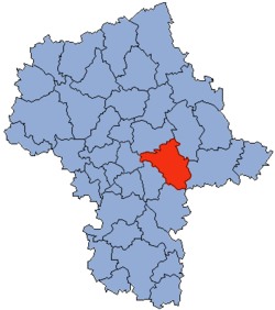 Location within the voivodeship | |
 Division into gminas | |
| Coordinates (Mińsk Mazowiecki): 52°11′N 21°34′E / 52.183°N 21.567°E | |
| Country | |
| Voivodeship | Masovian |
| Seat | Mińsk Mazowiecki |
| Gminas | |
| Area | |
| • Total | 1,164.35 km2 (449.56 sq mi) |
| Population (2019) | |
| • Total | 150,480 |
| • Density | 130/km2 (330/sq mi) |
| • Urban | 67,240 |
| • Rural | 82,638 |
| Car plates | WM |
| Website | http://www.powiatminski.pl |
Mińsk County (Polish: powiat miński) is a unit of territorial administration and local government (powiat) in Masovian Voivodeship, east-central Poland. It was (re)created on January 1, 1999, as a result of the Polish local government reforms passed in 1998. Its administrative seat and largest town is Mińsk Mazowiecki, which lies 39 kilometres (24 mi) east of Warsaw. The county contains three other towns: Sulejówek, 21 km (13 mi) west of Mińsk Mazowiecki, Halinów, 16 km (10 mi) west of Mińsk Mazowiecki, and Kałuszyn, 17 km (11 mi) east of Mińsk Mazowiecki.
The county covers an area of 1,164.35 square kilometres (449.6 sq mi). As of 2019 its total population is 150,480, out of which the population of Mińsk Mazowiecki is 40,836, that of Sulejówek is 19,766, that of Halinów is 3,739, that of Kałuszyn is 2,899, and the rural population is 82,638.[1]
Neighbouring counties
Mińsk County is bordered by Węgrów County to the north-east, Siedlce County to the east, Garwolin County to the south, Otwock County and the city of Warsaw to the west, and Wołomin County to the north-west.
Administrative division
The county is subdivided into 13 gminas (two urban, two urban-rural and nine rural). These are listed in the following table, in descending order of population.
| Gmina | Type | Area (km2) |
Population (2019) |
Seat |
| Mińsk Mazowiecki | urban | 13.1 | 40,836 | |
| Sulejówek | urban | 19.5 | 19,766 | |
| Gmina Halinów | urban-rural | 63.1 | 16,254 | Halinów |
| Gmina Mińsk Mazowiecki | rural | 112.3 | 15,364 | Mińsk Mazowiecki * |
| Gmina Dębe Wielkie | rural | 77.9 | 10,436 | Dębe Wielkie |
| Gmina Siennica | rural | 111.0 | 7,499 | Siennica |
| Gmina Stanisławów | rural | 106.0 | 6,777 | Stanisławów |
| Gmina Cegłów | rural | 95.7 | 6,118 | Cegłów |
| Gmina Dobre | rural | 124.9 | 5,974 | Dobre |
| Gmina Kałuszyn | urban-rural | 94.5 | 5,846 | Kałuszyn |
| Gmina Latowicz | rural | 114.2 | 5,403 | Latowicz |
| Gmina Mrozy | rural | 145.2 | 5,123 | Mrozy |
| Gmina Jakubów | rural | 87.2 | 5,084 | Jakubów |
| * seat not part of the gmina | ||||
References
- ^ GUS. "Population. Size and structure and vital statistics in Poland by territorial division in 2019. As of 30th June". stat.gov.pl. Retrieved 2020-09-14.
| Urban gminas |
|  |
|---|---|---|
| Urban-rural gminas | ||
| Rural gminas | ||

| International | |
|---|---|
| National | |