
Meshchovsk
Мещовск | |
|---|---|
 New Cathedral of the Annunciation | |
 Coat of arms | |
Location of Meshchovsk  | |
 Meshchovsk Location of Meshchovsk 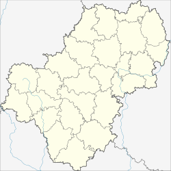 Meshchovsk Meshchovsk (Kaluga Oblast) | |
| Coordinates: 54°19′28″N 35°16′51″E / 54.32444°N 35.28083°E | |
| Country | Russia |
| Federal subject | Kaluga Oblast[1] |
| Administrative district | Meshchovsky District[1] |
| First mentioned | 1238 |
| Town status since | 1776 |
| Elevation | 215 m (705 ft) |
| Population | |
| • Total | 4,100 |
| • Estimate (2018)[3] | 3,837 (−6.4%) |
| • Capital of | Meshchovsky District[1] |
| • Municipal district | Meshchovsky Municipal District[4] |
| • Urban settlement | Meshchovsk Urban Settlement[4] |
| • Capital of | Meshchovsky Municipal District,[4] Meshchovsk Urban Settlement[4] |
| Time zone | UTC+3 (MSK |
| Postal code(s)[6] | 249240 |
| OKTMO ID | 29627101001 |
Meshchovsk (Russian: Мещо́вск) is a town and the administrative center of Meshchovsky District in Kaluga Oblast, Russia, located on the Tureya River 85 kilometers (53 mi) southwest of Kaluga, the administrative center of the oblast. Population: 3,810 (2021 Census);[7] 4,100 (2010 Census);[2] 4,540 (2002 Census);[8] 5,382 (1989 Census).[9]
YouTube Encyclopedic
-
1/1Views:574
-
Прогулка по Вильнюсу, часть III, Литва 2016
Transcription
History
Principality of Mezetsk 1238–ca. 1400
Grand Duchy of Lithuania ca. 1400–1503
Grand Duchy of Moscow 1503–1547
Tsardom of Russia 1547–1721
Russian Empire 1721–1917
Soviet Russia 1917–1922
Soviet Union 1922–1991
It was first mentioned in Russian chronicles in connection with the Mongol invasion of Rus' in 1238.[citation needed] During the Middle Ages it was the patrimony of Princes Mezetsky.
Catherine the Great granted it town rights in 1776.[citation needed]
During World War II, Meshchovsk was occupied by the German Army from October 7, 1941, to January 7, 1942.
Administrative and municipal status
Within the framework of administrative divisions, Meshchovsk serves as the administrative center of Meshchovsky District, to which it is directly subordinated.[1] As a municipal division, the town of Meshchovsk, together with forty-eight rural localities, is incorporated within Meshchovsky Municipal District as Meshchovsk Urban Settlement.[4]
Architecture
Notable buildings include the old (1678–1696) and new (1829–1854) Orthodox cathedrals, both dedicated to the feast of the Annunciation.
Notable people
It was the birthplace in 1846 of Vyacheslav von Plehve, the German-descended director of the Imperial Russian Police and later Minister of the Interior.
References
Notes
- ^ a b c d e Государственный комитет Российской Федерации по статистике. Комитет Российской Федерации по стандартизации, метрологии и сертификации. №ОК 019-95 1 января 1997 г. «Общероссийский классификатор объектов административно-территориального деления. Код 29 227», в ред. изменения №278/2015 от 1 января 2016 г.. (State Statistics Committee of the Russian Federation. Committee of the Russian Federation on Standardization, Metrology, and Certification. #OK 019-95 January 1, 1997 Russian Classification of Objects of Administrative Division (OKATO). Code 29 227, as amended by the Amendment #278/2015 of January 1, 2016. ).
- ^ a b Russian Federal State Statistics Service (2011). Всероссийская перепись населения 2010 года. Том 1 [2010 All-Russian Population Census, vol. 1]. Всероссийская перепись населения 2010 года [2010 All-Russia Population Census] (in Russian). Federal State Statistics Service.
- ^ "26. Численность постоянного населения Российской Федерации по муниципальным образованиям на 1 января 2018 года". Federal State Statistics Service. Retrieved January 23, 2019.
- ^ a b c d e Law #354-OZ
- ^ "Об исчислении времени". Официальный интернет-портал правовой информации (in Russian). June 3, 2011. Retrieved January 19, 2019.
- ^ Почта России. Информационно-вычислительный центр ОАСУ РПО. (Russian Post). Поиск объектов почтовой связи (Postal Objects Search) (in Russian)
- ^ Russian Federal State Statistics Service. Всероссийская перепись населения 2020 года. Том 1 [2020 All-Russian Population Census, vol. 1] (XLS) (in Russian). Federal State Statistics Service.
- ^ Russian Federal State Statistics Service (May 21, 2004). Численность населения России, субъектов Российской Федерации в составе федеральных округов, районов, городских поселений, сельских населённых пунктов – районных центров и сельских населённых пунктов с населением 3 тысячи и более человек [Population of Russia, Its Federal Districts, Federal Subjects, Districts, Urban Localities, Rural Localities—Administrative Centers, and Rural Localities with Population of Over 3,000] (XLS). Всероссийская перепись населения 2002 года [All-Russia Population Census of 2002] (in Russian).
- ^ Всесоюзная перепись населения 1989 г. Численность наличного населения союзных и автономных республик, автономных областей и округов, краёв, областей, районов, городских поселений и сёл-райцентров [All Union Population Census of 1989: Present Population of Union and Autonomous Republics, Autonomous Oblasts and Okrugs, Krais, Oblasts, Districts, Urban Settlements, and Villages Serving as District Administrative Centers]. Всесоюзная перепись населения 1989 года [All-Union Population Census of 1989] (in Russian). Институт демографии Национального исследовательского университета: Высшая школа экономики [Institute of Demography at the National Research University: Higher School of Economics]. 1989 – via Demoscope Weekly.
Sources
- Законодательное Собрание Калужской области. Закон №354-ОЗ от 4 октября 2004 г. «Об установлении границ муниципальных образований, расположенных на территории административно-территориальных единиц "Барятинский район", "Куйбышевский район", "Людиновский район", "Мещовский район", "Спас-Деменский район", "Ульяновский район" и наделении их статусом городского поселения, сельского поселения, муниципального района», в ред. Закона №694-ОЗ от 27 февраля 2015 г. «О внесении изменений в Закон Калужской области "Об установлении границ муниципальных образований, расположенных на территории административно-территориальных единиц "Барятинский район", "Куйбышевский район", "Людиновский район", "Мещовский район", "Спас-Деменский район", "Ульяновский район" и наделении их статусом городского поселения, сельского поселения, муниципального района"». Вступил в силу после вступления в силу Закона Калужской области "Об изменении статуса посёлков, расположенных на территории административно-территориальных единиц "Барятинский район", "Куйбышевский район", "Людиновский район", "Мещовский район", "Спас-Деменский район", "Ульяновский район" Калужской области", но не ранее чем через десять дней после официального опубликования. Опубликован: "Весть", №229–300, 9 октября 2004 г. (Legislative Assembly of Kaluga Oblast. Law #354-OZ of October 4, 2004 On Establishing the Borders of the Municipal Formations Located on the Territory of the Administrative-Territorial Units of "Baryatinsky District", "Kuybyshevsky District", "Lyudinovsky District", "Meshchovsky District", "Spas-Demensky District", "Ulyanovsky District", and on Granting Them the Status of an Urban Settlement, Rural Settlement, Municipal District, as amended by the Law #694-OZ of February 27, 2015 On Amending the Law of Kaluga Oblast "On Establishing the Borders of the Municipal Formations Located on the Territory of the Administrative-Territorial Units of "Baryatinsky District", "Kuybyshevsky District", "Lyudinovsky District", "Meshchovsky District", "Spas-Demensky District", "Ulyanovsky District", and on Granting Them the Status of an Urban Settlement, Rural Settlement, Municipal District". Effective as of after the Law of Kaluga Oblast "On Changing the Status of the Settlements Located on the Territory of the Administrative-Territorial Units of "Baryatinsky District", "Kuybyshevsky District", "Lyudinovsky District", "Meshchovsky District", "Spas-Demensky District", "Ulyanovsky District" of Kaluga Oblast" takes effect, but no earlier than after ten days since the official publication have passed.).
| Authority control databases: Geographic |
|---|