
| Menominee River | |
|---|---|
 Menominee River (USGS) | |
| Physical characteristics | |
| Source | |
| • location | Grant County, Wisconsin |
| • coordinates | 42°33′44″N 90°36′09″W / 42.5622222°N 90.6025°W |
| • elevation | 796 ft (243 m) |
| Mouth | |
• location | Confluence with the Mississippi, Jo Daviess County, Illinois |
• coordinates | 42°27′04″N 90°35′24″W / 42.4511111°N 90.59°W |
• elevation | 597 ft (182 m) |
| Length | 14 mi (23 km) |
| Basin features | |
| Progression | Menominee River → Mississippi → Gulf of Mexico |
| GNIS ID | 413409 |
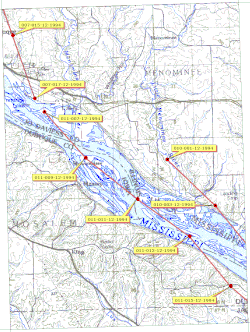
The Menominee River is an 11.3-mile-long (18.2 km)[1] tributary of the Mississippi River, which it joins in Jo Daviess County, Illinois.[2]
The name "Menominee" refers to the Menominee, a Native American people. The name means "good seed" or "wild rice".
The Menominee rises in Grant County, Wisconsin at the confluence of Louisburg and Kieler creeks one mile south of Kieler just east of U.S. Route 151 and flows south past Sandy Hook and enters Illinois just south of Wisconsin Highway 11.[3] It continues south through the northwestern corner of Illinois for about four miles before reaching its confluence with the Mississippi River after crossing under U.S. Route 20.[4]
The river is part of the Driftless Area of Illinois and Wisconsin, a region that remained ice-free during the last ice age.
YouTube Encyclopedic
-
1/3Views:1 4641 615488
-
Wisconsin Whitewater Rafting - Menominee River
-
Wisconsin Rafting on the Menominee River with Wildman Adventure Resort
-
Menominee River Flooding (720HD)
Transcription
See also
References
- ^ U.S. Geological Survey. National Hydrography Dataset high-resolution flowline data. The National Map Archived 2012-03-29 at the Wayback Machine, accessed May 13, 2011
- ^ U.S. Geological Survey Geographic Names Information System: Menominee River
- ^ Kieler, WI, 7.5 Minute Topographic Quadrangle, USGS, 1961 (1978 rev.)
- ^ Menominee, IL-IA, 7.5 Minute Topographic Quadrangle, USGS, 1955 (1971 rev.)
External links