
McKillop No. 220
Strassburg No. 220 (1909–1919) | |
|---|---|
| Rural Municipality of McKillop No. 220 | |
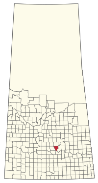 Location of the RM of McKillop No. 220 in Saskatchewan | |
| Coordinates: 50°55′37″N 105°05′06″W / 50.927°N 105.085°W[1] | |
| Country | Canada |
| Province | Saskatchewan |
| Census division | 6 |
| SARM division | 2 |
| Federal riding | Moose Jaw—Lake Centre—Lanigan |
| Provincial riding | Last Mountain-Touchwood |
| Formed[2] | December 13, 1909 |
| Name change[3] | July 15, 1919 (from RM of Strassburg No. 220) |
| Government | |
| • Reeve | Bob Schmidt |
| • Governing body | RM of McKillop No. 220 Council |
| • Office location | Bulyea |
| Area (2016)[5] | |
| • Land | 668.44 km2 (258.09 sq mi) |
| Population (2016)[5] | |
| • Total | 732 |
| • Density | 1.1/km2 (3/sq mi) |
| Time zone | CST |
| • Summer (DST) | CST |
| Postal code | S0G 0L0 |
| Area code(s) | 306 and 639 |
| Website | Official website |
The Rural Municipality of McKillop No. 220 (2016 population: 732) is a rural municipality (RM) in the Canadian province of Saskatchewan within Census Division No. 6 and SARM Division No. 2.
History
The RM of Strassburg No. 220 was originally incorporated as a rural municipality on December 13, 1909.[2] Its name was changed to the RM of McKillop No. 220 on July 15, 1919.[3]
Geography
The RM is adjacent to Last Mountain Lake.
Communities and localities
The following urban municipalities are surrounded by the RM.[6]
The following unincorporated communities are within the RM.
- Alta Vista
- Colesdale Park
- Collingwood Lakeshore Estates
- MacPheat Park
- Mohr's Beach
- North Colesdale Park
- Sorensen Beach
- Spring Bay
- Uhl's Bay
Demographics
In the 2021 Census of Population conducted by Statistics Canada, the RM of McKillop No. 220 had a population of 897 living in 418 of its 730 total private dwellings, a change of 22.5% from its 2016 population of 732. With a land area of 663.9 km2 (256.3 sq mi), it had a population density of 1.4/km2 (3.5/sq mi) in 2021.[10]
In the 2016 Census of Population, the RM of McKillop No. 220 recorded a population of 732 living in 320 of its 617 total private dwellings, a 27.3% change from its 2011 population of 575. With a land area of 668.44 km2 (258.09 sq mi), it had a population density of 1.1/km2 (2.8/sq mi) in 2016.[5]
Government
The RM of McKillop No. 220 is governed by an elected municipal council and an appointed administrator that meets on the second Monday of every month.[4] The reeve of the RM is Bob Schmidt while its administrator is Camille Box.[4] The RM's office is located in Bulyea.[4]
Transportation
- Rail[11]
- Bulyea Branch C.P.R.—serves Saskatchewan Beach, Silton, Gibbs, Bulyea,
- Brandon-Virden-Saskatoon Section C.P.R.—serves Markinch, Southey, Earl Grey, Bulyea, Strasbourg, Duval, Cymric, Govan.
- Roads[12]
- Highway 20—serves Bulyea, Saskatchewan
- Highway 322—serves Silton, Saskatchewan
See also
References
- ^ "Pre-packaged CSV files - CGN, Canada/Province/Territory (cgn_sk_csv_eng.zip)". Government of Canada. July 24, 2019. Retrieved May 23, 2020.
- ^ a b "Rural Municipality Incorporations (Alphabetical)". Saskatchewan Ministry of Municipal Affairs. Archived from the original on April 21, 2011. Retrieved May 9, 2020.
- ^ a b "Renamed Rural Municipalities". Saskatchewan Ministry of Municipal Affairs. Archived from the original on February 25, 2012. Retrieved May 9, 2020.
- ^ a b c d "Municipality Details: RM of McKillop No. 220". Government of Saskatchewan. Retrieved May 21, 2020.
- ^ a b c "Population and dwelling counts, for Canada, provinces and territories, and census subdivisions (municipalities), 2016 and 2011 censuses – 100% data (Saskatchewan)". Statistics Canada. February 8, 2017. Retrieved May 1, 2020.
- ^ Statistics Canada
- ^ "2019-2020 Rural Revenue Sharing Organized Hamlet Grant". Government of Saskatchewan. Retrieved October 16, 2019.[permanent dead link]
- ^ "Saskatchewan Census Population" (PDF). Saskatchewan Bureau of Statistics. Archived from the original (PDF) on September 24, 2015. Retrieved May 9, 2020.
- ^ "Saskatchewan Census Population". Saskatchewan Bureau of Statistics. Retrieved May 9, 2020.
- ^ "Population and dwelling counts: Canada, provinces and territories, census divisions and census subdivisions (municipalities), Saskatchewan". Statistics Canada. February 9, 2022. Retrieved April 13, 2022.
- ^ Canadian Maps: January 1925 Waghorn's Guide. Post Offices in Man. Sask. Alta. and West Ontario.
- ^ Eversoft Streets and Trips
