
Carlow Mayo | |
|---|---|
| Township of Carlow Mayo | |
 Community of McArthur Mills along Hwy 28. | |
 Carlow Mayo | |
| Coordinates: 45°08′N 77°37′W / 45.133°N 77.617°W | |
| Country | |
| Province | |
| County | Hastings |
| Settled | 1850s |
| Incorporated | January 1, 2001 |
| Government | |
| • Type | Township |
| • Mayor | Randy Wallace |
| • Federal riding | Hastings—Lennox and Addington |
| • Prov. riding | Hastings—Lennox and Addington |
| Area | |
| • Land | 390.79 km2 (150.88 sq mi) |
| Population (2016)[2] | |
| • Total | 864 |
| • Density | 2.2/km2 (6/sq mi) |
| Time zone | UTC-5 (EST) |
| • Summer (DST) | UTC-4 (EDT) |
| Postal Code | K0L 1G0 |
| Area code(s) | 613, 343 |
| Website | www |
Carlow Mayo is a township in northern Hastings County in Eastern Ontario, Canada. It was formed in 2001 by the amalgamation of the townships of Carlow and Mayo.
Historically, the economy in the area was based on timber and mining. The Little Mississippi River and York River were used to transport logs out of the forests. Now, tourism is an important part of the local economy. Over half of the land in the region is designated crown land.
Carlow and Mayo were named after the counties of the same name in Ireland (County Carlow and County Mayo).
Communities within the municipal boundaries include: Bessemer, Boulter, Childs Mines, Craigmont, Fort Stewart, Hartsmere, Havergal, Hermon, McArthur Mills, New Carlow, and Rowland.
Demographics
In the 2021 Census of Population conducted by Statistics Canada, Carlow/Mayo had a population of 953 living in 416 of its 663 total private dwellings, a change of 10.3% from its 2016 population of 864. With a land area of 385.32 km2 (148.77 sq mi), it had a population density of 2.5/km2 (6.4/sq mi) in 2021.[3]
| 2021 | 2016 | 2011 | |
|---|---|---|---|
| Population | 953 (+10.3% from 2016) | 864 (-3.1% from 2011) | 892 (-6.1% from 2006) |
| Land area | 385.32 km2 (148.77 sq mi) | 390.79 km2 (150.88 sq mi) | 390.94 km2 (150.94 sq mi) |
| Population density | 2.5/km2 (6.5/sq mi) | 2.2/km2 (5.7/sq mi) | 2.3/km2 (6.0/sq mi) |
| Median age | 55.2 (M: 54.8, F: 55.6) | 54.1 (M: 54.9, F: 52.8) | |
| Private dwellings | 663 (total) 416 (occupied) | 627 (total) | 585 (total) |
| Median household income | $68,000 | $54,208 |
Mother tongue:[7]
- English as first language: 94.7%
- French as first language: 3.7%
- English and French as first language: 0%
- Other as first language: 1.6%
| Year | Pop. | ±% |
|---|---|---|
| 1996 | 891 | — |
| 2001 | 833 | −6.5% |
| 2006 | 950 | +14.0% |
| 2011 | 892 | −6.1% |
| 2016 | 864 | −3.1% |
| [9][1][2] | ||
See also
References
- ^ a b "Carlow Mayo census profile". 2011 Census of Population. Statistics Canada. Archived from the original on 2016-09-23. Retrieved 2012-02-29.
- ^ a b "Census Profile, 2016 Census: Carlow Mayo, Township". Statistics Canada. 8 February 2017. Retrieved June 16, 2019.
- ^ "Population and dwelling counts: Canada, provinces and territories, census divisions and census subdivisions (municipalities), Ontario". Statistics Canada. February 9, 2022. Retrieved April 2, 2022.
- ^ "2021 Community Profiles". 2021 Canadian Census. Statistics Canada. February 4, 2022. Retrieved 2023-10-19.
- ^ "2016 Community Profiles". 2016 Canadian Census. Statistics Canada. August 12, 2021. Retrieved 2018-02-19.
- ^ "2011 Community Profiles". 2011 Canadian Census. Statistics Canada. March 21, 2019. Retrieved 2012-02-29.
- ^ a b "2006 Community Profiles". 2006 Canadian Census. Statistics Canada. August 20, 2019.
- ^ "2001 Community Profiles". 2001 Canadian Census. Statistics Canada. July 18, 2021.
- ^ Statistics Canada: 1996, 2001, 2006 census
External links
Places adjacent to Carlow/Mayo | |
|---|---|
| Cities | 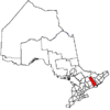 | |
|---|---|---|
| Towns | ||
| Townships | ||
| First Nations | ||
| Indian reserves | ||
| ||
This Ontario location article is a stub. You can help Wikipedia by expanding it. |